- Branford, Florida
Infobox Settlement
official_name = Branford, Florida
other_name =
native_name =
nickname =
settlement_type =Town
motto =
imagesize =
image_caption =
flag_size =
image_
seal_size =
image_shield =
shield_size =
image_blank_emblem =
blank_emblem_type =
blank_emblem_size =
imagesize =
image_caption =
flag_size =
image_
seal_size =
image_shield =
shield_size =
image_blank_emblem =
blank_emblem_type =
blank_emblem_size =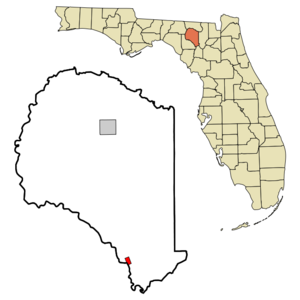
mapsize = 250x200px
map_caption = Location in Suwannee County and the state ofFlorida
mapsize1 =
map_caption1 =
image_dot_
dot_mapsize =
dot_map_caption =
dot_x =
dot_y =
pushpin_
pushpin_label_position =
pushpin_map_caption =
pushpin_mapsize =
subdivision_type = Country
subdivision_name = flag|United States
subdivision_type1 = State
subdivision_name1 = flag|Florida
subdivision_type2 = County
subdivision_name2 = noflag|Suwannee
subdivision_type3 =
subdivision_name3 =
subdivision_type4 =
subdivision_name4 =
government_footnotes =
government_type =
leader_title =
leader_name =
leader_title1 =
leader_name1 =
leader_title2 =
leader_name2 =
leader_title3 =
leader_name3 =
leader_title4 =
leader_name4 =
established_title =
established_date =
established_title2 =
established_date2 =
established_title3 =
established_date3 =
area_magnitude =
unit_pref = Imperial
area_footnotes =
area_total_km2 = 2.1
area_land_km2 = 2.1
area_water_km2 = 0
area_total_sq_mi = 0.8
area_land_sq_mi = 0.8
area_water_sq_mi = 0
area_water_percent =
area_urban_km2 =
area_urban_sq_mi =
area_metro_km2 =
area_metro_sq_mi =
area_blank1_title =
area_blank1_km2 =
area_blank1_sq_mi =
population_as_of = 2000
population_footnotes =
population_note =
population_total = 695
population_density_km2 = 331
population_density_sq_mi = 868.8
population_metro =
population_density_metro_km2 =
population_density_metro_sq_mi =
population_urban =
population_density_urban_km2 =
population_density_urban_sq_mi =
population_blank1_title =
population_blank1 =
population_density_blank1_km2 =
population_density_blank1_sq_mi =
timezone = Eastern (EST)
utc_offset = -5
timezone_DST = EDT
utc_offset_DST = -4
latd = 29 |latm = 57 |lats = 42 |latNS = N
longd = 82 |longm = 55 |longs = 38 |longEW = W
elevation_footnotes =
elevation_m = 13
elevation_ft = 43
postal_code_type =ZIP code
postal_code = 32008
area_code = 386
blank_name = FIPS code
blank_info = 12-08175GR|2
blank1_name = GNIS feature ID
blank1_info = 0279335GR|3
website =
footnotes =Branford is a town in Suwannee County,
Florida ,United States . The population was 695 at the 2000 census.Geography
Branford is located at coor dms|29|57|42|N|82|55|38|W|city (29.961803, -82.927204)GR|1.
The town is located on the banks of the
Suwannee River . U.S. Highway 27 and U.S. Highway 129 intersect in Branford.According to the
United States Census Bureau , the town has a total area of 0.8square mile s (2.1km² ), all of it land.Branford is located (depending on the route of travel) "approximately":
2 hours SE of the state capitol,
Tallahassee , home toFlorida State University and theFlorida State Seminoles 1 hour and 45 minutes SW of
Jacksonville 45 minutes NW of
Gainesville, Florida , home of theUniversity of Florida and theFlorida Gators 2 hours and 30 minutes NW of
Orlando, Florida 2 hours and 30 minutes W of
St. Augustine, Florida 3 hours N of
Tampa 30 minutes SW of
Lake City, Florida 30 minutes S of
Live Oak, Florida (Suwannee County Government seat)Branford has the distinction of being the "Spring Diving Capital of the World".Fact|date=August 2008
Demographics
As of the
census GR|2 of 2000, there were 695 people, 270 households, and 170 families residing in the town. Thepopulation density was 838.6 people per square mile (323.3/km²). There were 320 housing units at an average density of 386.1/sq mi (148.9/km²). The racial makeup of the town was 87.05% White, 7.05% African American, 0.29% Native American, 0.29% Asian, 2.73% from other races, and 2.59% from two or more races. Hispanic or Latino of any race were 9.50% of the population.There were 270 households out of which 33.0% had children under the age of 18 living with them, 42.2% were married couples living together, 15.6% had a female householder with no husband present, and 36.7% were non-families. 31.1% of all households were made up of individuals and 17.4% had someone living alone who was 65 years of age or older. The average household size was 2.53 and the average family size was 3.15.
In the town the population was spread out with 27.6% under the age of 18, 9.8% from 18 to 24, 28.1% from 25 to 44, 20.6% from 45 to 64, and 14.0% who were 65 years of age or older. The median age was 33 years. For every 100 females there were 90.9 males. For every 100 females age 18 and over, there were 95.7 males.
The median income for a household in the town was $24,286, and the median income for a family was $31,705. Males had a median income of $24,583 versus $18,750 for females. The
per capita income for the town was $12,716. About 13.8% of families and 21.0% of the population were below thepoverty line , including 17.2% of those under age 18 and 26.4% of those age 65 or over.References
External links
* [http://www.suwanneeonline.com/ Suwannee Online]
Wikimedia Foundation. 2010.