- Waimanalo Beach, Hawaii
Infobox Settlement
official_name = Waimanalo Beach, Hawaii
other_name =
native_name =
nickname =
settlement_type = CDP
motto =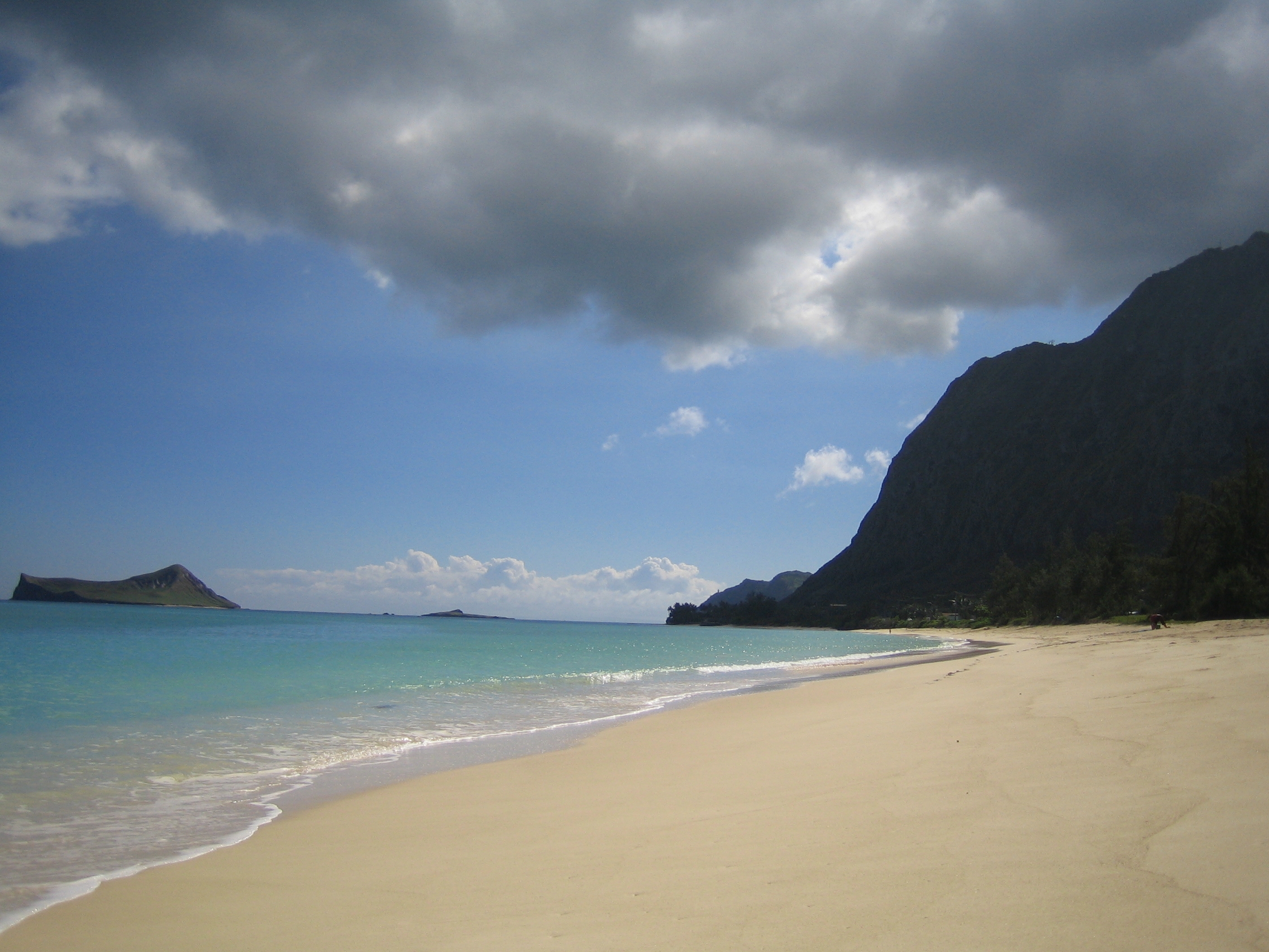
imagesize = 250px
image_caption = The beach at Waimānalo on windward O‘ahu
flag_size =
image_
seal_size =
image_shield =
shield_size =
image_blank_emblem =
blank_emblem_type =
blank_emblem_size =
flag_size =
image_
seal_size =
image_shield =
shield_size =
image_blank_emblem =
blank_emblem_type =
blank_emblem_size =
mapsize =
map_caption = Location in Honolulu County and the state ofHawaii
mapsize1 =
map_caption1 =
image_dot_
dot_mapsize =
dot_map_caption =
dot_x =
dot_y =
pushpin_
pushpin_label_position =
pushpin_map_caption =
pushpin_mapsize =
subdivision_type = Country
subdivision_name =United States
subdivision_type1 = State
subdivision_name1 =Hawaii
subdivision_type2 =
subdivision_name2 =
subdivision_type3 =
subdivision_name3 =
subdivision_type4 =
subdivision_name4 =
government_footnotes =
government_type =
leader_title =
leader_name =
leader_title1 =
leader_name1 =
leader_title2 =
leader_name2 =
leader_title3 =
leader_name3 =
leader_title4 =
leader_name4 =
established_title =
established_date =
established_title2 =
established_date2 =
established_title3 =
established_date3 =
area_magnitude =
unit_pref = Imperial
area_footnotes =
area_total_km2 = 7.9
area_land_km2 = 4.2
area_water_km2 = 3.7
area_total_sq_mi = 3.1
area_land_sq_mi = 1.6
area_water_sq_mi = 1.4
area_water_percent =
area_urban_km2 =
area_urban_sq_mi =
area_metro_km2 =
area_metro_sq_mi =
area_blank1_title =
area_blank1_km2 =
area_blank1_sq_mi =
population_as_of = 2000
population_footnotes =
population_note =
population_total = 4271
population_density_km2 = 1010.5
population_density_sq_mi = 2617.1
population_metro =
population_density_metro_km2 =
population_density_metro_sq_mi =
population_urban =
population_density_urban_km2 =
population_density_urban_sq_mi =
population_blank1_title =
population_blank1 =
population_density_blank1_km2 =
population_density_blank1_sq_mi =
timezone = Hawaii-Aleutian
utc_offset = -10
timezone_DST =
utc_offset_DST =
latd = 21
latm = 20
lats = 1
latNS = N
longd = 157
longm = 41
longs = 53
longEW = W
elevation_footnotes =
elevation_m = 5
elevation_ft = 16
postal_code_type =
postal_code =
area_code = 808
blank_name = FIPS code
blank_info = 15-78200
blank1_name = GNIS feature ID
blank1_info = 0364777
website =
footnotes = Waimānalo Beach is acensus-designated place (CDP) located in the City & County of Honolulu, in the District of Ko'olaupoko on the island of O'ahu in theU.S. state ofHawaii . This small windward community is located near the eastern end of the island and the climate is dry. As of the 2000 Census, the town had a total population of 4,271. This neighborhood is close to, but somewhat separate from Waimānalo, although the two form a single community.Waimānalo Beach (the town) lies along the eastern half of Waimānalo Beach (the beach), with an overall length of nearly 5.5 mi (8.8 km), the longest stretch of sandy shoreline on O`ahu. Waimānalo Beach has sparse commercial development along Kalanianaole Highway, and is noteworthy for its local flavor and proximity to Makapu'u Beach and Sea Life Park, which lie closer to Makapu'u Point at the east end of the Island of O'ahu. There are no hotels here.
The U.S.
postal code for Waimānalo Beach and Waimānalo is 96795.Geography
Waimānalo Beach is located at coor dms|21|20|1|N|157|41|53|W|city (21.333657, -157.698055).GR|1 The nearest town is Waimānalo to the west.
According to the
United States Census Bureau , the town has a total area of 3.0square mile s (7.9km² ), of which, 1.6 square miles (4.2 km²) of it is land and 1.4 square miles (3.7 km²) of it is water. The total area is 46.56% water.Demographics
As of the
census GR|2 of2000 , there were 4,271 people, 1,006 households, and 848 families residing in the CDP. Thepopulation density was 2,617.1 people per square mile (1,011.7/km²). There were 1,046 housing units at an average density of 640.9/sq mi (247.8/km²). The racial makeup of the CDP was 12.97% White, 0.09%African American , 0.23% Native American, 5.34% Asian, 47.39% Pacific Islander, 0.63% from other races, and 33.34% from two or more races. 6.49% of the population were Hispanic orLatino of any race.There were 1,006 households out of which 28.7% had children under the age of 18 living with them, 51.4% were married couples living together, 23.2% had a female householder with no husband present, and 15.7% were non-families. 8.9% of all households were made up of individuals and 2.7% had someone living alone who was 65 years of age or older. The average household size was 4.25 and the average family size is 4.50.
In the CDP the population was spread out with 26.7% under the age of 18, 10.3% from 18 to 24, 28.9% from 25 to 44, 22.5% from 45 to 64, and 11.6% who were 65 years of age or older. The median age was 35 years. For every 100 females there were 97.5 males. For every 100 females age 18 and over, there were 92.7 males.
The median income for a household in the CDP was $55,781, and the median income for a family was $57,281. Males had a median income of $35,074 versus $25,440 for females. The
per capita income for the town was $16,089. 8.5% of the population and 5.5% of families were below thepoverty line . Out of the total population, 5.3% of those under the age of 18 and 7.9% of those 65 and older were living below the poverty line.Trivia
Waimanalo Beach was the site where the first Japanese prisoner of war,
Kazuo Sakamaki was captured during the Japanese attack on Pearl Harbor in World War Two on December 7, 1941.References
External links
* [http://www.hawaiibeachsafety.org/?i=oahu&shid=3&bch=waimanalo Hawai`i Beach Safety Website] - Current beach conditions and information from Hawaii Lifeguard Association
* [http://www.pixi.com/~isd/Waimanalo.html Waimānalo ahupua'a] - non-commercial community siteReferences
External links
Wikimedia Foundation. 2010.