- Strathcona County, Alberta
Infobox Settlement
official_name = Strathcona County
other_name =
native_name =
nickname =
settlement_type = Specialized municipality
motto =
imagesize =
image_caption =
flag_size =
image_
seal_size =
image_shield =
shield_size =
city_logo =
citylogo_size =
mapsize =
map_caption =
mapsize1 =
map_caption1 =
image_dot_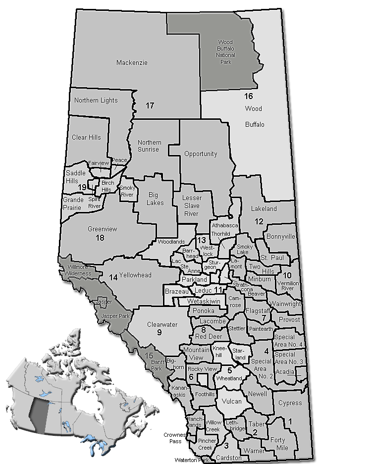
dot_mapsize = 250px
dot_map_caption = Location of Strathcona County inAlberta
dot_x = 145 |dot_y = 178
pushpin_
pushpin_label_position =
pushpin_map_caption =
pushpin_mapsize =
subdivision_type = Country
subdivision_name = CAN
subdivision_type1 = Province
subdivision_name1 = AB
subdivision_type2 = Region
subdivision_name2 = Edmonton Region
subdivision_type3 = Census division
subdivision_name3 = No. 11
subdivision_type4 =
subdivision_name4 =
government_footnotes =Cite web| url= http://www.strathcona.ab.ca/Strathcona/Council/Mayor+and+Councillors/default.htm| title= Council| author= Strathcona County|accessdate= 2007-07-09]
government_type =
leader_title = Governing body
leader_name = Strathcona County Council
leader_title1 = Mayor
leader_name1 = Cathy Olesen
leader_title2 = Municipal seat
leader_name2 = Sherwood Park
leader_title3 =
leader_name3 =
leader_title4 =
leader_name4 =
established_title = Established
established_date = 1962
established_title2 = Incorporated
established_date2 = 1962
established_title3 =
established_date3 =
area_magnitude =
unit_pref =
area_footnotes =
area_total_km2 = 1179
area_land_km2 =
area_water_km2 =
area_total_sq_mi =
area_land_sq_mi =
area_water_sq_mi =
area_water_percent =
area_urban_km2 =
area_urban_sq_mi =
area_metro_km2 =
area_metro_sq_mi =
area_blank1_title =
area_blank1_km2 =
area_blank1_sq_mi =
population_as_of = 2006
population_footnotes =
population_note =
population_total = 82511
population_density_km2 = 70
population_density_sq_mi =
population_metro =
population_density_metro_km2 =
population_density_metro_sq_mi =
population_urban =
population_density_urban_km2 =
population_density_urban_sq_mi =
population_blank1_title = Dwellings
population_blank1 = 29293
population_density_blank1_km2 =
population_density_blank1_sq_mi =
timezone = MST
utc_offset = -7
timezone_DST =
utc_offset_DST =
latd= 53|latm= 31|lats= 24|latNS=N
longd= 113|longm= 18|longs= 32|longEW=W
elevation_footnotes =
elevation_m =
elevation_ft =
postal_code_type =
postal_code =
area_code =
blank_name =
blank_info =
blank1_name =
blank1_info =
website = [http://www.strathcona.ab.ca/ Strathcona County]
footnotes = Strathcona County is a Specialized municipality in centralAlberta ,Canada between Edmonton andElk Island National Park .It is located in Division No. 11 and is also part of the Edmonton Census Metropolitan Area. More than half of the population lives in Sherwood Park, a large community east of Edmonton that has opted to retain hamlet status. Strathcona county was designated as a Specialized Municipality on Jan 01, 1996, in order to accommodate the specific needs of an area that includes both urban and rural territory [http://www.municipalaffairs.gov.ab.ca/cfml/profiles/data/0302_1.htm Municipality Profile] - Alberta Municipal Affairs] .
Demographics
According to the
Canada 2001 Census [ [http://www12.statcan.ca/english/Profil01/CP01/Details/Page.cfm?Lang=E&Geo1=CSD&Code1=4811052&Geo2=PR&Code2=48&Data=Count&SearchText=Strathcona%20County&SearchType=Begins&SearchPR=01&B1=All&Custom= Strathcona County Community Profile] - Statistics Canada. 2002. 2001 Community Profiles. Released June 27, 2002. Last modified: 2005-11-30. Statistics Canada Catalogue no. 93F0053XIE] , the county had a population of 71,986 (increased to 80,232 in 2005 [ [http://www.strathcona.ab.ca/Strathcona/Whats+New/News+releases/2005/September+2005/2005+census+results.htm Strathcona County 2005 Census Report] ] ), a 12.2% increase from 1996. With and area of km2 to mi2|1182.11 and 24,528 dwellings, the population density was 60.9 persons per square kilometre in 2001.In 2006, Strathcona County had a population of 82,511 living in 29,293 dwellings, a 14.6% increase from 2001. The specialized municipality has a land area of km2 to mi2|1179.43|abbr=yes|wiki=yes and a
population density of Pop density km2 to mi2|70.0| spell=UK | abbr=yes.Cite web| url= http://www12.statcan.ca/english/census06/data/profiles/community/Details/Page.cfm?Lang=E&Geo1=CSD&Code1=4811052&Geo2=PR&Code2=48&Data=Count&SearchText=Strathcona%20County&SearchType=Begins&SearchPR=01&B1=All&GeoLevel=&GeoCode=4811052 | title= Strathcona County - Community Profile | author= Statistics Canada| authorlink= Statistics Canada| year= Census 2006 | accessdate= 2007-06-11]Unlike other Albertan counties, which elect reeves as governors, Strathcona County elects a mayor.
Cathy Olesen was elected in 2004 and re-elected in 2007.History
First officially recognized in 1893 by the territorial legislature (it was then part of the North West Territories) as Statute Labour District #2, Strathcona County has changed immensely since its inception. In 1913 Statute Labour District #2 was renamed to Local Improvement District #517 (Clover Bar), which then, in 1943, merged with Local Improvement District #518 (Strathcona) to become Municipal District #83 (Strathcona). By joining with local school divisions in 1962, Municipal District #83 officially became a
county . County status was subsequently revoked in 1995 when the County Act was repealed by the provincial legislature, but was quickly returned in 1996 when the County of Strathcona #20 officially changed its name to Strathcona County and received Specialized Municipality status.On March 29, 2007 the county announced plans to create an entirely new urban settlement from scratch to complement Sherwood Park. This development is supposed to be more dense and pedestrian friendly, and could hold up to 200,000 people. However opponents have pointed out that the development will destroy land of high agricultural value, and the City of Edmonton opposes it an another example of
urban sprawl in the region. [ [http://www.canada.com/edmontonjournal/news/story.html?id=6a60f252-ba06-4b28-8e9e-b57570461939&k=10879 New city rising ] ]Communities
Hamlets
*Antler Lake
*Ardrossan
*Collingwood Cove
*Half Moon Lake
*Hastings Lake
*Josephburg
*North Cooking Lake
*Sherwood Park
*South Cooking LakeOther Communities
*Akenside
*Antler Meadows
*Belvedere Heights
*Birch Park Estates
*Bremner
*Bretona
*Brookville
*Century
*Chrenek
*Clover Bay
*Croftland Subdivision
*Deville
*Elk Island
*Forest Hills
*Forest Hills Country Estates
*Fountain Creek
*Good Hope
*Graham Heights
*Greenwood Park Estates
*Griesbach
*Hude Estates
*Lakewood Acres
*Lina Country Estates
*Los Villas
*Lynley Ridge
*Ministik
*Parkview Ridge Estates
*Partridge Hill
*Pointe aux Pins Estates
*Queensdale Place
*Sconadale
*Scotford
*Silver Birch Hills
*Steinke Estates
*Trevithick Park
*Uncas
*Valley Point
*Whitecroft
*Winfield Heights
*Woodland Downs
*Wyecliffee also
Strathcona County Transit Strathcona County Library References
External links
* [http://www.strathcona.ab.ca/ Strathcona County]
Canadian City Geographic Location (8-way)
Northwest =

Wikimedia Foundation. 2010.