- Roselawn, Indiana
-
Roselawn, Indiana — CDP — 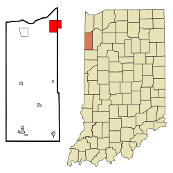
Coordinates: 41°9′16″N 87°17′19″W / 41.15444°N 87.28861°WCoordinates: 41°9′16″N 87°17′19″W / 41.15444°N 87.28861°W Country United States State Indiana Counties Newton, Jasper Township Lincoln Area – Total 8.1 sq mi (21.0 km2) – Land 8.1 sq mi (21.0 km2) – Water 0.0 sq mi (0.0 km2) Elevation 682 ft (208 m) Population (2010) – Total 4,131 – Density 484.4/sq mi (187.0/km2) Time zone Central (CST) (UTC-6) – Summer (DST) CDT (UTC-5) ZIP code 46372 Area code(s) 219 FIPS code 18-66006[1] GNIS feature ID 0449722[2] Roselawn is a census-designated place (CDP) in Newton and Jasper counties in the U.S. state of Indiana. The population was 4,131 at the 2010 census.
Roselawn is known within northwestern Indiana for the two nudist resorts which operate in this town: the Ponderosa Sun Club and Sun Aura.[3] Sun Aura resort was previously known as Naked City, but closed in 1986 after its operator, Dick Drost, encountered significant legal troubles. The resort continued to operate under several different owners and was known as Sunspot resort prior to becoming Sun Aura. The clubs are long-standing fixtures of the community, dating to the 1930s.[4]
Roselawn is also the location where the crash of American Eagle Flight 4184 occurred on October 31, 1994, killing all 64 passengers and four crew members aboard.[5]
Geography
Roselawn is located at 41°9′16″N 87°17′19″W / 41.15444°N 87.28861°W (41.154559, -87.288695)[6].
According to the United States Census Bureau, the CDP has a total area of 8.1 square miles (21 km2), all land.
Demographics
As of the census[1] of 2000, there were 3,933 people, 1,286 households, and 1,099 families residing in the CDP. The population density was 484.4 people per square mile (187.0/km²). There were 1,326 housing units at an average density of 163.3/sq mi (63.1/km²). The racial makeup of the CDP was 97.30% White, 0.15% African American, 0.13% Native American, 0.28% Asian, 0.18% Pacific Islander, 0.97% from other races, and 0.99% from two or more races. Hispanic or Latino of any race were 3.33% of the population.
There were 1,286 households out of which 41.4% had children under the age of 18 living with them, 71.7% were married couples living together, 9.2% had a female householder with no husband present, and 14.5% were non-families. 11.7% of all households were made up of individuals and 3.0% had someone living alone who was 65 years of age or older. The average household size was 2.99 and the average family size was 3.22.
In the CDP the population was spread out with 29.3% under the age of 18, 7.5% from 18 to 24, 29.6% from 25 to 44, 24.7% from 45 to 64, and 8.9% who were 65 years of age or older. The median age was 34 years. For every 100 females there were 101.3 males. For every 100 females age 18 and over, there were 96.5 males.
The median income for a household in the CDP was $48,625, and the median income for a family was $49,351. Males had a median income of $42,284 versus $18,208 for females. The per capita income for the CDP was $19,136. About 4.3% of families and 3.9% of the population were below the poverty line, including 3.0% of those under age 18 and none of those age 65 or over.
References
- ^ a b "American FactFinder". United States Census Bureau. http://factfinder.census.gov. Retrieved 2008-01-31.
- ^ "US Board on Geographic Names". United States Geological Survey. 2007-10-25. http://geonames.usgs.gov. Retrieved 2008-01-31.
- ^ Roselawn more than its odd notoriety / nwi.com
- ^ 'Free to be me': Local nudist resort camps no longer are 'best-kept secrets' in their communities / nwi.com
- ^ Crash Still Stings / nwi.com
- ^ "US Gazetteer files: 2010, 2000, and 1990". United States Census Bureau. 2011-02-12. http://www.census.gov/geo/www/gazetteer/gazette.html. Retrieved 2011-04-23.
Municipalities and communities of Newton County, Indiana Towns 
Townships Unincorporated
communitiesAde | Beaver City | Conrad | Effner | Enos | Foresman | Lake Village | Perkins | Roselawn‡ | Sumava Resorts | Thayer
Footnotes ‡This populated place also has portions in an adjacent county or counties
Municipalities and communities of Jasper County, Indiana City 
Towns Townships Communities Aix | Asphaltum | Baileys Corner | Collegeville | Deer Park | Dunns Bridge | Egypt | Fair Oaks | Forest City | Fountain Park | Gifford | Kersey | Kniman | McCoysburg | Newland | Parr | Pleasant Ridge | Roselawn‡ | Stoutsburg | Surrey | Tefft | Virgie
Footnotes ‡This populated place also has portions in an adjacent county or counties
Categories:- Populated places in Newton County, Indiana
- Census-designated places in Indiana
- Populated places in Jasper County, Indiana
- Northwest Indiana

Wikimedia Foundation. 2010.