- Dyersville, Iowa
-
"Dyersville" redirects here. For the ghost town in Colorado, see Dyersville, Colorado.
Dyersville, Iowa — City — Location in Iowa
Coordinates: 42°28′53″N 91°7′15″W / 42.48139°N 91.12083°WCoordinates: 42°28′53″N 91°7′15″W / 42.48139°N 91.12083°W Country  United States
State  Iowa
IowaCounties Dubuque, Delaware Government – Mayor James Heavens Area – City 4.6 sq mi (11.9 km2) – Land 4.6 sq mi (11.9 km2) – Water .01 sq mi (.03 km2) .22% Elevation 951 ft (290 m) Population (2006)[1] – City 4,167 – Density 878.1/sq mi (338.7/km2) – Metro 92,384 Time zone CST (UTC-6) – Summer (DST) CDT (UTC-5) ZIP code 52040 Area code(s) 563 FIPS code 19-23115 GNIS feature ID 0456086 Website http://www.cityofdyersville.com Dyersville is a city in eastern Delaware and western Dubuque Counties in the U.S. state of Iowa. It is part of the Dubuque, Iowa, Metropolitan Statistical Area. The population was 4,035 at the 2000 census and was estimated to be 4,167 in 2006.[2]
Local attractions in Dyersville include:
- The baseball field built for the film Field of Dreams.
- The Basilica of St. Francis Xavier, one of the few minor Roman Catholic basilicas in the United States outside a large metropolitan area.
- The Ertl Company as well as an outlet store.
- The National Farm Toy Museum.
Contents
Geography
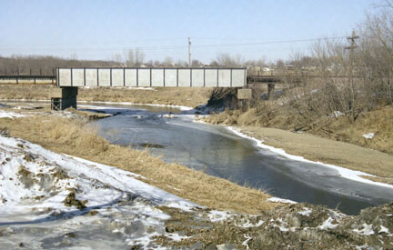
Dyersville is located at 42°28′53″N 91°7′15″W / 42.48139°N 91.12083°W (42.481316, -91.120967),[3] along the North Fork of the Maquoketa River.
According to the United States Census Bureau, the city has a total area of 4.6 square miles (12 km2), of which, 4.6 square miles (12 km2) of it is land and 0.22% is water.
Demographics
 Population history of Dyersville, Iowa (1940-2006).
As of the census[4] of 2000, there were 4,035 people, 1,578 households, and 1,117 families residing in the city. The population density was 878.1 people per square mile (338.7/km²). There were 1,669 housing units at an average density of 363.2 per square mile (140.1/km²). The racial makeup of the city was 98.71% White, 0.45% African American, 0.17% Pacific Islander, 0.12% Asian, 0.05% from other races, and 0.50% from two or more races. Hispanic or Latino of any race were 0.45% of the population.
There were 1,578 households out of which 35.4% had children under the age of 18 living with them, 61.0% were married couples living together, 7.8% had a female householder with no husband present, and 29.2% were non-families. 25.7% of all households were made up of individuals and 13.2% had someone living alone who was 65 years of age or older. The average household size was 2.52 and the average family size was 3.07.
In the city the population was spread out with 28.0% under the age of 18, 6.7% from 18 to 24, 29.1% from 25 to 44, 18.5% from 45 to 64, and 17.7% who were 65 years of age or older. The median age was 36 years. For every 100 females there were 91.2 males. For every 100 females age 18 and over, there were 88.8 males.

The median income for a household in the city was $38,469, and the median income for a family was $45,625. Males had a median income of $29,674 versus $21,312 for females. The per capita income for the city was $17,195. About 4.6% of families and 4.8% of the population were below the poverty line, including 5.5% of those under the age of 18 and 8.4% of those 65 and older.
Law and government
Dyersville's current Mayor is James A. Heavens and is serving in his 3rd term or 6th year as mayor (as of 2009). Dyersville is represented by Senator Tom Hancock (D-Epworth) in the Iowa Senate, and Representative Steven Lukan (R-New Vienna) in the Iowa House of Representatives. At the federal level, it is within Iowa's 1st congressional district, represented by Bruce Braley (D-Waterloo) in the U.S. House of Representatives. Dyersville, and all of Iowa, are represented by U.S. Senators Chuck Grassley (R) and Tom Harkin (D).
Education
All public school students living in Dyersville are zoned to schools in the Western Dubuque Community School District. Elementary school students first attend Dyersville Elementary School (in Dyersville) for grades K-1, then go to Drexler Elementary School in nearby Farley, Iowa for grades 2-5. Middle school students are zoned to Drexler Middle School (also in Farley), and high school students are zoned to Western Dubuque High School in Epworth, Iowa. Dyersville is the largest community in Iowa without a K-5 public school, but one is under construction on the west side of town.
 The Basilica of St. Francis Xavier in Dyersville.
Dyersville also has thriving private schools. Parochial school students attend St. Francis Xavier Elementary School for grades PreK-6, then go to Beckman High School for grades 7-12, both of which are in Dyersville. These schools are both affiliated with the Roman Catholic Church, and are a part of the Roman Catholic Archdiocese of Dubuque.
Economy
Dyersville is a thriving farming city with a long history. It is nicknamed "The Farm Toy Capitol of the World" because it hosts a farm toy show the first weekend in June and the National Farm Toy Show the first weekend in November. It was also the long time home of the Ertl Company a maker of die-cast farm toys. Multiple local businesses are based on this part of its economy.
The city is the location of a manufacturing plant operated by All American Homes, a manufactured housing company.
References
- ^ http://www.census.gov/popest/cities/tables/SUB-EST2006-04-19.xls
- ^ "Dyersville population estimate 2006". http://www.census.gov/popest/cities/tables/SUB-EST2006-04-19.xls. Retrieved June 29, 2007.
- ^ "US Gazetteer files: 2010, 2000, and 1990". United States Census Bureau. 2011-02-12. http://www.census.gov/geo/www/gazetteer/gazette.html. Retrieved 2011-04-23.
- ^ "American FactFinder". United States Census Bureau. http://factfinder.census.gov. Retrieved 2008-01-31.
External links
Municipalities and communities of Delaware County, Iowa Cities 
Townships Adams | Bremen | Coffins Grove | Colony | Delaware | Delhi | Elk | Hazel Green | Honey Creek | Milo | North Fork | Oneida | Prairie | Richland | South Fork | Union
Unincorporated
communitiesPetersburg | Robinson | Rockville
Footnotes ‡This populated place also has portions in an adjacent county or counties
Municipalities and communities of Dubuque County, Iowa Cities Asbury | Balltown | Bankston | Bernard | Cascade‡ | Centralia | Dubuque | Durango | Dyersville‡ | Epworth | Farley | Graf | Holy Cross | Luxemburg | New Vienna | Peosta | Rickardsville | Sageville | Sherrill | Worthington | Zwingle‡

Townships Unincorporated
communityFootnotes ‡This populated place also has portions in an adjacent county or counties
Categories:- Cities in Iowa
- Populated places in Dubuque County, Iowa
- Populated places in Delaware County, Iowa


Wikimedia Foundation. 2010.