- Downderry
-
Coordinates: 50°21′42″N 4°22′12″W / 50.3618°N 4.3701°W
Downderry Cornish: Donderri 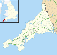
 Downderry
Downderry shown within CornwallOS grid reference SX315540 Unitary authority Cornwall Ceremonial county Cornwall Region South West Country England Sovereign state United Kingdom Post town TORPOINT Postcode district PL11 Dialling code 01503 Police Devon and Cornwall Fire Cornwall Ambulance South Western EU Parliament South West England UK Parliament South East Cornwall List of places: UK • England • Cornwall Downderry (Cornish: Downderri) is a coastal village in southeast Cornwall, United Kingdom. It is situated 18 miles (29 km) west of Plymouth and one mile east of Seaton[1].
Downderry has a long beach of light shingle. Dogs are allowed on the beach. The east beach has a reputation as a nudist beach.
The village and beach offer views of Looe Island to the west and Rame Head to the east and on clear days sight of the Eddystone Lighthouse 8 miles (13 km) to the south.
The village has a Church of England church, a Methodist chapel, a shop with a Post Office, a pub, a restaurant, a coffee shop and a primary school. The hinterland is mainly council-owned farmland.
The Church of St Nicolas Downderry began as a mission church to service the growing population of the village. The building dates from the late 19th century.
References
- ^ Ordnance Survey: Landranger map sheet 201 Plymouth & Launceston ISBN 9780319231463
 Downderry Church
External links
 Media related to Downderry at Wikimedia Commons
Geography of Cornwall Cornwall Portal Unitary authorities Major settlements Bodmin • Bude • Callington • Camborne • Camelford • Falmouth • Fowey • Hayle • Helston • Launceston • Liskeard • Looe • Lostwithiel • Marazion • Newlyn • Newquay • Padstow • Par • Penryn • Penzance • Porthleven • Redruth • Saltash • St Austell • St Blazey • St Columb Major • St Ives • St Just-in-Penwith • St Mawes • Stratton • Torpoint • Truro • Wadebridge
See also: Civil parishes in CornwallRivers Topics History • Status debate • Flag • Culture • Places • People • The Duchy • Diocese • Politics • Hundreds/shires • Places of interest • full list...Categories:- Villages in Cornwall
- Populated coastal places in Cornwall
- Cornwall geography stubs


Wikimedia Foundation. 2010.