- Amboy, Minnesota
Infobox Settlement
official_name = Amboy, Minnesota
settlement_type =City
nickname =
motto =
imagesize =
image_caption =
image_
imagesize =
image_caption =
image_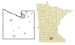
mapsize = 250px
map_caption = Location of Amboy, Minnesota
mapsize1 =
map_caption1 =subdivision_type = Country
subdivision_name =United States
subdivision_type1 = State
subdivision_name1 =Minnesota
subdivision_type2 = County
subdivision_name2 = Blue Earthgovernment_footnotes =
government_type =
leader_title =
leader_name =
leader_title1 =
leader_name1 =
established_title =
established_date =unit_pref = Imperial
area_footnotes =area_magnitude =
area_total_km2 = 0.8
area_land_km2 = 0.8
area_water_km2 = 0.0
area_total_sq_mi = 0.3
area_land_sq_mi = 0.3
area_water_sq_mi = 0.0population_as_of = 2000
population_footnotes =
population_total = 575
population_density_km2 = 710.0
population_density_sq_mi = 1838.9timezone = Central (CST)
utc_offset = -6
timezone_DST = CDT
utc_offset_DST = -5
elevation_footnotes =
elevation_m = 317
elevation_ft = 1040
latd = 43 |latm = 53 |lats = 14 |latNS = N
longd = 94 |longm = 9 |longs = 27 |longEW = Wpostal_code_type =
ZIP code
postal_code = 56010
area_code = 507
blank_name = FIPS code
blank_info = 27-01324GR|2
blank1_name = GNIS feature ID
blank1_info = 0639321GR|3
website =
footnotes =Amboy is a city in Blue Earth County,
Minnesota ,United States . The population was 575 at the 2000 census. It is part of the Mankato–North Mankato Micropolitan Statistical Area.Geography
According to the
United States Census Bureau , the city has a total area of 0.3square mile s (0.8km² ), all of it land.U.S. Route 169 andMinnesota State Highway 30 are two of the main routes in the community.Demographics
As of the
census GR|2 of 2000, there were 575 people, 242 households, and 161 families residing in the city. Thepopulation density was 1,838.9 people per square mile (716.2/km²). There were 268 housing units at an average density of 857.1/sq mi (333.8/km²). The racial makeup of the city was 98.43% White, 0.17% Asian, and 1.39% from two or more races. Hispanic or Latino of any race were 1.39% of the population.There were 242 households out of which 33.1% had children under the age of 18 living with them, 57.9% were married couples living together, 5.8% had a female householder with no husband present, and 33.1% were non-families. 30.6% of all households were made up of individuals and 17.4% had someone living alone who was 65 years of age or older. The average household size was 2.38 and the average family size was 2.98.
In the city the population was spread out with 27.0% under the age of 18, 6.1% from 18 to 24, 25.0% from 25 to 44, 23.0% from 45 to 64, and 19.0% who were 65 years of age or older. The median age was 40 years. For every 100 females there were 96.9 males. For every 100 females age 18 and over, there were 91.8 males.
The median income for a household in the city was $35,595, and the median income for a family was $39,844. Males had a median income of $31,667 versus $20,833 for females. The
per capita income for the city was $15,658. About 8.3% of families and 13.0% of the population were below thepoverty line , including 21.8% of those under age 18 and 12.8% of those age 65 or over.Education
Maple River West Middle School is located in Amboy. As the name implies it is a middle school servicing 6th, 7th, and 8th graders.
References
Wikimedia Foundation. 2010.