- Oklee, Minnesota
-
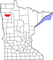
Oklee, Minnesota — City — Location of Oklee, Minnesota
Coordinates: 47°50′15″N 95°51′12″W / 47.8375°N 95.85333°W Country United States State Minnesota County Red Lake Area – Total 0.7 sq mi (1.7 km2) – Land 0.7 sq mi (1.7 km2) – Water 0.0 sq mi (0.0 km2) Elevation 1,152 ft (351 m) Population (2010)[1] – Total 435 – Density 621.4/sq mi (255.9/km2) Time zone Central (CST) (UTC-6) – Summer (DST) CDT (UTC-5) ZIP code 56742 Area code(s) 218 FIPS code 27-48202[2] GNIS feature ID 0648913[3] Oklee is a city in Red Lake County, Minnesota, United States on Minnesota State Highway 222. The population was 435 at the 2010 census.[1]
Contents
Geography
According to the United States Census Bureau, the city has a total area of 0.7 square miles (1.8 km2), all of it land.
History
Oklee was founded in 1910 and named after O. K. Lee — hence the name "Oklee". Oklee has long been an active grain farming community.
Demographics
As of the census[2] of 2000, there were 396 people, 196 households, and 105 families residing in the city. The population density was 603.7 people per square mile (231.7/km²). There were 229 housing units at an average density of 349.1 per square mile (134.0/km²). The racial makeup of the city was 98.74% White, 1.01% Native American, and 0.25% from two or more races. Hispanic or Latino of any race were 0.25% of the population.
There were 196 households out of which 26.5% had children under the age of 18 living with them, 42.3% were married couples living together, 9.2% had a female householder with no husband present, and 46.4% were non-families. 44.9% of all households were made up of individuals and 26.5% had someone living alone who was 65 years of age or older. The average household size was 2.02 and the average family size was 2.85.
In the city the population was spread out with 24.7% under the age of 18, 5.8% from 18 to 24, 23.2% from 25 to 44, 19.9% from 45 to 64, and 26.3% who were 65 years of age or older. The median age was 42 years. For every 100 females there were 90.4 males. For every 100 females age 18 and over, there were 82.8 males.
The median income for a household in the city was $23,214, and the median income for a family was $30,417. Males had a median income of $22,333 versus $18,500 for females. The per capita income for the city was $14,342. About 12.3% of families and 14.7% of the population were below the poverty line, including 27.5% of those under age 18 and 8.1% of those age 65 or over.
References
- ^ a b "2010 Census Redistricting Data (Public Law 94-171) Summary File". American FactFinder. U.S. Census Bureau, 2010 Census. http://factfinder2.census.gov/faces/tableservices/jsf/pages/productview.xhtml?pid=DEC_10_PL_GCTPL2.ST13&prodType=table. Retrieved 23 April 2011.
- ^ a b "American FactFinder". United States Census Bureau. http://factfinder.census.gov. Retrieved 2008-01-31.
- ^ "US Board on Geographic Names". United States Geological Survey. 2007-10-25. http://geonames.usgs.gov. Retrieved 2008-01-31.
Municipalities and communities of Red Lake County, Minnesota Cities Brooks | Oklee | Plummer | Red Lake Falls
Townships Browns Creek | Emardville | Equality | Garnes | Gervais | Lake Pleasant | Lambert | Louisville | Poplar River | Red Lake Falls | River | Terrebonne | Wylie
Unincorporated
communitiesDorothy | Huot | Terrebonne
Coordinates: 47°50′21″N 95°51′16″W / 47.83917°N 95.85444°W
Categories:- Cities in Minnesota
- Populated places in Red Lake County, Minnesota


Wikimedia Foundation. 2010.