Djimla District

Djimla District
Djimla District
دائرة جيملة
—  District  —
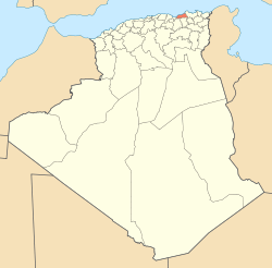
Map of Algeria highlighting Jijel Province
Map of Jijel Province highlighting Djimla District
Country  Algeria
Province Jijel
District seat Djimla
Area
 – Total 145.37 km2 (56.1 sq mi)
Population (1998)
 – Total 22,297
 – Density 153.4/km2 (397.3/sq mi)
Time zone CET (UTC+01)
Municipalities 2

Djimla is a district in Jijel Province, Algeria. It was named after its capital, Djimla.

Municipalities

The district is further divided into 2 municipalities:


Wikimedia Foundation. 2010.

Игры ⚽ Нужна курсовая?

Look at other dictionaries:

  • Djimla —   Commune and town   Country  Algeria Province Jijel Province …   Wikipedia

  • Jijel — Coordinates: 36°48′N 5°46′E / 36.8°N 5.767°E / 36.8; 5.767 …   Wikipedia

  • Chahna —   Commune and town   Country  Algeria Province Jijel Province …   Wikipedia

  • Chekfa —   Commune and town   Country  Algeria Province Jijel Province …   Wikipedia

  • Djemaa Beni Habibi — is a municipality in Jijel province. It is located in the Northeast of the province and close to the Mediterranean coast, at 40 km Eastern Jijel s City centre and 90 km Northwest Constantine City. Its territory (48.25 km²) is bounded by the west… …   Wikipedia

  • Ouadjana —   Commune and town   Country  Algeria Province Jijel Province …   Wikipedia

  • Ouled Rabah — M3 Beni khattab   Commune and town   Country  Algeria …   Wikipedia

  • Ouled Yahia Khedrouche —   Commune and town   Country  Algeria Province …   Wikipedia

Share the article and excerpts

Direct link
Do a right-click on the link above
and select “Copy Link”