- Merwin, Missouri
-
Merwin, Missouri — Village — Location of Merwin, Missouri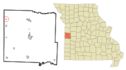
Coordinates: 38°24′18″N 94°35′24″W / 38.405°N 94.59°WCoordinates: 38°24′18″N 94°35′24″W / 38.405°N 94.59°W Country United States State Missouri County Bates Area – Total 0.1 sq mi (0.4 km2) – Land 0.1 sq mi (0.4 km2) – Water 0.0 sq mi (0.0 km2) Elevation 899 ft (274 m) Population (2000) – Total 83 – Density 572.7/sq mi (221.1/km2) Time zone Central (CST) (UTC-6) – Summer (DST) CDT (UTC-5) FIPS code 29-47540[1] GNIS feature ID 0722244[2] Merwin is a village in Bates County, Missouri, United States. The population was 83 at the 2000 census.
Geography
Merwin is located at 38°24′18″N 94°35′24″W / 38.405°N 94.59°W (38.404972, -94.590084)[3].
According to the United States Census Bureau, the village has a total area of 0.1 square miles (0.26 km2), all of it land.
Demographics
As of the census[1] of 2000, there were 83 people, 32 households, and 22 families residing in the village. The population density was 572.7 people per square mile (228.9/km²). There were 33 housing units at an average density of 227.7 per square mile (91.0/km²). The racial makeup of the village was 87.95% White, and 12.05% from two or more races.
There were 32 households out of which 43.8% had children under the age of 18 living with them, 56.3% were married couples living together, 9.4% had a female householder with no husband present, and 31.3% were non-families. 28.1% of all households were made up of individuals and 15.6% had someone living alone who was 65 years of age or older. The average household size was 2.59 and the average family size was 3.14.
In the village the population was spread out with 32.5% under the age of 18, 3.6% from 18 to 24, 34.9% from 25 to 44, 19.3% from 45 to 64, and 9.6% who were 65 years of age or older. The median age was 36 years. For every 100 females there were 112.8 males. For every 100 females age 18 and over, there were 86.7 males.
The median income for a household in the village was $23,125, and the median income for a family was $26,250. Males had a median income of $28,750 versus $23,750 for females. The per capita income for the village was $10,038. There were 23.3% of families and 27.4% of the population living below the poverty line, including 29.2% of under eighteens and 57.1% of those over 64.
References
- ^ a b "American FactFinder". United States Census Bureau. http://factfinder.census.gov. Retrieved 2008-01-31.
- ^ "US Board on Geographic Names". United States Geological Survey. 2007-10-25. http://geonames.usgs.gov. Retrieved 2008-01-31.
- ^ "US Gazetteer files: 2010, 2000, and 1990". United States Census Bureau. 2011-02-12. http://www.census.gov/geo/www/gazetteer/gazette.html. Retrieved 2011-04-23.
Municipalities and communities of Bates County, Missouri Cities 
Villages Townships Charlotte | Deepwater | Deer Creek | East Boone | Elkhart | Grand River | Homer | Howard | Hudson | Lone Oak | Mingo | Mound | Mount Pleasant | New Home | Osage | Pleasant Gap | Prairie | Rockville | Shawnee | Spruce | Summit | Walnut | West Boone | West Point
Footnotes ‡This populated place also has portions in an adjacent county or counties
Categories:- Villages in Bates County, Missouri


Wikimedia Foundation. 2010.