- Chain of Rocks, Missouri
-
Chain of Rocks, Missouri — Village — Location of Chain of Rocks, Missouri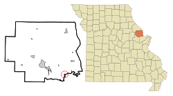
Coordinates: 38°54′53″N 90°48′8″W / 38.91472°N 90.80222°WCoordinates: 38°54′53″N 90°48′8″W / 38.91472°N 90.80222°W Country United States State Missouri County Lincoln Area – Total 0.2 sq mi (0.4 km2) – Land 0.2 sq mi (0.4 km2) – Water 0.0 sq mi (0.0 km2) Elevation 472 ft (144 m) Population (2000) – Total 91 – Density 528.1/sq mi (203.9/km2) Time zone Central (CST) (UTC-6) – Summer (DST) CDT (UTC-5) ZIP code 63369 Area code(s) 636 FIPS code 29-13006[1] GNIS feature ID 0715698[2] Chain of Rocks is a village in Lincoln County, Missouri, United States. The population was 91 at the 2000 census.
Geography
Chain of Rocks is located at 38°54′53″N 90°48′8″W / 38.91472°N 90.80222°W (38.914718, -90.802133)[3]. It is named after an exposure of bedrock in the Mississippi River north of St. Louis that forms a remarkable "chain of rocks" across its width. According to the United States Census Bureau, the village has a total area of 0.2 square miles (0.52 km2), all of it land.
Demographics
As of the census[1] of 2000, there were 91 people, 34 households, and 24 families residing in the village. The population density was 528.1 people per square mile (206.7/km²). There were 42 housing units at an average density of 243.7/sq mi (95.4/km²). The racial makeup of the village was 100.00% White.
There were 34 households out of which 38.2% had children under the age of 18 living with them, 58.8% were married couples living together, 8.8% had a female householder with no husband present, and 29.4% were non-families. 29.4% of all households were made up of individuals and 8.8% had someone living alone who was 65 years of age or older. The average household size was 2.68 and the average family size was 3.29.
In the village the population was spread out with 28.6% under the age of 18, 6.6% from 18 to 24, 33.0% from 25 to 44, 22.0% from 45 to 64, and 9.9% who were 65 years of age or older. The median age was 36 years. For every 100 females there were 102.2 males. For every 100 females age 18 and over, there were 103.1 males.
The median income for a household in the village was $31,250, and the median income for a family was $38,125. Males had a median income of $61,000 versus $22,500 for females. The per capita income for the village was $18,848. There were 7.1% of families and 13.6% of the population living below the poverty line, including 28.6% of under eighteens and 44.4% of those over 64.
References
- ^ a b "American FactFinder". United States Census Bureau. http://factfinder.census.gov. Retrieved 2008-01-31.
- ^ "US Board on Geographic Names". United States Geological Survey. 2007-10-25. http://geonames.usgs.gov. Retrieved 2008-01-31.
- ^ "US Gazetteer files: 2010, 2000, and 1990". United States Census Bureau. 2011-02-12. http://www.census.gov/geo/www/gazetteer/gazette.html. Retrieved 2011-04-23.
Municipalities and communities of Lincoln County, Missouri Cities Elsberry | Foley | Hawk Point | Moscow Mills | Old Monroe | Troy | Winfield

Villages Cave | Chain of Rocks | Fountain N' Lakes | Silex | Truxton | Whiteside
Unincorporated
communitiesCategories:- Villages in Lincoln County, Missouri


Wikimedia Foundation. 2010.