- Greenville, Missouri
Infobox Settlement
official_name = Greenville, Missouri
settlement_type =City
nickname =
motto =
imagesize =
image_caption =
image_
imagesize =
image_caption =
image_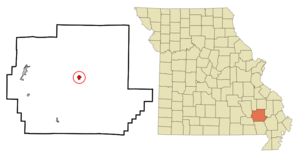
mapsize = 250px
map_caption = Location of Greenville, Missouri
mapsize1 =
map_caption1 =subdivision_type = Country
subdivision_name =United States
subdivision_type1 = State
subdivision_name1 =Missouri
subdivision_type2 = County
subdivision_name2 = Wayne
government_footnotes =
government_type =
leader_title =
leader_name =
leader_title1 =
leader_name1 =
established_title =
established_date =unit_pref = Imperial
area_footnotes =area_magnitude =
area_total_km2 = 1.7
area_land_km2 = 1.7
area_water_km2 = 0.0
area_total_sq_mi = 0.7
area_land_sq_mi = 0.7
area_water_sq_mi = 0.0population_as_of = 2000
population_footnotes =
population_total = 451
population_density_km2 = 260.4
population_density_sq_mi = 674.3timezone = Central (CST)
utc_offset = -6
timezone_DST = CDT
utc_offset_DST = -5
elevation_footnotes =
elevation_m = 124
elevation_ft = 407
latd = 37 |latm = 7 |lats = 38 |latNS = N
longd = 90 |longm = 26 |longs = 54 |longEW = Wpostal_code_type =
ZIP code
postal_code = 63944
area_code = 573
blank_name = FIPS code
blank_info = 29-29476GR|2
blank1_name = GNIS feature ID
blank1_info = 0750153GR|3
website =
footnotes =Greenville is a small city in Wayne County,
Missouri , in theUnited States , along theSt. Francis River . As of the 2000 census, the city population was 451. It is thecounty seat of Wayne CountyGR|6.Geography
Greenville is located on the edge of the
Ozark Mountains situated in a hilly forested landscape.U.S. Route 67 , which leads from Illinois in the north to theGulf of Mexico in the south, runs directly through Greenville. The coordinates are coor dms|37|7|38|N|90|26|54|W|city (37.127302, -90.448471)GR|1. The next larger city with more shopping venues and a cinema is Poplar Bluff, which lies ca. 30 miles south of Greenville via Route 67. According to theUnited States Census Bureau , the city has a total area of 0.7square mile s (1.7km² ), all of it land.chools
Greenville has in addition to a kindergarten with an attached elementary school a small, combined junior high school and a high school with a total of 762 students and 57 teachers. The colors of the school are red and black and white. The mascot is the bear. The most popular types of sports at the schools are baseball, basketball, girl's softball, girl's volleyball .
Media
The single local newspaper is the weekly "Wayne County Journal Banner".
Demographics
As of the
census GR|2 of 2000, there were 451 people, 190 households, and 113 families residing in the city. Thepopulation density was 674.3 people per square mile (259.9/km²). There were 222 housing units at an average density of 331.9/sq mi (127.9/km²). The racial makeup of the city was 98.67% White, 0.22% Native American, and 1.11% from two or more races. Hispanic or Latino of any race were 1.33% of the population.There were 190 households out of which 28.9% had children under the age of 18 living with them, 47.4% were married couples living together, 10.0% had a female householder with no husband present, and 40.5% were non-families. 37.4% of all households were made up of individuals and 22.1% had someone living alone who was 65 years of age or older. The average household size was 2.16 and the average family size was 2.85.
In the city the population was spread out with 21.3% under the age of 18, 7.8% from 18 to 24, 25.5% from 25 to 44, 20.2% from 45 to 64, and 25.3% who were 65 years of age or older. The median age was 42 years. For every 100 females there were 72.8 males. For every 100 females age 18 and over, there were 67.5 males.
The median income for a household in the city was $28,214, and the median income for a family was $39,375, and therefore lies at more than 30% below the national average. Males had a median income of $27,500 versus $17,656 for females. The
per capita income for the city was $16,802. About 13.1% of families and 14.2% of the population were below thepoverty line , including 20.4% of those under age 18 and 11.0% of those age 65 or over.References
External links
Wikimedia Foundation. 2010.