- North Grosvenor Dale
-
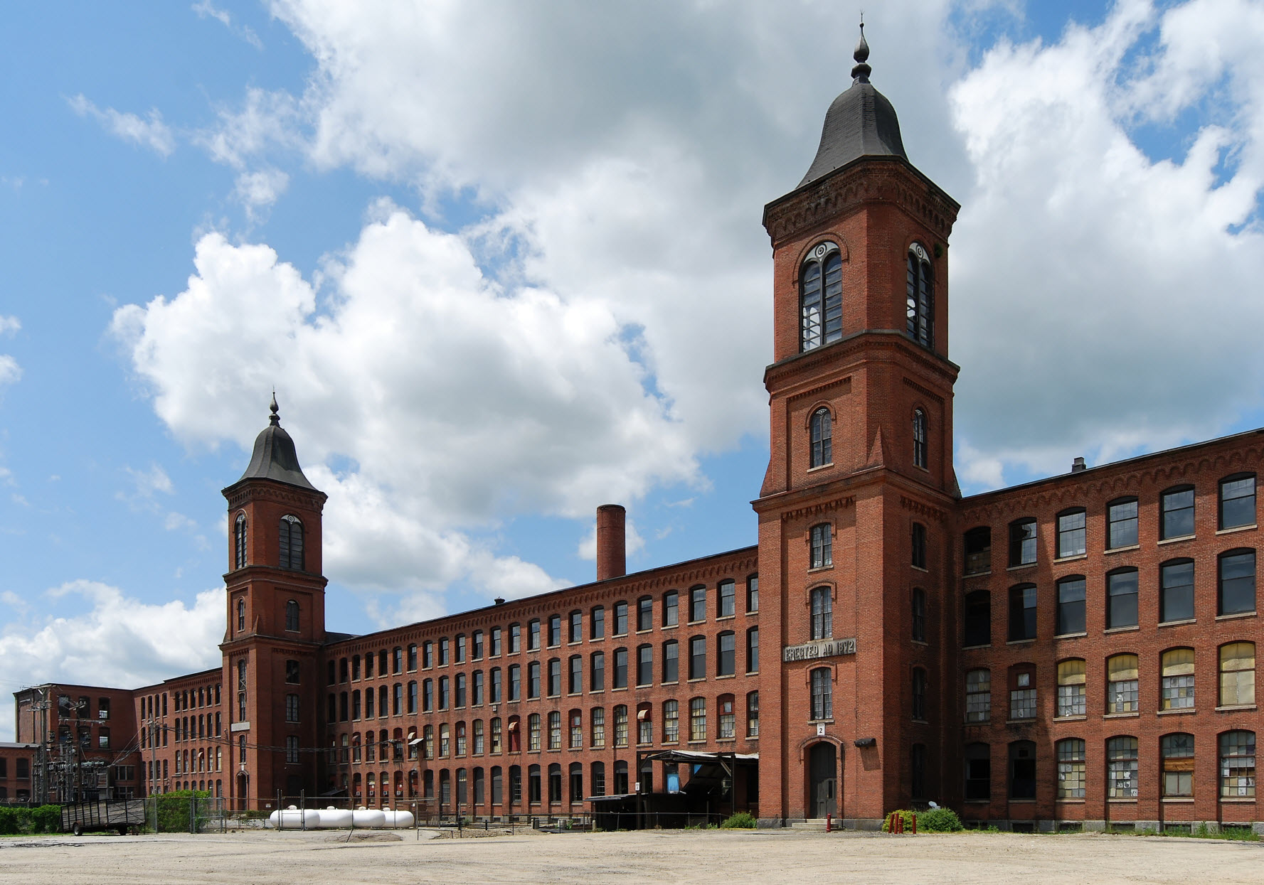
North Grosvenordale Mill Historic District
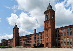
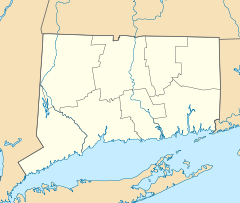

Location: Riverside Dr. (CT 12), Buckley Hill Rd., Floral Ave., Market La., and Marshall, Central, River, and Holmes Sts., Thompson, Connecticut Coordinates: 41°59′9″N 71°53′53″W / 41.98583°N 71.89806°WCoordinates: 41°59′9″N 71°53′53″W / 41.98583°N 71.89806°W Area: 70 acres (28 ha) Built: 1872 Architect: F.P. Sheldon Co. Architectural style: Greek Revival, Romanesque Governing body: State NRHP Reference#: 93000288[1] Added to NRHP: April 16, 1993 North Grosvenor Dale is a village and census-designated place (CDP) in the town of Thompson in Windham County, Connecticut, United States. The population was 1,424 at the 2000 census. The core of the village is listed as the North Grosvenordale Mill Historic District on the National Register of Historic Places. The historic area was listed in 1993 and is located on Riverside Drive (Route 12), Buckley Hill Road, Floral Avenue, Market Lane, and Marshall, Central, River, and Holmes Streets.
Geography
According to the United States Census Bureau, the CDP has a total area of 5.8 km² (2.2 mi²), all land.
Demographics
As of the census[2] of 2000, there were 1,424 people, 589 households, and 385 families residing in the CDP. The population density was 244.4/km² (632.2/mi²). There were 654 housing units at an average density of 112.2/km² (290.4/mi²). The racial makeup of the CDP was 97.19% White, 0.84% African American, 0.63% Native American, 0.28% Asian, 0.49% from other races, and 0.56% from two or more races. Hispanic or Latino of any race were 1.83% of the population.
There were 589 households out of which 32.4% had children under the age of 18 living with them, 45.8% were married couples living together, 13.6% had a female householder with no husband present, and 34.5% were non-families. 29.2% of all households were made up of individuals and 11.5% had someone living alone who was 65 years of age or older. The average household size was 2.42 and the average family size was 2.96.
In the CDP the population was spread out with 26.3% under the age of 18, 8.1% from 18 to 24, 31.7% from 25 to 44, 20.2% from 45 to 64, and 13.8% who were 65 years of age or older. The median age was 36 years. For every 100 females there were 93.0 males. For every 100 females age 18 and over, there were 90.0 males.
The median income for a household in the CDP was $38,850, and the median income for a family was $38,214. Males had a median income of $33,906 versus $25,372 for females. The per capita income for the CDP was $16,409. About 6.7% of families and 10.9% of the population were below the poverty line, including 12.1% of those under age 18 and 8.0% of those age 65 or over.
Municipalities and communities of Windham County, Connecticut Towns 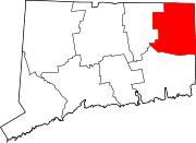
Borough Unincorporated
communitiesCentral Village | Dayville | East Brooklyn | Moosup | North Grosvenor Dale | Plainfield Village | Putnam District | Quebec | Quinebaug | South Windham | South Woodstock | Wauregan | Willimantic | Windham Center
U.S. National Register of Historic Places Topics Lists by states Alabama • Alaska • Arizona • Arkansas • California • Colorado • Connecticut • Delaware • Florida • Georgia • Hawaii • Idaho • Illinois • Indiana • Iowa • Kansas • Kentucky • Louisiana • Maine • Maryland • Massachusetts • Michigan • Minnesota • Mississippi • Missouri • Montana • Nebraska • Nevada • New Hampshire • New Jersey • New Mexico • New York • North Carolina • North Dakota • Ohio • Oklahoma • Oregon • Pennsylvania • Rhode Island • South Carolina • South Dakota • Tennessee • Texas • Utah • Vermont • Virginia • Washington • West Virginia • Wisconsin • WyomingLists by territories Lists by associated states Other References
- ^ "National Register Information System". National Register of Historic Places. National Park Service. 2009-03-13. http://nrhp.focus.nps.gov/natreg/docs/All_Data.html.
- ^ "American FactFinder". United States Census Bureau. http://factfinder.census.gov. Retrieved 2008-01-31.
Categories:- Historic districts in Connecticut
- Historic districts in Windham County, Connecticut
- Census-designated places in Windham County, Connecticut
- Early American industrial centers
- Thompson, Connecticut
- Villages in Connecticut


Wikimedia Foundation. 2010.