- Jerusalem Binyanei HaUma Railway Station
-
Jerusalem Binyanei HaUma Railway Station 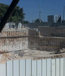
Construction of the underground railway stationStation statistics Connections Buses from the Jerusalem Central Bus Station and light rail stop Structure Underground Depth 80m Levels 3 Platforms 4 Other information Opened Expected in 2018 Jerusalem Binyanei HaUma Railway Station is a future railway station on the future high-speed railway to Jerusalem near Binyanei HaUma in Jerusalem, Israel. The station is currently under construction and will be mostly underground, 60–80 m deep. It is located adjacent to the Jerusalem Central Bus Station and the Jerusalem Light Rail line which is currently under construction.
Construction of the station's foundations began in 2009, after the company Ramat beat Terre Armee, Ram Engineering and Linom in a tender to excavate the station's lower level and platforms at the cost of NIS 83 million.[1] Ramat's excavation was halted for an extended period of time due to financial problems at the company and was restarted in early 2010. As of April 2011, tenders for subsequent construction phases of the station's structure have yet to be published.
The station's total floor area will be 26,000 m2,[1] and the length of the platforms will be 300 m.[2] The station is set to double as a shelter in case of a biological or chemical attack, being able to provide refuge for 5,000 people.[3]
References
- ^ a b "Israel Railways Beginning to Build the Railway Station in Jerusalem". Port2Port. December 24, 2008. http://port2port.co.il/Index.asp?ArticleID=64942&CategoryID=46&Year=2008&Month=12&Page=1. Retrieved 2008-12-25.
- ^ "Construction on Railway Station in Jerusalem to Start Soon". nrg Maariv. December 24, 2008. http://www.nrg.co.il/online/54/ART1/830/088.html?hp=54&loc=4&tmp=6473. Retrieved 2008-12-25.
- ^ Petersburg, Ofer (August 18, 2010). "Israel's 'Judgment Day' Shelters". Ynetnews. http://www.ynetnews.com/articles/0,7340,L-3939140,00.html. Retrieved 2010-08-18.
Coordinates: 31°47′17.59″N 35°12′8.78″E / 31.7882194°N 35.2024389°E
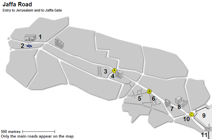
Jaffa Road 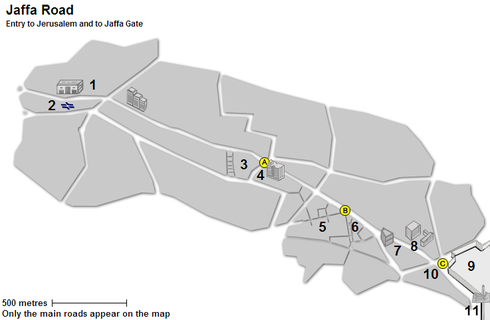
Places 1. Central Bus Station · 2. Railway station (planned) · 3. Mahane Yehuda Market · 4. Klal Center
5. Ben Yehuda Street · 6. Nahalat Shiva · 7. Generali Building · 8. Safra Square / City Hall · 9. Old City
10. Mamilla · 11. Jaffa Gate / Tower of DavidSquares A. Davidka Square · B. Zion Square · C. Tzahal Square · D. Safra Square 
This article about an Asian railroad station is a stub. You can help Wikipedia by expanding it. This article about transport in Israel is a stub. You can help Wikipedia by expanding it.