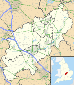
Murcott, Northamptonshire
- Murcott, Northamptonshire
-
Categories:
- Northamptonshire geography stubs
- Villages in Northamptonshire
Wikimedia Foundation.
2010.
Look at other dictionaries:
Murcott — is the name of more than one place in England: Murcott, Northamptonshire Murcott, Oxfordshire Murcott, Wiltshire For the settlement in Worcestershire, see Murcot. This disambiguation page lists articles about distinct geographical locations with… … Wikipedia
Murcott — Recorded as Morcott, Murcott, Murcutt, and possibly others, this is an English surname. It is of locational origin either from Morcott in Rutland recorded as Morcote in the famous Domesday Book of 1086, Murcot in Oxfordshire or Murcott in… … Surnames reference
List of lost settlements in Northamptonshire — This list is of deserted medieval villages (DMVs), shrunken villages and other settlements known to have been lost or significantly reduced in size over the centuries. [ An Inventory of Archaeological Sites in North West Northamptonshire (1981)… … Wikipedia
List of places in Northamptonshire — This is a list of places in the ceremonial county of Northamptonshire, United Kingdom. See the list of places in England for places in other counties See also compactTOC NOTOC AAbington Abthorpe Achurch Adstone Alderton Aldwincle Althorp… … Wikipedia
Murcutt — Recorded as Morcott, Murcott, Murcutt, and possibly others, this is an English surname. It is of locational origin either from Morcott in Rutland recorded as Morcote in the famous Domesday Book of 1086, Murcot in Oxfordshire or Murcott in… … Surnames reference
Charlton-on-Otmoor — Coordinates: 51°50′24″N 1°11′02″W / 51.840°N 1.184°W / 51.840; 1.184 … Wikipedia
List of lost settlements in the UK — This list includes some of the thousands of deserted medieval villages (DMVs), shrunken villages and other settlements known to have been lost or significantly reduced in size over the centuries. There are estimated to be as many as 3,000 DMVs in … Wikipedia
Deddington — Coordinates: 51°59′20″N 1°19′12″W / 51.989°N 1.320°W / 51.989; 1.320 … Wikipedia
Mollington, Oxfordshire — Coordinates: 52°07′26″N 1°21′40″W / 52.124°N 1.361°W / 52.124; 1.361 … Wikipedia
Claydon, Oxfordshire — Coordinates: 52°08′49″N 1°19′59″W / 52.147°N 1.333°W / 52.147; 1.333 … Wikipedia
 Murcott