- Mousehold Heath
-
 Britannia Barracks
 Heathland
Mousehold Heath is an area of heathland and woodland which lies in north east Norwich, England and a designated Local Nature Reserve [1]. It is now mostly covered by broad-leaf semi-natural woodland, although some areas of heath remain and are actively managed.
Contents
History
In 1144 the body of a boy, William of Norwich, was found on the heath. The story was circulated that his death was the result of ritual murder carried out by Jews and he attained the status of saint and martyr. This was the first medieval example of blood libel against Jews. A chapel was erected on the site where the body was found, and its remains can still be seen on the northern edge of the present heath.
In 1381 the final battle of the Peasants' Revolt took place a few days after a huge meeting of people on the Heath occurred on 17th June. There Geoffrey Litster, later to be defeated at the Battle of North Walsham, was proclaimed 'King of the Commons'.[2]
In the Tudor period, Mousehold Heath stretched as far north as South Walsham and was 35 km (22 mi) round. By 1779, it still stretched to Woodbastwick.
In 1549 Robert Kett, rebelling against the Duke of Somerset, led a large group of men who camped for six weeks on the heath before the rebellion was suppressed.
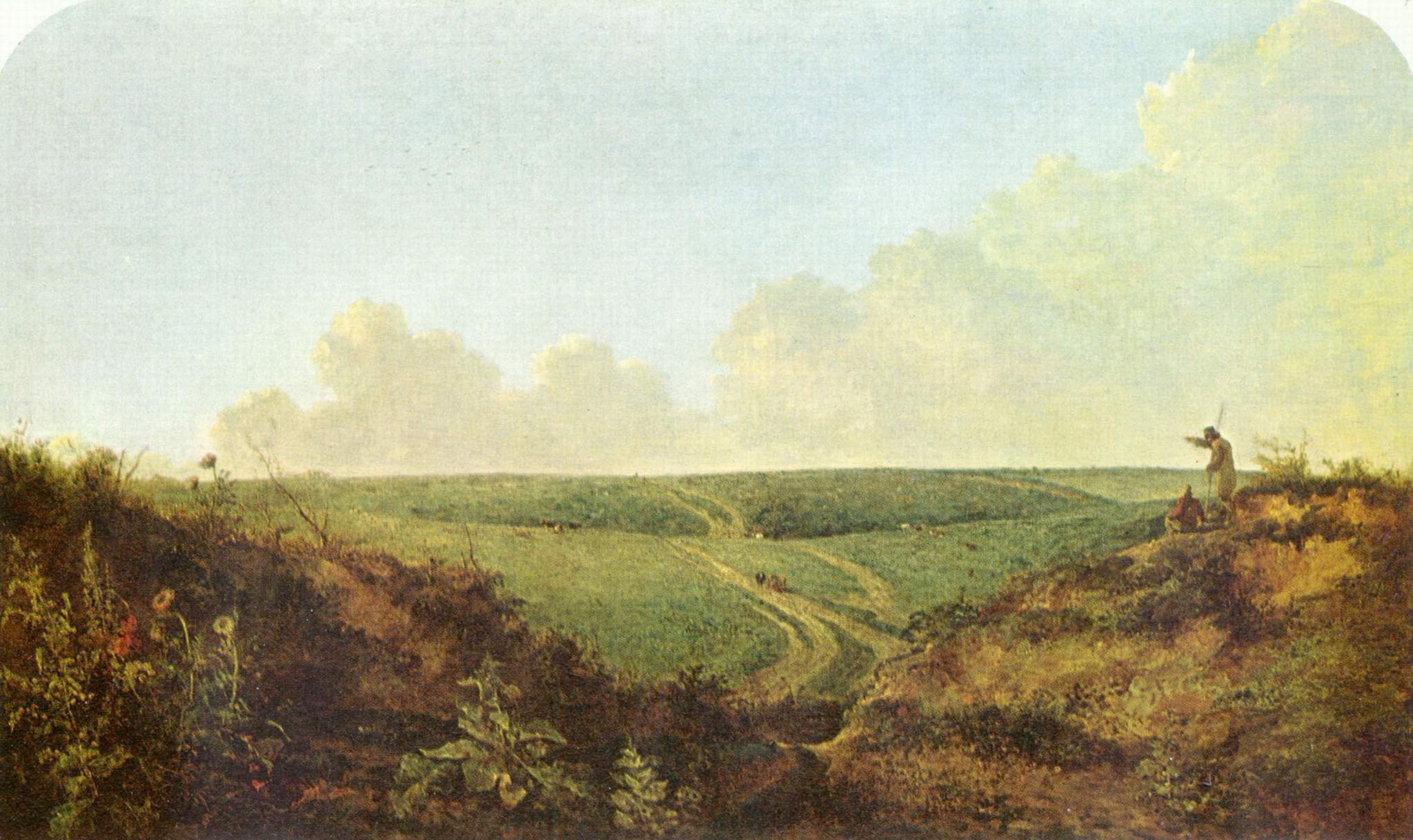
 Mousehold Heath c. 1818-1820 by John Crome
Mousehold Heath was famously painted by a number of the Norwich school artists including John Crome and John Sell Cotman. In his autobiographical work Lavengro George Borrow records his meetings with gypsies on the heath. The Norwich born novelist, and one time Lord Mayor, R. H. Mottram was another artist who valued the open space of Mousehold Heath. He once described it as "the property of those who have the privilege of Norwich birth".
Many parts of the heath are riddled with pits which are the result of sand and gravel extraction in the 19th century and earlier. It also includes the sites of numerous former brick kilns and clay pits.
The heath was given to Norwich City Council (then known as the local corporation) to look after on behalf of the citizens of Norwich in 1880 during the mayoralty of Sir Charles Rackham Gilman. This was officially recorded by Parliament in an agreement called the Mousehold Heath Confirmation Act. In 1884, Mousehold Heath Conservators, an independent governing body for the heath, was formed, and Gilman served as the first Chairman of Conservators of the Heath.[3] In 1984 a new Mousehold Heath Act became law.
By the early 1900s, Mousehold Heath was open countryside with virtually no trees - a classic heathland landscape. The area was kept open by grazing animals and by local people collecting bedding and feed for livestock and fuel for the winter. As the way people lived changed, these traditions disappeared. This resulted in a gradual loss of open heath to scrub and woodland.
The area between the Salhouse and Plumstead roads (outside of the outer ring road) was originally the Cavalry training ground and then became the Royal Flying Corps Mousehold Heath aerodrome where Boulton Paul, among other manufacturers, passed over the aircraft they made for service. After the First World War, Boulton and Paul continued to use the site which then became the first Norwich Airport. The whole area is now the Heartsease Housing Estate.
A tram line used to run through the heath, and its route is now a pathway through the wooded area to the left of Gurney Road.
Ron Saunders, the Norwich City Football Club manager, used to use the hills near the Britannia Barracks to train the players.
 The Bandstand, Mousehold Heath
 Former mineral workings
Today
Today the heath covers nearly 200 acres (81 ha) . It is now mostly pleasant woodland with a range of wildlife and is much appreciated by Norwich people as a public open space and 'country in the city'. It contains two football pitches, a pitch-and-putt course, Zaks Restaurant and a band stand where performances are given in the summer. There is a fine view of the city of Norwich and Norwich Cathedral from Brittania Road. The facade of the old Britannia Barracks which also looks over the city is now the administrative offices and staff club and restaurant of Norwich Prison. The impressive barrack block which stood behind the facade served as a Category C prison for some years from the 1970s but was demolished in the 1980s and replaced by a modern Category B prison block. The Victorian Norwich Prison which stands at the end of Knox Road behind the old Barracks site was built in the mid-19th century as part of the reformation of the penal system brought about by the great prison reformers of that time. These included Elizabeth Fry.
The original Rangers house has been bought for renovation and restoration and Gilman Road has been closed to traffic.
During the winter months in the right conditions, St James' Hill which is adjacent to the barracks becomes a mecca for winter sports such as sledging. It is also a well known for its views across the city.
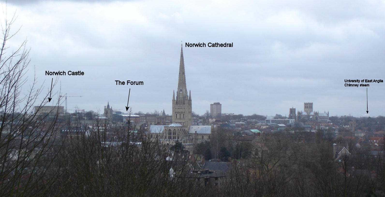
 Norwich as viewed from St James' Hill
Vinegar Pond the rain fed dew pond is the only standing water on the heath. It is believed to have been created in World War II by Bren gun carriers exercising on the heath - their weight compressing the soil and rendering it impervious to water[4] During prolonged spells of dry weather the heath is a target for arsonists.[5]
Wildlife
The heath is home to a number of rare insects: Green Hairstreak, Purple Hairstreak, Small Heath and Small Copper butterflies; and a number of rare solitary bees including cuckoo bees. Amphibians include Common Frog and Common Toad, while reptiles include Grass Snake, Common Lizard and Slow Worm. Mammals on the heath include Muntjak and Roe deer, Red Fox, Rabbit and various small mice and voles.
As well as most common urban birds, the heath holds breeding Sparrowhawk and Tawny Owl as well as Nuthatch, Treecreeper and Great Spotted Woodpecker.[6]
See also
- RAF Mousehold Heath
References
- ^ Local Nature Reserves in Norwich Retrieved 29 June 2011
- ^ Walsingham, Thomas, (Editors Taylor, J., Childs, W. R., Watkiss, L.), The St Albans Chronicle: The Chronica Maiora of Thomas Walsingham Volume I 1376-1394 ISBN 0-19-820471-X
- ^ Searches into the History of the Gillman or Gilman Family, Alexander William Gillman, Eliiot Stock, London, 1895
- ^ World War II military exercises Retrieved July 23, 2008
- ^ News report Retrieved 9 May 2011
- ^ Mousehold Heath wildlife Retrieved 02 April. 2010
External links
- Mousehold Heath
- Flying on Mousehold Heath
- Dragonflies on Mousehold Heath
- Mousehold Heath Conservators
- Mousehold Heath Defenders
Categories:- Geography of Norfolk
- Districts of Norwich
- Historic parks, heaths and woods of Norfolk
- Local Nature Reserves in England


Wikimedia Foundation. 2010.