- Cloverland, Indiana
-
Cloverland — Unincorporated town — Cloverland, Indiana, along State Road 340 Clay County's location in Indiana
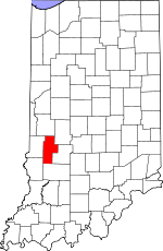 Location in Clay County
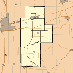
 Cloverland
Coordinates: 39°30′05″N 87°13′53″W / 39.50139°N 87.23139°WCoordinates: 39°30′05″N 87°13′53″W / 39.50139°N 87.23139°W Country United States State Indiana County Clay Township Posey Elevation 607 ft (185 m) ZIP code 47834 FIPS code 18-13888[1] GNIS feature ID 432691[2] Cloverland is an unincorporated town in Posey Township, Clay County, Indiana. It is part of the Terre Haute Metropolitan Statistical Area.
Geography
Cloverland is located at 39°30′05″N 87°13′53″W / 39.50139°N 87.23139°W. Is it located about 6 miles west of the county seat, Brazil, and less than a mile east of the Vigo-Clay line. Cloverland is within the humid continental climate zone. The terrain is gently rolling and includes a small brook. [3]
History
[4] The town was platted in 1834 as a speculative venture by Terre Haute doctor Charles Modesitt. The town grew steadily with several general stores, a carpentry shop, and several other ventures. With the construction of the railroad, business activity shifted to nearby Brazil, and the town's population dwindled. Today, a church, a commercial building, and cluster of houses are all that remains.
References
- ^ "American FactFinder". United States Census Bureau. http://factfinder.census.gov. Retrieved 2008-01-31.
- ^ "Cloverland, Indiana". Geographic Names Information System, U.S. Geological Survey. http://geonames.usgs.gov/pls/gnispublic/f?p=gnispq:3:::NO::P3_FID:432691. Retrieved 2009-10-10.
- ^ http://en.wikipedia.org/wiki/Humid_continental_climate
- ^ Clay County Interim Report, published by Historic Landmarks Foundation of Indiana
Municipalities and communities of Clay County, Indiana City 
Towns Carbon | Center Point | Clay City | Harmony | Knightsville | Staunton
Townships Brazil | Cass | Dick Johnson | Harrison | Jackson | Lewis | Perry | Posey | Sugar Ridge | Van Buren | Washington
Unincorporated
communitiesArt | Ashboro | Asherville | Barrick Corner | Bee Ridge | Benwood | Billtown | Billville | Bogle Corner | Bowling Green | Brunswick | Buchanan Corner | Cardonia | Cloverland | Coalmont | Cory | Cottage Hill | Eel River | Hoffman Crossing | Hoosierville | Howesville | Lap Corner | Middlebury | Old Hill | Perth | Poland | Pontiac | Prairie City | Purdy Hill | Roadman Corner | Saline City | Shady Lane | Six Points | Stearleyville | Turner | Twin Beach
Categories:- Populated places in Clay County, Indiana
- Unincorporated communities in Indiana
- Terre Haute metropolitan area
- Southern Indiana geography stubs


Wikimedia Foundation. 2010.