- Clark Township, Atchison County, Missouri
-
Clark Township — Township — 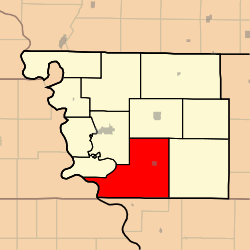
Coordinates: 40°20′00″N 095°24′31″W / 40.3333333°N 95.40861°WCoordinates: 40°20′00″N 095°24′31″W / 40.3333333°N 95.40861°W Country United States State Missouri County Atchison Area - Total 75.03 sq mi (194.33 km2) - Land 74.72 sq mi (193.53 km2) - Water 0.31 sq mi (0.8 km2) 0.41% Elevation[1] 906 ft (276 m) Population (2000) - Total 932 - Density 12.5/sq mi (4.8/km2) FIPS code 29-13996[2] GNIS feature ID 0766232 Clark Township is one of eleven townships in Atchison County, Missouri, USA. As of the 2000 census, its population was 932.
Contents
Geography
Clark Township covers an area of 75.03 square miles (194.3 km2) and contains one incorporated settlement, Fairfax. It contains five cemeteries: Beck, Corning, Mount Hope, Pleasant Ridge and Pleasant Ridge.
The streams of Cow Branch, Old Channel Nishnabotna River and Rock Creek run through this township.
Transportation
Clark Township contains one airport, Steele Airport.
References
- ^ "US Board on Geographic Names". United States Geological Survey. 2007-10-25. http://geonames.usgs.gov. Retrieved 2008-01-31.
- ^ "American FactFinder". United States Census Bureau. http://factfinder.census.gov. Retrieved 2008-01-31.
External links
Municipalities and communities of Atchison County, Missouri Cities 
Village Townships Unincorporated
communityCategories:- Townships in Atchison County, Missouri
- Missouri geography stubs


Wikimedia Foundation. 2010.