- Marshville, North Carolina
-
For Marshville in Missouri, see Marshfield, Missouri.
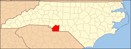
Marshville, North Carolina — Town — Location of Marshville, North Carolina
Coordinates: 34°59′18″N 80°22′4″W / 34.98833°N 80.36778°WCoordinates: 34°59′18″N 80°22′4″W / 34.98833°N 80.36778°W Country United States State North Carolina County Union Area - Total 2.1 sq mi (5.3 km2) - Land 2.0 sq mi (5.3 km2) - Water 0.0 sq mi (0.0 km2) Elevation 584 ft (178 m) Population (2000) - Total 2,360 - Density 1,151.4/sq mi (444.6/km2) Time zone Eastern (EST) (UTC-5) - Summer (DST) EDT (UTC-4) ZIP code 28103 Area code(s) 704 FIPS code 37-41640[1] GNIS feature ID 0989388[2] Marshville is a town in Union County, North Carolina, United States. Its population was 2,360 at the 2000 census. Marshville is known as the birthplace of country music singer Randy Travis.
Contents
Geography
Marshville is located at 34°59′18″N 80°22′4″W / 34.98833°N 80.36778°W (34.988458, -80.367845)[3].
According to the United States Census Bureau, the town has a total area of 2.1 square miles (5.4 km2), of which, 2.0 square miles (5.2 km2) of it is land and 0.49% is water.
Demographics
As of the census[1] of 2000, there were 2,360 people, 812 households, and 578 families residing in the town. The population density was 1,151.4 people per square mile (444.5/km²). There were 868 housing units at an average density of 423.5 per square mile (163.5/km²). The racial makeup of the town was 52.03% White, 44.87% African American, 0.55% Native American, 0.30% Asian, 1.27% from other races, and 0.97% from two or more races. Hispanic or Latino of any race were 3.22% of the population.
There were 812 households out of which 37.8% had children under the age of 18 living with them, 50.7% were married couples living together, 15.9% had a female householder with no husband present, and 28.8% were non-families. 24.5% of all households were made up of individuals and 11.3% had someone living alone who was 65 years of age or older. The average household size was 2.79 and the average family size was 3.36.
In the town the population was spread out with 28.8% under the age of 18, 8.2% from 18 to 24, 29.2% from 25 to 44, 19.3% from 45 to 64, and 14.5% who were 65 years of age or older. The median age was 34 years. For every 100 females there were 88.6 males. For every 100 females age 18 and over, there were 81.0 males.
The median income for a household in the town was $36,140, and the median income for a family was $42,589. Males had a median income of $30,039 versus $21,413 for females. The per capita income for the town was $15,498. About 8.3% of families and 10.9% of the population were below the poverty line, including 9.3% of those under age 18 and 13.1% of those age 65 or over.
Culture
Marshville is the site of the Boll Weevil Festival, an annual street fair and carnival that takes place every fall. Parts of the 1985 Oscar-nominated movie The Color Purple were filmed in Marshville.[4] The movie was directed by Steven Spielberg and its cast included Oprah Winfrey and Whoopi Goldberg.
Notable people
- Marshville is the birthplace of country singer Randy Travis.
- R&B Recording artists K-Ci and JoJo of the group Jodeci hail from Marshville.
References
- ^ a b "American FactFinder". United States Census Bureau. http://factfinder.census.gov. Retrieved 2008-01-31.
- ^ "US Board on Geographic Names". United States Geological Survey. 2007-10-25. http://geonames.usgs.gov. Retrieved 2008-01-31.
- ^ "US Gazetteer files: 2010, 2000, and 1990". United States Census Bureau. 2011-02-12. http://www.census.gov/geo/www/gazetteer/gazette.html. Retrieved 2011-04-23.
- ^ "The Color Purple filming locations". The 80s Movie Rewind. http://www.fast-rewind.com/locations_colorpurple.htm. Retrieved 17 January 2011.
Municipalities and communities of Union County, North Carolina County seat: Monroe City 
Towns Fairview | Hemby Bridge | Indian Trail | Marshville | Mineral Springs | Mint Hill‡ | Stallings‡ | Unionville | Waxhaw | Weddington‡ | Wingate
Villages CDP Unincorporated
communityDogwood Acres | Jackson | New Salem | Roughedge
Footnotes ‡This populated place also has portions in an adjacent county or counties
Categories:- Towns in North Carolina
- Populated places in Union County, North Carolina

Wikimedia Foundation. 2010.