- Kipton, Ohio
Infobox Settlement
official_name = Kipton, Ohio
settlement_type = Village
nickname =
motto =
imagesize =
image_caption =
image_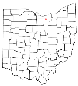
mapsize = 250x200px
map_caption = Location of Kipton, Ohio
mapsize1 =
map_caption1 =subdivision_type = Country
subdivision_name =United States
subdivision_type1 = State
subdivision_name1 =Ohio
subdivision_type2 = County
subdivision_name2 = Loraingovernment_footnotes =
government_type =
leader_title =
leader_name =
leader_title1 =
leader_name1 =
established_title =
established_date =unit_pref = Imperial
area_footnotes =area_magnitude =
area_total_km2 = 1.2
area_land_km2 = 1.2
area_water_km2 = 0.0
area_total_sq_mi = 0.5
area_land_sq_mi = 0.5
area_water_sq_mi = 0.0population_as_of = 2000
population_footnotes =
population_total = 265
population_density_km2 = 221.3
population_density_sq_mi = 573.2timezone = Eastern (EST)
utc_offset = -5
timezone_DST = EDT
utc_offset_DST = -4
elevation_footnotes = GR|3
elevation_m = 259
elevation_ft = 850
latd = 41 |latm = 16 |lats = 2 |latNS = N
longd = 82 |longm = 18 |longs = 12 |longEW = Wpostal_code_type =
ZIP code
postal_code = 44049
area_code = 440
blank_name = FIPS code
blank_info = 39-40544GR|2
blank1_name = GNIS feature ID
blank1_info = 1064946GR|3
website =
footnotes =Kipton is a village in Lorain County,
Ohio ,United States . The population was 265 at the 2000 census.Kipton was the site of a famous
train wreck onApril 19 ,1891 , which was caused by railroad engineers' watches not being in sync and led to the adoption of stringent quality-control standards forrailroad chronometers in1893 .Kipton is at one end of a paved bicycle and pedestrian path built on an abandoned railroad bed. The path travels east from Kipton and then curves northeast, going through Oberlin and continuing on to Elyria. There is a small park in Kipton where the path terminates.
Geography
Kipton is located at coor dms|41|16|2|N|82|18|12|W|city (41.267101, -82.303337)GR|1.
According to the
United States Census Bureau , the village has a total area of 0.5square mile s (1.2km² ), all of it land.Demographics
As of the
census GR|2 of 2000, there were 265 people, 105 households, and 76 families residing in the village. Thepopulation density was 573.2 people per square mile (222.4/km²). There were 108 housing units at an average density of 233.6/sq mi (90.7/km²). The racial makeup of the village was 98.49% White, 0.75% African American, and 0.75% from two or more races. Hispanic or Latino of any race were 0.38% of the population.There were 105 households out of which 32.4% had children under the age of 18 living with them, 58.1% were married couples living together, 10.5% had a female householder with no husband present, and 26.7% were non-families. 22.9% of all households were made up of individuals and 9.5% had someone living alone who was 65 years of age or older. The average household size was 2.52 and the average family size was 2.92.
In the village the population was spread out with 24.9% under the age of 18, 9.8% from 18 to 24, 31.7% from 25 to 44, 20.4% from 45 to 64, and 13.2% who were 65 years of age or older. The median age was 38 years. For every 100 females there were 113.7 males. For every 100 females age 18 and over, there were 109.5 males.
The median income for a household in the village was $48,182, and the median income for a family was $44,375. Males had a median income of $46,250 versus $22,188 for females. The
per capita income for the village was $19,499. About 2.4% of families and 4.5% of the population were below thepoverty line , including 8.3% of those under the age of eighteen and 7.7% of those sixty five or over.References
External links
Wikimedia Foundation. 2010.