- Stringtown, Oklahoma
Infobox Settlement
official_name = Stringtown, Oklahoma
settlement_type =Town
nickname =
motto =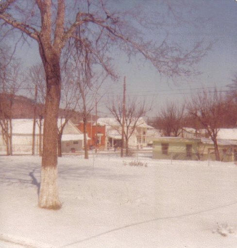
imagesize = 250px
image_caption = A view of the town in 1978 looking towards the old post office.
image_
mapsize = 250px
map_caption = Location of Stringtown, Oklahoma
mapsize1 =
map_caption1 =
subdivision_type = Country
subdivision_type1 = State
subdivision_type2 = County
subdivision_name =United States
subdivision_name1 =Oklahoma
subdivision_name2 = Atoka
government_type =
leader_title = Chairman of the Board of Trustees
leader_name = Toni Benson
established_title =
established_date =
area_magnitude =
area_total_sq_mi = 12.3
area_total_km2 = 12.3
area_land_sq_mi = 12.3
area_land_km2 = 12.3
area_water_sq_mi = 0.1
area_water_km2 = 0.1
population_as_of = estimate, 2007
population_note =
population_total = 416
population_metro =
population_urban =
population_density_km2 = 32.3
population_density_sq_mi = 83.7
timezone = CST
utc_offset = -6
timezone_DST = CDT
utc_offset_DST = -5
latd = 34 |latm = 23 |lats = 3 |latNS = N
longd = 96 |longm = 7 |longs = 39 |longEW = W
elevation_m = 191
elevation_ft = 627
website =
postal_code_type =ZIP code
postal_code = 74569
area_code = 580
blank_name = FIPS code
blank_info = 40-70850GR|2
blank1_name = GNIS feature ID
blank1_info = 1098585GR|3
footnotes =Stringtown is a town in Atoka County,
Oklahoma ,United States . The population was 396 at the 2000 census. It is the second largest town in Atoka County.Geography
Stringtown is located at coor dms|34|28|6|N|96|3|10|W|city (34.468448, -96.052860)GR|1.
According to the
United States Census Bureau , the town has a total area of 4.8square mile s (12.3km² ), of which, 4.7 square miles (12.3 km²) of it is land and 0.04 square miles (0.1 km²) of it (0.42%) is water.Stringtown is located at the southern intersection of U.S. Highway 69 and State Highway 43.cite map|publisher=Oklahoma Department of Transportation|title=Official State Map|edition=2008]
History
Originally named Springtown, for the natural springs that flow out of the hills the town is built upon, the current name is believed to be a corruption. Once home to a bank, theater and pub, the town has declined over the years, both economically and in population. In the past five years, small population growth and the addition of a new cafe have brought new life to the town. Annually in September, the Good Ole Days Festival celebrates the town's past with parade, cookout, and concert.
On August 5, 1932, while
Bonnie Parker was visiting her mother, Clyde Barrow and two associates were drinking alcohol at a dance in Stringtown (illegal underProhibition ). When they were approached by sheriff C. G. Maxwell and his deputy, Clyde opened fire, killing deputy Eugene C. Moore. That was the first killing of a lawman by what was later known as the Barrow Gang, a total which would eventually amount to nine slain officers.In the late 1960s, a
tornado touched down in the town directly on top of the (then) recently built Community Center, now the Senior Citizen's Center. The tornado was only on the ground for a few seconds, but during that time the building was almost completely destroyed. This was an unusual occurrence for atornado to touch down in the town itself, given its being situated between two chains of steephill s.The nearby Mack Alford State Penitentiary is a large source of employment in the county. It was an internment camp for enemy POW's in World War II.
Despite its small size, Stringtown (2003 pop. est. 401) is the second-largest town in Atoka County, behind Atoka (pop. est. 3,100) and ahead of Tushka (pop. est. 350).
2007-2008 City Government Issues
Following a ruling the Oklahoma Department of Public Safety in early 2007, Stringtown was declared a speed trap under the Oklahoma anti-speed trap law and the city's ability to write tickets for travelers on U.S. 69 was revoked pending an ivestigation. Under the anti-speed trap law, when more than 50% of a town's revenue was derived from traffic citations, it was deemed a speed trap and the ability of law enforcement to write citations was put in jeopardy. This caused the city to lose a substantial amount of revenue, and it was reported in the Atoka County Times that unless drastic measures were taken, the town would face bankruptcy. All but the Chief of Police of the city law enforcement were laid off and an audit was ordered by the State of Oklahoma.
After what some Oklahoma lawmakers deemed underhanded and sneaky, Oklahoma State Representative Paul D. Roan (D-Tishomingo), who represents the residents of Stringtown in the Oklahoma House of Representatives, added a last minute addition to HB 1616 which in effect repealed the statute regarding speed traps. As a result, Stringtown was allowed once again to write traffic tickets.
In early 2008, the Mayor of Stringtown, Toni Benson, resigned from his office, citing the stress of the office as the principal reason. As well, it was reported at that time by the Atoka County Times of allegations of misappropriation of funds and corruption made against the Stringtown Board of Trustees, whose head is the mayor. Following the resignation of Benson, the Board had 60 days to appoint a replacement, but instead, the Board contacted the Atoka County Election Board to schedule a special election to fill the vacant post. Some time later, the Board informed the chairman of the County Election Board that they wished to have the election canceled. However, according to election law, the election board must be notified in writing in order to cancel an election. As a result, the election was not canceled and, according to the Atoka County Times, the Board of Trustees was unaware of the procedural error.
On the final day to register to run in the election, a Stringtown resident, Gail Enochs, did so one hour before the deadline. Since the election was never publicized, few were aware that it underway. Due the lack of publication, Enochs won the election by default and was issued a certificate by the county election board granting her a seat on the Board of Trustees. Many in the town called the election illegal because it was never publicized.
At the Board's meeting on June 16, 2008, city attorney David Youngblood discussed the legal issues surrounding the recent events. Allegations were made that neither former Mayor Toni Benson nor Trustee Joe Hayes had been sworn in. When faced with the inquiry, the city clerk did not know if either had been sworn in, bringing into question the legitimacy of their offices. The meeting proceeded to break down with one trustee leaving before the end of the meeting. When faced with the question of the legality of her election, Enochs reportedly dared anyone present to challenge her in court. The Atoka County Times reported her as saying, "If anyone's got five grand, let's go to court: I'm ready," speaking in reference to the court fee to challenge an official's election. When she wasn't seated on the Board, Enochs declared the meeting to be illegal and ended.
Demographics
As of the
census GR|2 of 2000, there were 396 people, 166 households, and 113 families residing in the town. Thepopulation density was 83.7 people per square mile (32.3/km²). There were 217 housing units at an average density of 45.9/sq mi (17.7/km²). The racial makeup of the town was 69.95% White, 11.36% African American, 10.35% Native American, 0.25% Asian, 0.25% Pacific Islander, and 7.83% from two or more races.There were 166 households out of which 26.5% had children under the age of 18 living with them, 54.2% were married couples living together, 10.8% had a female householder with no husband present, and 31.9% were non-families. 28.9% of all households were made up of individuals and 14.5% had someone living alone who was 65 years of age or older. The average household size was 2.39 and the average family size was 2.89.
In the town the population was spread out with 24.0% under the age of 18, 9.6% from 18 to 24, 21.2% from 25 to 44, 27.5% from 45 to 64, and 17.7% who were 65 years of age or older. The median age was 42 years. For every 100 females there were 103.1 males. For every 100 females age 18 and over, there were 89.3 males.
The median income for a household in the town was $20,536, and the median income for a family was $22,614. Males had a median income of $19,643 versus $14,861 for females. The
per capita income for the town was $9,612. About 15.1% of families and 25.1% of the population were below thepoverty line , including 45.0% of those under age 18 and 30.9% of those age 65 or over.References
External links
Wikimedia Foundation. 2010.