- Matthew and Hunter Islands
-
For other uses, see Hunter Island (disambiguation).
Matthew and Hunter Islands Disputed island
Other names: île Matthew and île Hunter, Fern/Fearn Island (Hunter Island)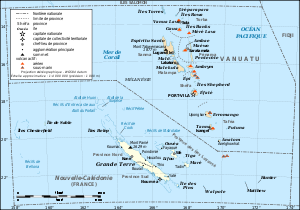
Vanuatu and New Caledonia, Matthew and Hunter Islands on the right bottom. Geography Location Coordinates 22°22′S 171°43′E / 22.367°S 171.717°ECoordinates: 22°22′S 171°43′E / 22.367°S 171.717°E Total islands 2 Area 1.3 square kilometres (0.50 sq mi) Highest point unnamed peak on Hunter Island
242 metres (794 ft)Administered by  France
Dependency New Caledonia Claimed by FranceDependency New Caledonia  Vanuatu
Province Tafea Demographics Population 0 The Matthew and Hunter Islands are a group of two small and uninhabited volcanic islands in the South Pacific, located 300 km east of New Caledonia and south-east of Vanuatu archipelago. Hunter Island and Matthew Island, 70 km apart, are claimed both by Vanuatu (as part of Tafea province, and considered by the people of Anatom Island part of their custom ownership) and France (as part of New Caledonia).
Small, arid, without fresh water and not easily accessible, the islands had no interest for Britain or France during their colonization of the Pacific in the course of the 18th and 19th centuries. France officially annexed both islands in 1929. In 1965, the United Kingdom also claimed the two islands, as part of the New Hebrides. France conducted a symbolic occupation in 1975. In 1980, on its independence, Vanuatu claimed sovereignty, but made no occupation of the islands. In 1979, Météo-France set up an automatic weather station on one of the islands, and the French Navy regularly visits both of them.
Contents
Matthew Island
île Matthew in French, the island is 0.7 km² in area, and a 177 meter high stratovolcano located at 22°21′S 171°21′E / 22.35°S 171.35°E.
Captain Thomas Gilbert of the Royal Navy on board the Charlotte discovered Matthew Island on 27 May 1788 and named it after the owner of his ship. The island is in fact two conic islets attached by a rocky 200-metre-wide isthmus. The western part is of lava and slag, with a serrated peak 177 metres high, and the eastern part is of basalt with a 142 metre peak. There is still some volcanic activity on the island with sulphuric fumaroles rising from craters in the south-east. The conformation of the island seems to have changed over the last century, since it was described as having only one peak before the second world war. The last eruptions of the Matthew Island Volcano happened in 1956.
Hunter Island
Hunter Island (île Hunter in French) is also known as Fern or Fearn Island. It lies 70 km east of Matthew Island at 22°24′S 172°5′E / 22.4°S 172.083°E. About 0.6 km² in area, the island has a domed shape, and is 242 metres in height.
Captain Jimmy Joe, on board the whaler "Hunter", discovered the island (probably in 1798) and named it after his ship.
See also
- Fiji–France Maritime Delimitation Agreement
References
- Sharp, Andrew: The discovery of the Pacific Islands; Oxford 1960
- Dunmore, John: Who's who in Pacific navigation; Honolulu: Univ. of Hawaii Pr., 1991 ISBN 0-8248-1350-2
External links
- Wolfgang Schippke: Île Metthew & Île Hunter (German), (English, but much shorter)
- Bits of info
Categories:- Disputed islands of Oceania
- Volcanoes of the Pacific Ocean
- Territorial disputes of Vanuatu
- Territorial disputes of France
- Borders of New Caledonia
- Uninhabited islands of New Caledonia
- Uninhabited islands of Vanuatu

Wikimedia Foundation. 2010.