- Mount Penn, Pennsylvania
-
Borough of Mount Penn Borough Country United States State Pennsylvania County Berks Elevation 482 ft (146.9 m) Coordinates 40°19′46″N 75°53′26″W / 40.32944°N 75.89056°W Area 0.4 sq mi (1 km2) - land 0.4 sq mi (1 km2) - water 0.0 sq mi (0 km2) Population 3,076 (2009) Density 7,076.8 / sq mi (2,732.4 / km2) Timezone EST (UTC-5) - summer (DST) EDT (UTC-4) Area code 610 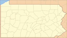
 Location of Mount Penn in Pennsylvania
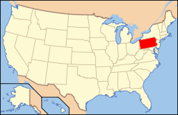 Location of Pennsylvania in the United States
Mount Penn is the name of a mountain peak and a borough in Berks County, Pennsylvania, United States. The population was 3,076 at the 2009 Census.[1] The peak is sometimes recognized as the southern end of the Reading Prong mountains.
Geography
Mount Penn Borough is located at 40°19′46″N 75°53′26″W / 40.32944°N 75.89056°W (40.329359, -75.890691),[2], just to the east of the City of Reading. The peak is to the northwest of the borough and northeast of Reading.
According to the United States Census Bureau, the borough has a total area of 0.4 square miles (1.1 km²), all of it land.
Local attractions on the mountain range include the Pagoda and the Fire Tower.
Demographics
As of the census[3] of 2000, there were 3,016 people, 1,278 households, and 829 families residing in the borough. The population density was 7,076.8 people per square mile (2,708.1/km²). There were 1,335 housing units at an average density of 3,132.5 per square mile (1,198.7/km²). The racial makeup of the borough was 96.45% White, 1.06% African American, 0.03% Native American, 1.06% Asian, 0.50% from other races, and 0.90% from two or more races. Hispanic or Latino of any race were 3.38% of the population.
There were 1,278 households out of which 30.2% had children under the age of 18 living with them, 50.4% were married couples living together, 11.2% had a female householder with no husband present, and 35.1% were non-families. 29.6% of all households were made up of individuals and 13.7% had someone living alone who was 65 years of age or older. The average household size was 2.35 and the average family size was 2.93.
In the borough the population was spread out with 24.5% under the age of 18, 6.8% from 18 to 24, 30.7% from 25 to 44, 21.6% from 45 to 64, and 16.3% who were 65 years of age or older. The median age was 37 years. For every 100 females there were 91.6 males. For every 100 females age 18 and over, there were 85.9 males.
The median income for a household in the borough was $41,326, and the median income for a family was $47,917. Males had a median income of $40,603 versus $26,890 for females. The per capita income for the borough was $21,738. About 2.4% of families and 4.4% of the population were below the poverty line, including 4.8% of those under age 18 and 9.5% of those age 65 or over.
Mount Penn is governed by an elected mayor and seven-member Borough Council. The current mayor is Joshua Nowotarski. The members of council are Thomas Staron, Dennis Swartz, James Cocuzza, Mark Dudash, Scott Hauck, Tony Phyrillas and Cynthia Mitchell.
Historical populations Census Pop. %± 1980 3,025 — 1990 2,883 −4.7% 2000 3,016 4.6% Est. 2008 3,063 1.6% References
- ^ http://factfinder.census.gov/servlet/SAFFPopulation?_event=Search&_name=mount+penn&_state=&Submit.x=14&Submit.y=15&_county=mount+penn%2C+pennsylvania&_cityTown=mount+penn%2C+pennsylvania&_zip=&_sse=on&_lang=en&pctxt=fph
- ^ "US Gazetteer files: 2010, 2000, and 1990". United States Census Bureau. 2011-02-12. http://www.census.gov/geo/www/gazetteer/gazette.html. Retrieved 2011-04-23.
- ^ "American FactFinder". United States Census Bureau. http://factfinder.census.gov. Retrieved 2008-01-31.
Municipalities and communities of Berks County, Pennsylvania City 
Boroughs Adamstown‡ | Bally | Bechtelsville | Bernville | Birdsboro | Boyertown | Centerport | Fleetwood | Hamburg | Kenhorst | Kutztown | Laureldale | Leesport | Lenhartsville | Lyons | Mohnton | Mount Penn | New Morgan | Robesonia | St. Lawrence | Shillington | Shoemakersville | Sinking Spring | Strausstown | Topton | Wernersville | West Reading | Womelsdorf | Wyomissing
Townships Albany | Alsace | Amity | Bern | Bethel | Brecknock | Caernarvon | Centre | Colebrookdale | Cumru | District | Douglass | Earl | Exeter | Greenwich | Heidelberg | Hereford | Jefferson | Longswamp | Lower Alsace | Lower Heidelberg | Maidencreek | Marion | Maxatawny | Muhlenberg | North Heidelberg | Oley | Ontelaunee | Penn | Perry | Pike | Richmond | Robeson | Rockland | Ruscombmanor | South Heidelberg | Spring | Tilden | Tulpehocken | Union | Upper Bern | Upper Tulpehocken | Washington | Windsor
CDPs Unincorporated
communitiesAlbany | Alleghenyville | Alsace Manor | Amityville | Barto | Basket | Baumstown | Beckersville | Berne | Bethel | Blandon | Bowers | Boyers Junction | Breezy Corner | Brownsville | Chapel‡ | Clayton | Dale | Dauberville | Douglassville | Dreibelbis | Dryville | Eckville | Edenburg | Eshbach | Evansville | Five Points | Fredericksville | Fritztown | Frystown | Geigertown | Gibraltar | Gouglersville | Greenawald | Grill | Grimville | Hancock | Harlem | Henningsville | Hereford | Hinterleiter | Host | Huffs Church | Hyde Park | Jacksonwald | Jalappa | Joanna | Joanna Heights | Kempton | Kempville | Kirbyville | Klinesville | Knauers | Krumsville | Kulptown | Landis Store | Leinbachs | Limekiln | Lincoln Park | Lobachsville | Longswamp | Manatawny | Maple Grove | Maxatawny | Mertztown | Mohrsville | Molltown | Montello | Monterey | Morgantown | Morysville | Moselem | Moselem Springs | Mount Aetna | New Hensingersville‡ | New Jerusalem | North Heidelberg | Pine Waters | Pleasant Valley | Pleasantville | Plowville | Pricetown | Quaker City | Rehrersburg | Rittenhouse Gap | Sally Ann | Scarlets Mill | Seisholtzville | Shartlesville | South Temple | State Hill | Stony Run | Stouchsburg | Temple | Trexler | Unionville | Vinemont | Virginville | Walnuttown | Weavertown | West Hamburg | West Lawn | Windsor Castle | Wintersville | Woodchoppertown | Wyomissing Hills | Yellow House
Footnotes ‡This populated place also has portions in an adjacent county or counties
Categories:- Populated places established in 1800
- Boroughs in Berks County, Pennsylvania


Wikimedia Foundation. 2010.