- Manor Township, Lancaster County, Pennsylvania
-
Not to be confused with Manor Township, Armstrong County, Pennsylvania.
Manor Township,
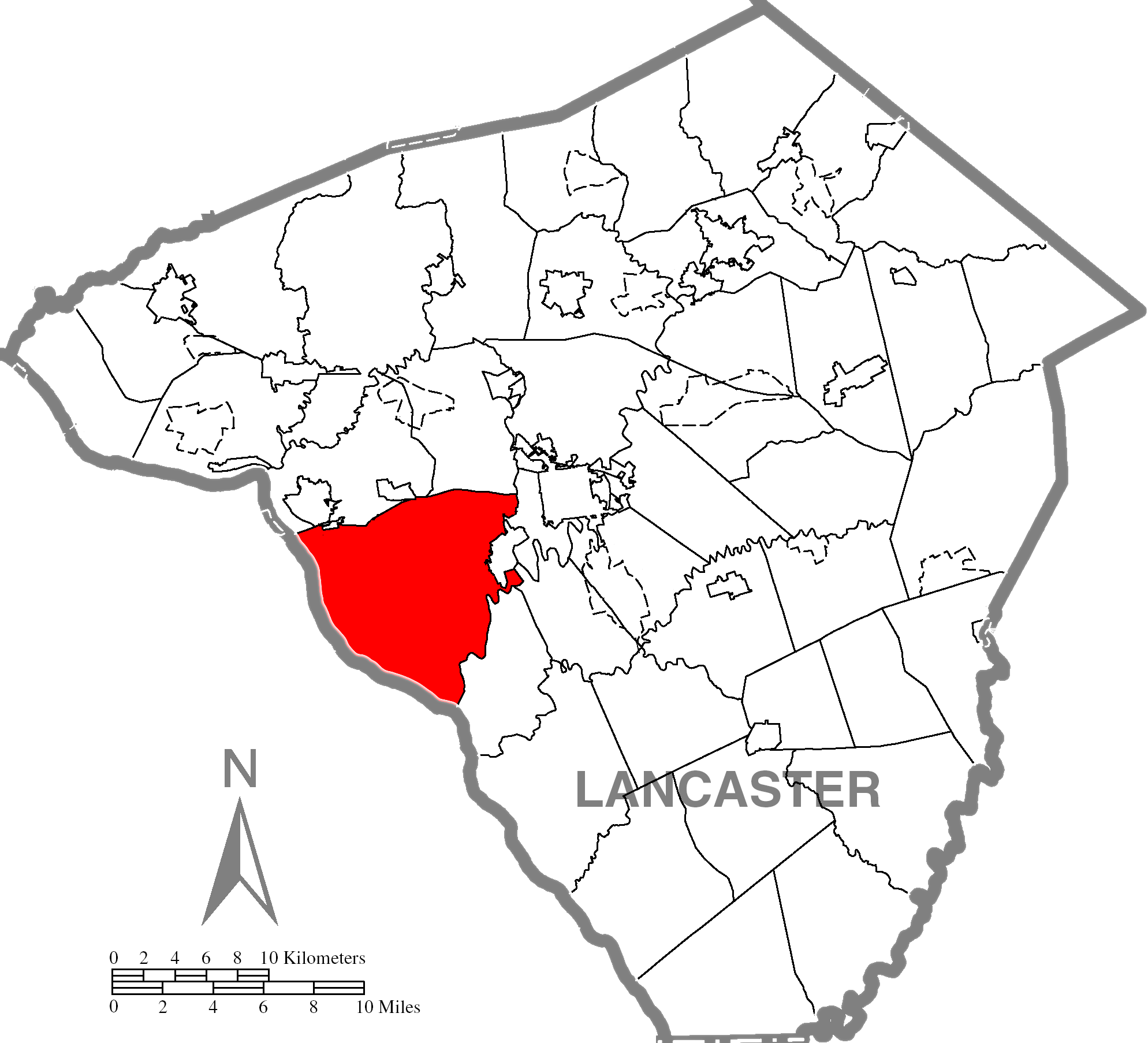
Lancaster County, Pennsylvania— Township — Mann's Creek Map of Lancaster County highlighting Manor Township
Country United States State Pennsylvania County Lancaster Settled 1717 Incorporated 1730 Government – Type Board of Supervisors Area – Total 48.6 sq mi (125.9 km2) – Land 38.5 sq mi (99.7 km2) – Water 10.1 sq mi (26.2 km2) Population (2000) – Total 16,498 – Density 427.9/sq mi (165.2/km2) Time zone Eastern (EST) (UTC-5) – Summer (DST) EDT (UTC-4) Area code(s) 717 Website Manor Township Manor Township is a township in west central Lancaster County, Pennsylvania, United States. Manor Township takes its name from the Manor of Conestoga, which was originally surveyed and reserved for William Penn in 1719. It was changed to its present form in 1759. The population was 16,498 at the 2000 census.
Manor Township is one of the six immediate suburbs of the city of Lancaster, all sharing the same official designation as Lancaster, Pennsylvania by the United States Postal Service.[1] With exceptions such as parts of Millersville, 17551. Conestoga 17516, Washington Borough 17582, and Pequea 17565.
Geography
According to the United States Census Bureau, the township has a total area of 48.6 square miles (125.9 km²), of which, 38.5 square miles (99.8 km²) of it is land and 10.1 square miles (26.1 km²) of it (20.70%) is water.
Demographics
As of the census[2] of 2000, there were 16,498 people, 6,464 households, and 4,699 families residing in the township. The population density was 427.9 people per square mile (165.2/km²). There were 6,710 housing units at an average density of 174.0/sq mi (67.2/km²). The racial makeup of the township was 95.64% White, 1.35% African American, 0.10% Native American, 1.26% Asian, 0.01% Pacific Islander, 0.78% from other races, and 0.86% from two or more races. Hispanic or Latino of any race were 2.28% of the population.
There were 6,464 households out of which 31.4% had children under the age of 18 living with them, 62.3% were married couples living together, 7.5% had a female householder with no husband present, and 27.3% were non-families. 22.5% of all households were made up of individuals and 8.9% had someone living alone who was 65 years of age or older. The average household size was 2.53 and the average family size was 2.99.
In the township the population was spread out with 24.0% under the age of 18, 7.3% from 18 to 24, 28.6% from 25 to 44, 24.6% from 45 to 64, and 15.4% who were 65 years of age or older. The median age was 39 years. For every 100 females there were 95.9 males. For every 100 females age 18 and over, there were 91.2 males.
The median income for a household in the township was $47,806, and the median income for a family was $54,958. Males had a median income of $37,932 versus $27,398 for females. The per capita income for the township was $22,243. About 2.4% of families and 3.8% of the population were below the poverty line, including 3.4% of those under age 18 and 6.2% of those age 65 or over.
References
- ^ "Lancaster's suburbs". Google. http://books.google.com/books?id=f891HxR6y9MC&pg=PA225&lpg=PA225&dq=east+hempfield+township+suburb+of+lancaster. Retrieved March 18, 2008.
- ^ "American FactFinder". United States Census Bureau. http://factfinder.census.gov. Retrieved 2008-01-31.
Coordinates: 39°58′00″N 76°24′59″W / 39.9666667°N 76.41639°W
Categories:- Populated places established in 1717
- Townships in Lancaster County, Pennsylvania

Wikimedia Foundation. 2010.