- Nowendoc, New South Wales
-
Nowendoc
New South Wales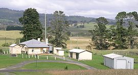
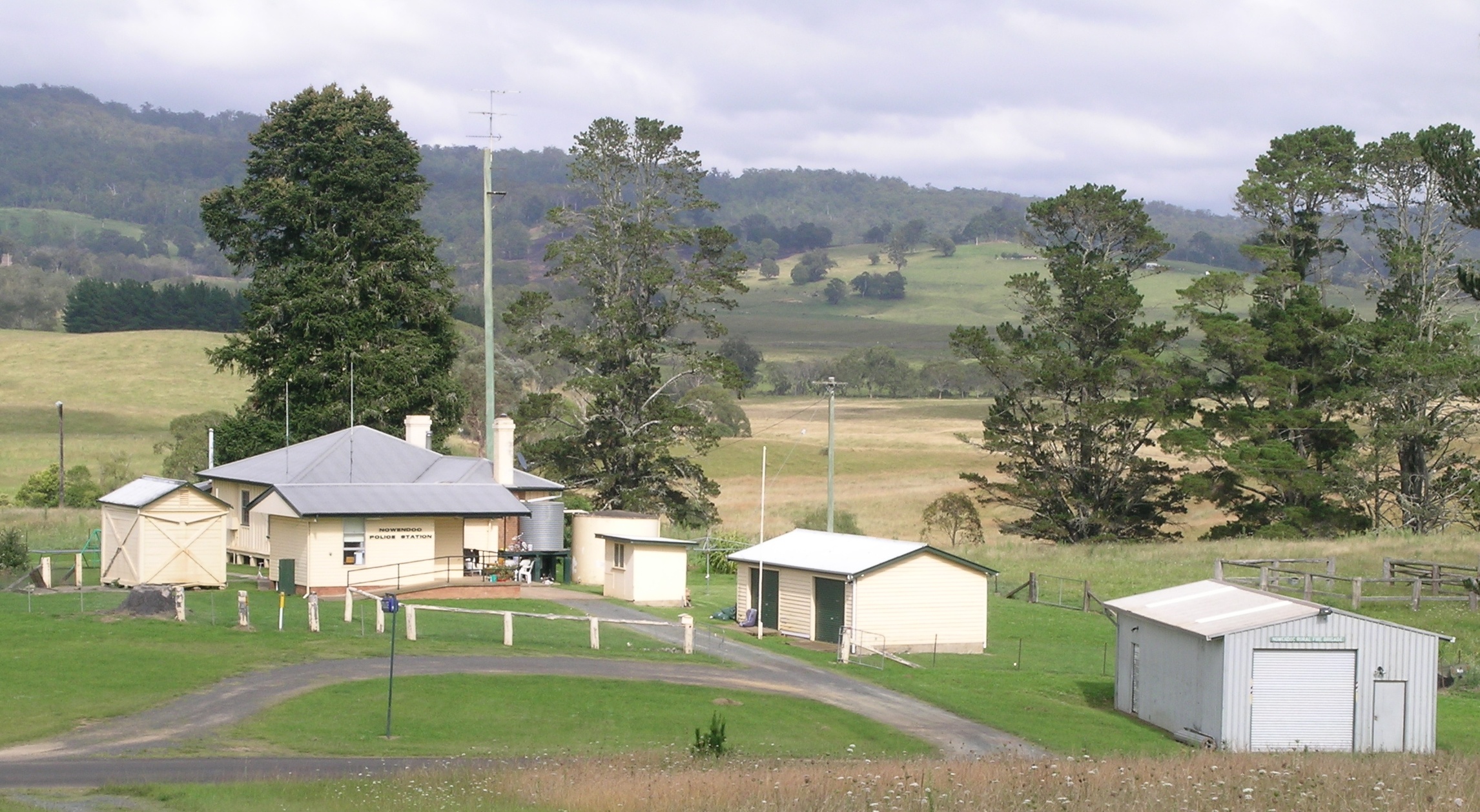
Nowendoc Police Station and Rural Fire Service building on the right
 Nowendoc
Population: 157[1] Established: 1857 Postcode: 2354 Location: LGA: Walcha Shire Council County: Hawes State District: Northern Tablelands Federal Division: New England  Nowendoc Public School
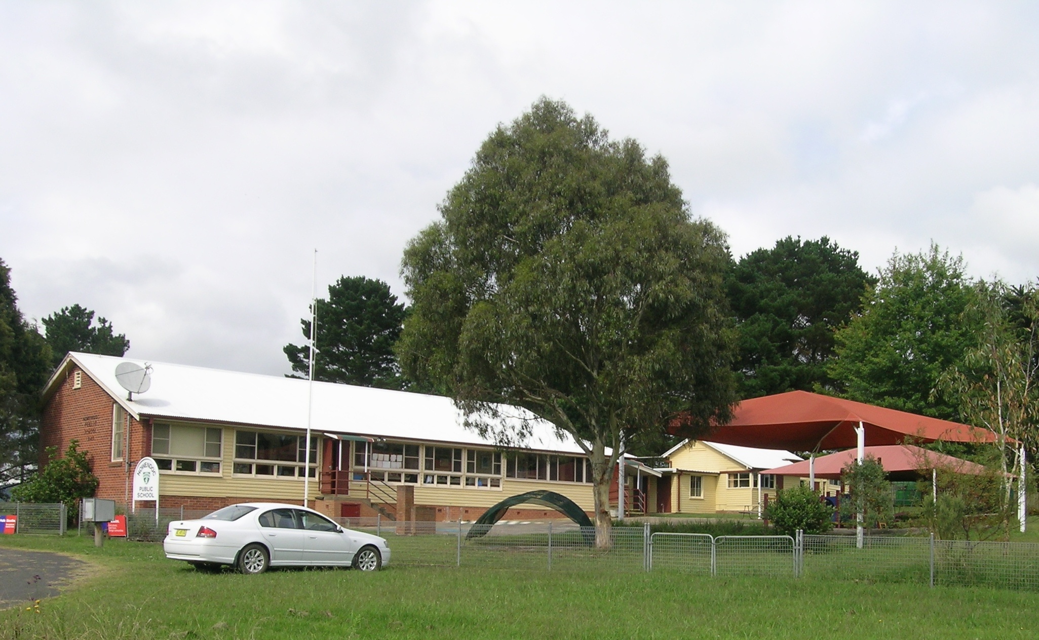
Nowendoc is a parish and village on the Northern Tablelands, New South Wales, Australia. The town is located 360 km north of the state capital, Sydney, 66 km south of Walcha and is in the Walcha Shire Local Government Area. A sealed road, Thunderbolts Way, is about three hundred metres to the south of Nowendoc and provides links to the south and north.
History
In 1836 William Telfer marked a tree line from Gloucester through Giro on the Barnard River, over Hungry Hill to Nowendoc and on to Ogunbil via White's Sugarloaf. The Australian Agricultural Company (AACo) set up stations and resting places for their travelling sheep along this route to be known as the ‘Peel Line’. During the years 1840 to 1845 Nowendoc was one of the AACo outstations for their sheep.[2] In 1857 John Hall surveyed 39 allotments to define the village of Nowendoc. Thomas Laurie discovered alluvial gold there in 1872 and by 1873 there were about 100 people camping at Township Spur. By 1945 nearly all mining has ceased. Some dairying was done during the earlier years of settlement.
The village has a cemetery, church, school, sports ground, store, police station, Rural Fire Service station and community hall. A post office has operated intermittently from 1861 to 1979. The completion of the telephone line to Walcha in 1921 reduced the isolation of the area. Rural electricity was supplied during 1964-5 to those who made the contribution of £248/10/- towards the cost of connection. The local Uniting Church was officially opened in 1976.
At the 2006 census, Nowendoc and the surrounding area had a population of 157.[1] The main industries nowadays are beef cattle breeding and timber.
Nowendoc is a centre for those keen on bushwalking, fishing and similar activities and lies near the top of the escarpment that contains the bulk of the Barrington Tops National Park. Many scenic walks and drives can be easily accessed from Nowendoc with the Nowendoc National Park nearby. Tennis, football and cricket are popular sports that enjoyed by residents. An annual rodeo is held on the Nowendoc sports ground.
Citations
- ^ a b Australian Bureau of Statistics (25 October 2007). "Nowendoc (State Suburb)". 2006 Census QuickStats. http://www.censusdata.abs.gov.au/ABSNavigation/prenav/LocationSearch?collection=Census&period=2006&areacode=SSC18407&producttype=QuickStats&breadcrumb=PL&action=401. Retrieved 2008-03-04.
- ^ Donald, J.Kay, Exploring the North Coast and New England, Kangaroo Press, Kenthurst, 1978, ISBN 0864171218
References
- “Nowendoc - A Glimpse into History” by Jean Holstein and Suzanne Lyon
Categories:- Towns in New South Wales
- Towns in New England, New South Wales

Wikimedia Foundation. 2010.