- Fort Hancock, Texas
Infobox Settlement
official_name = Fort Hancock, Texas
settlement_type = CDP
nickname =
motto =
imagesize =
image_caption =
image_
mapsize = 250px
map_caption = Location of Fort Hancock, Texas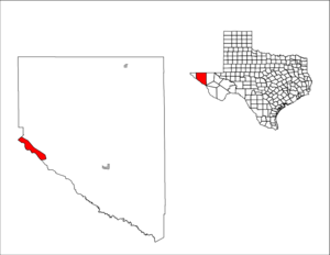
mapsize1 = 250px
map_caption1 =subdivision_type = Country
subdivision_name =United States
subdivision_type1 = State
subdivision_name1 =Texas
subdivision_type2 = County
subdivision_name2 = Hudspethgovernment_footnotes =
government_type =
leader_title =
leader_name =
leader_title1 =
leader_name1 =
established_title =
established_date =unit_pref = Imperial
area_footnotes =area_magnitude =
area_total_km2 = 97.9
area_land_km2 = 97.5
area_water_km2 = 0.4
area_total_sq_mi = 37.8
area_land_sq_mi = 37.7
area_water_sq_mi = 0.2population_as_of = 2000
population_footnotes =
population_total = 1713
population_density_km2 = 17.6
population_density_sq_mi = 45.5timezone = Mountain (MST)
utc_offset = -7
timezone_DST = MDT
utc_offset_DST = -6
elevation_footnotes =
elevation_m = 1091
elevation_ft = 3579
latd = 31 |latm = 17 |lats = 30 |latNS = N
longd = 105 |longm = 51 |longs = 37 |longEW = Wpostal_code_type =
ZIP code
postal_code = 79839
area_code = 915
blank_name = FIPS code
blank_info = 48-26724GR|2
blank1_name = GNIS feature ID
blank1_info = 1357587GR|3
website =
footnotes =Fort Hancock is a
census-designated place (CDP) in Hudspeth County,Texas ,United States . The population was 2,545 at the 2005 census. Fort Hancock andEl Porvenir, Chihuahua area is connected by theFort Hancock-El Porvenir International Bridge .Geography
Fort Hancock is located at coor dms|31|17|30|N|105|51|37|W|city (31.291596, -105.860364)GR|1.
According to the
United States Census Bureau , the CDP has a total area of 37.8square mile s (97.9km² ), of which, 37.7 square miles (97.5 km²) of it is land and 0.2 square miles (0.4 km²) of it (0.42%) is water.Demographics
As of the
census GR|2 of 2005, there were 2,545 people, 616 households, and 579 families residing in the CDP. Thepopulation density was 45.5 people per square mile (17.6/km²). There were 579 housing units at an average density of 15.4/sq mi (5.9/km²). The racial makeup of the CDP was 94.51% White, 0.18% Native American, 4.03% from other races, and 1.28% from two or more races. Hispanic or Latino of any race were 90.83% of the population.There were 616 households out of which 58.6% had children under the age of 18 living with them, 66.7% were married couples living together, 14.0% had a female householder with no husband present, and 16.5% were non-families. 15.2% of all households were made up of individuals and 8.2% had someone living alone who was 65 years of age or older. The average household size was 3.52 and the average family size was 3.97.
In the CDP the population was spread out with 39.3% under the age of 18, 9.3% from 18 to 24, 27.1% from 25 to 44, 16.3% from 45 to 64, and 7.9% who were 65 years of age or older. The median age was 26 years. For every 100 females there were 105.6 males. For every 100 females age 18 and over, there were 90.3 males.
The median income for a household in the CDP was $17,525, and the median income for a family was $18,560. Males had a median income of $17,411 versus $13,281 for females. The
per capita income for the CDP was $7,037. About 44.6% of families and 46.7% of the population were below thepoverty line , including 50.7% of those under age 18 and 57.6% of those age 65 or over.Education
Fort Hancock is served by the
Fort Hancock Independent School District .Miscellaneous
Fort Hancock plays a prominent part in the movie
The Shawshank Redemption , as the place where both Andy and Red crossed into Mexico after leaving prison.Between the years of 1986 and 1992, Fort Hancock played in the Six Man Football state championship game 6 times, winning 5 state championships. Among these championships was a streak of 4 straight 6-man titles between 1988 and 1991. [http://www.sixmanfootball.com/archiveplayoff.htm]
References
External links

Wikimedia Foundation. 2010.