- Tenino, Washington
Infobox Settlement
official_name = Tenino, Washington
settlement_type =City
nickname =
motto =
imagesize =
image_caption =
image_
imagesize =
image_caption =
image_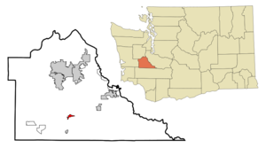
mapsize = 250px
map_caption = Location of Tenino, Washington
mapsize1 =
map_caption1 =subdivision_type = Country
subdivision_name =United States
subdivision_type1 = State
subdivision_name1 =Washington
subdivision_type2 = County
subdivision_name2 = Thurstongovernment_footnotes =
government_type =
leader_title =
leader_name =
leader_title1 =
leader_name1 =
established_title =
established_date =unit_pref = Imperial
area_footnotes =
area_magnitude =
area_total_km2 = 2.2
area_land_km2 = 2.2
area_water_km2 = 0.0
area_total_sq_mi = 0.8
area_land_sq_mi = 0.8
area_water_sq_mi = 0.0population_as_of = 2000
population_footnotes =
population_total = 1447
population_density_km2 = 664.2
population_density_sq_mi = 1720.3timezone = Pacific (PST)
utc_offset = -8
timezone_DST = PDT
utc_offset_DST = -7
elevation_footnotes =
elevation_m = 88
elevation_ft = 289
latd = 46 |latm = 51 |lats = 24 |latNS = N
longd = 122 |longm = 51 |longs = 1 |longEW = Wpostal_code_type =
ZIP code
postal_code = 98589
area_code = 360
blank_name = FIPS code
blank_info = 53-70630GR|2
blank1_name = GNIS feature ID
blank1_info = 1512718GR|3
website =
footnotes =Tenino is a city in Thurston County,
Washington ,United States . The population was 1,447 at the 2000 census.History
Tenino was officially incorporated on
July 24 ,1906 , though it existed as a rural community since the mid-1800s. Initially, Americans were attracted to the open prairies created and maintained by local natives through controlled burns. Records indicate the initial settlers' community centered on the prairie approximately 1/2 mile south of the present town. Early residents named their first post office and school "Coal Bank," a reference to a nearby coal outcropping.The name Tenino is reputedly a Chinook Indian word, which means "fork in the trail." It refers to the site where the Cowlitz Trail between The
Columbia River andPuget Sound split, branching toBudd Inlet atOlympia, Washington andCommencement Bay respectively. Some writers assert Tenino was named after either a train locomotive or a survey reference point with the number 1090: ten-nine-oh. Art Dwelley, former editor of the Tenino Independent and avid local historian, found no such locomotive or survey marker designations but discovered references to the area as "the tenino" in regional newspapers predating the arrival of the railroad. When theNorthern Pacific Railway arrived in 1872 they adopted Tenino as the name of the new station. Visitors to the town may see it written as "T9O", which is also how it's pronounced.In the late 1800s a number of
sandstone quarrying companies began shipping building stone, used in many regional buildings including the old Capitol building in Olympia, as well as the old Thurston County Courthouse, Denny Hall at theUniversity of Washington , Seattle, and several post office buildings, including atThe Dalles, Oregon . The US Government also used stone from these quarries to costruct coastal jetties atWestport, WA and elsewhere. The quarries declined in the early 1900s when many builders switched to concrete.Logging, sawmilling, and coal mining were also well established industries in the area. However, as the timber played out and railroads switched to
diesel in the mid 1900s, these industries declined. While Tenino retains its historic business core, the town now serves largely as a "bedroom community," many of its citizens commuting by car to larger cities such as Olympia and Tacoma for work.Geography
Tenino is located at coor dms|46|51|24|N|122|51|1|W|city (46.856745, -122.850290)GR|1.
According to the
United States Census Bureau , the city has a total area of 0.8square mile s (2.2km² ), all of it land.Demographics
As of the
census GR|2 of 2000, there were 1,447 people, 575 households, and 396 families residing in the city. Thepopulation density was 1,720.3 people per square mile (665.1/km²). There were 615 housing units at an average density of 731.1/sq mi (282.7/km²). The racial makeup of the city was 90.53% White, 0.83% African American, 1.17% Native American, 3.11% Asian, 0.07% Pacific Islander, 1.94% from other races, and 2.35% from two or more races. Hispanic or Latino of any race were 3.80% of the population.There were 575 households out of which 37.7% had children under the age of 18 living with them, 48.7% were married couples living together, 15.7% had a female householder with no husband present, and 31.0% were non-families. 27.3% of all households were made up of individuals and 13.6% had someone living alone who was 65 years of age or older. The average household size was 2.52 and the average family size was 3.01.
In the city the population was spread out with 29.8% under the age of 18, 7.6% from 18 to 24, 29.4% from 25 to 44, 18.9% from 45 to 64, and 14.3% who were 65 years of age or older. The median age was 34 years. For every 100 females there were 91.4 males. For every 100 females age 18 and over, there were 89.2 males.
The median income for a household in the city was $34,526, and the median income for a family was $41,208. Males had a median income of $31,058 versus $25,972 for females. The
per capita income for the city was $18,244. About 5.0% of families and 9.1% of the population were below thepoverty line , including 12.4% of those under age 18 and 9.9% of those age 65 or over.Points of interest
*
Wolf Haven International
*Tenino Depot MuseumTenino is also well known to Soldiers in the Army and to Army ROTC cadets, as the area it is located on is the standardized Land Navigation Instruction map due to its variety of terrain features and its magnetic declination of 21.50.
References
External links
* [http://www.ci.tenino.wa.us/index.htm City of Tenino]
* [http://www.ci.tenino.wa.us/museum.htm Tenino Depot Museum]
Wikimedia Foundation. 2010.