- Oldbury-on-the-Hill
-
Coordinates: 51°35′N 2°16′W / 51.59°N 2.26°W
Oldbury-on-the-Hill 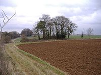
Nan Tow's Tump, Oldbury-on-the-Hill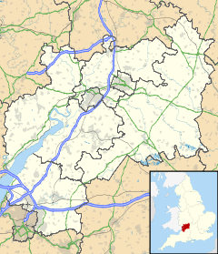
 Oldbury-on-the-Hill
Oldbury-on-the-Hill shown within GloucestershireOS grid reference ST8082 District Cotswold Shire county Gloucestershire Region South West Country England Sovereign state United Kingdom Police Gloucestershire Fire Gloucestershire Ambulance Great Western EU Parliament South West England List of places: UK • England • Gloucestershire Oldbury-on-the-Hill is a small village and former civil parish in Gloucestershire, England, ninety-three miles west of London and less than one mile (1.6 km) north of the village of Didmarton.[1]
Contents
History
Oldbury-on-the-Hill has been inhabited since prehistoric times, and Nan Tow's Tump, a round barrow beside the A46 road, is a Bronze Age earthwork and archaeological site.[2][3] The tree-grown barrow is about thirty metres in diameter and three metres high.[4][5] The name refers to Nan Tow, said to have been a local witch who was buried upright in the barrow.[6][7][8][9]
The parishes of Oldbury-on-the-Hill and Didmarton were together surrounded on all sides by the parish of Hawkesbury and the county boundary with Wiltshire, which is taken to suggest that they were anciently part of Hawkesbury.[10]
The Domesday Book of 1086 calls the village Aldeberie.[11] Before 1066, it was held by Eadric, Sheriff of Wiltshire, and in 1086 by Ernulf de Hesdin.[10] A document of 972 gives the name as Ealdanbyri, meaning 'old fortification'.[12] A possible derivation from the name of St Arilda has also been suggested.
In 1342, the tithe of hay and other lesser tithes in Didmarton and Oldbury-on-the-Hill belonging to Badminton church were assessed at £4 13s. 4d.[10]
Together with neighbouring Didmarton, the parish was subject to enclosure in 1829.[13][14]
Benjamin Clarke's British Gazetteer (1852) says:[15]
OLDBURY-ON-THE-HILL, Gloucester, a parish in the upper division of the hundd. of Grumbald's Ash, union of Tetbury: 135 miles (217 km) from London (coach road 102), 6 from Tetbury, 8 from Malmesbury - Gt. West. Rail. through Bristol to Charfield, thence 3 miles (4.8 km): from Derby, through Birmingham to Charfield, &c. 117 miles (188 km), Money orders issued at Tetbury: London letters delivd. 9 a.m.: post closes 4 p.m. The living, a rectory with that of Didmorton, in the diocese of Gloucester and Bristol, is valued at £16: pres. net income, £250: patron, Duke of Beaufort: pres. incumbent, E. J. Everard, 1840: contains 1,870 acres (7.6 km2): 84 houses: popn. in 1841, 483: assd. propr. £2,329: poor rates in 1848, £165. 9s.
According to The National Gazetteer of Great Britain and Ireland (1868):[16]
OLDBURY-ON-THE-HILL, a parish in the upper division of the hundred of Grumbald's Ash, county Gloucester, 5 miles (8.0 km) S.W. of Tetbury. Chippenham is its post town. The village, which is of small extent, is situated among the Cotswold hills. The tithes have been commuted for a rent-charge of £245. The living is a rectory with the rectory of Didmarton annexed, in the diocese of Gloucester and Bristol, joint value £387. The church, dedicated to St Arild or St Ariva, is a small ancient structure. There is a village school supported by the Duchess of Beaufort.
On 25 March 1883, Oldbury-on-the-Hill was incorporated into the civil parish of Didmarton, the two having shared a Rector since 1735.[17]
Parish records
Parish registers for Oldbury-on-the-Hill survive from as early as 1568, and all surviving records for the period 1568 to 1978 are deposited at the Gloucester Record Office.[18][19][20]
Monumental inscriptions from St Arilda's churchyard include the names Alcock, Baker, Bayliss, Chappell, Clark, Cockram, Dale, Fry, Gunter, Hatherell, Hatherle, Holborow, Holobrow, Long, Pirtt, Rice, Thompson, Toghill, Verrinder, Walker, Watts, Webb, White, and Yorke.[21]
Parish church
Main article: St Arild's Church, Oldbury-on-the-HillThe earliest record so far found of a church at Oldbury-on-the-Hill occurs in 1273, when there is a mention of a ‘free chapel’ there.[22] In 1291, the Rector of Great Badminton had a portion of 8s. and 6d. in the chapel of Oldbury.[10] The oldest part of the present medieval parish church of Oldbury is estimated to date from the 14th century.[23]
The church shares its ancient dedication to St Arilda with the church of Oldbury-on-Severn, some twenty miles (32 km) away. St Arilda was a Gloucestershire virgin and martyr who lived at an uncertain time before the Norman conquest of England at Kington, near Thornbury, which is now in the parish of Oldbury-on-Severn. Her feast day is 20 July.[24]
St Arilda's at Oldbury-on-the-Hill has been declared redundant, so is no longer used for regular worship.[24]
Notes
- ^ Oldbury on the Hill page at abstuk.co.uk, including location map (accessed 13 April 2008)
- ^ ST8089: Nan Tow's Tump, near to Oldbury on the Hill, Gloucestershire, Great Britain at www.geograph.org.uk (accessed 13 April 2008)
- ^ History of the Cotswolds at thecotswoldgateway.co.uk (accessed 13 April 2008)
- ^ NEOLITHIC-EBA EXCURSION number 7 at stonehenge-avebury.net (accessed 13 April 2008)
- ^ O'Neil, Helen, & and Grinsell, Leslie, Gloucestershire barrows in Transactions of the Bristol and Gloucestershire Archaeological Society (1960)
- ^ The Cotswolds - Neolithic, Bronze and Iron Age Sites at digital-brilliance.com (accessed 13 April 2008)
- ^ Nan Tow's Tump - Round Barrow(s) in England in Gloucestershire at megalithic.info (The Megalithic Portal) (accessed 13 April 2008)
- ^ 'The Exeter Riddling Rhymes' at ralphhoyte.net (accessed 19 April 2008): "Nan Tow's Tump a barrow at Didmarton, south of Stroud. Legend has it that the barrow is unusually high (9ft) rather than long because it was Nan Tow’s, a local witch’s, house and one of the Dukes of Beaufort had her buried upright as a punishment for her wickedness."
- ^ Country Cottages Online at countrycottagesonline.com (accessed 19 April 2008): "Nan Tow a local witch is believed to be buried in a large Bronze Age round barrow on the A46 near Birdlip and Crickley Hills."
- ^ a b c d Barrow, Julia, & Brooks, Nicholas, St Wulfstan and His World (Ashgate Publishing, 2005, ISBN 0754608026) pp. 158-159 online at books.google.co.uk (accessed 13 April 2008)
- ^ Place name: Oldbury on the Hill, Gloucestershire Folio: 169r Great Domesday Book abstract at nationalarchives.gov.uk (accessed 13 April 2008)
- ^ Mills, A. D., Oxford Dictionary of British Place Names (Oxford University Press, 2003, ISBN 987-0-19-852758-9, ISBN 0-19-852758-6)
- ^ AN ACT for inclosing Lands in the Manors and Parishes of Didmarton and Oldbury-on-the-Hill (HMSO, 1829, 10 Geo. IV c. 4, 18pp.)
- ^ Didmarton and Oldbury on the Hill enclosure at nationalarchives.gov.uk (accessed 13 April 2008)
- ^ Clarke, Benjamin, The British Gazetteer, Political, Commercial, Ecclesiastical, and Historical, Volume III, L-Z, (London, H. G Collins, 1852) page 333 online at books.google.co.uk (accessed 13 April 2008)
- ^ Hamilton, N. E. S. (ed.), The National Gazetteer of Great Britain and Ireland (London, J. S. Virtue, 1868)
- ^ Didmarton: A ramble through history (Didmarton Parish Council, 2000)
- ^ Oldbury-on-the-Hill parish online at nationalarchives.gov.uk (accessed 13 April 2008)
- ^ Oldbury-on-the-Hill, Gloucestershire, UK, Marriages 1568-1751 online at glosgen.co.uk (accessed 13 April 2008)
- ^ Oldbury-on-the-Hill, Gloucestershire, UK, Marriages 1754-1812 online at glosgen.co.uk (accessed 13 April 2008)
- ^ Some Memorial Inscriptions - Oldbury on the Hill, Gloucestershire, St Arilda's Churchyard online at wishful-thinking.org.uk (accessed 13 April 2008)
- ^ Phillimore, W. P. W. ‘’et al.’’ Inquisitiones Post Mortem for Gloucestershire’’, vol. IV (British Record Society Index Library, 1903) pp. 73-74
- ^ Verey, D., The Buildings of England: Gloucestershire: The Cotswolds (London, Penguin Books, 1974) p. 351
- ^ a b St Arilda of Oldbury on Severn, Gloucestershire at bath.ac.uk (accessed 13 April 2008)
External links
- Oldbury-on-the-Hill at genuki.org.uk
- DIDMARTON, LASBOROUGH, LEIGHTERTON, BOXWELL, OLDBURY-on-the-HILL & SADDLEWOOD page at rootsweb.ancestry.com, with photograph of St Arilda's Church, Oldbury-on-the-Hill
- Photograph of St Arilda's Church, Oldbury-on-the-Hill at wishful-thinking.org.uk
- Oldbury-on-the-Hill location map from google.co.uk/maps
- Oldbury-on-the-Hill at geodaisy.com (includes current weather report and weather forecast for next ten days)
- Gloucestershire census returns 1801-1901 at genuki.org.uk
Categories:- Villages in Gloucestershire
- Cotswold (district)


Wikimedia Foundation. 2010.