- Kingman Reef
-
Kingman Reef Reef  Southeast part of Kingman Reef, looking north
Country United States Region Northern Line Islands
(Fanning's Group)Coordinates 6°23′N 162°25′W / 6.383°N 162.417°W Length 18 km (11 mi), East-West Width 9 km (6 mi), North-South Height 1.5 m (5 ft) Depth 82 m (269 ft) Area 76 km2 (29 sq mi) - land 0.012 km2 (0 sq mi) - water 76 km2 (29 sq mi) Population 0 Material Coral, limestone Owner United States
(Claimed under the Guano Islands Act in 1856)Discovered by Edmund Fanning - date 1789  Map of Kingman Reef
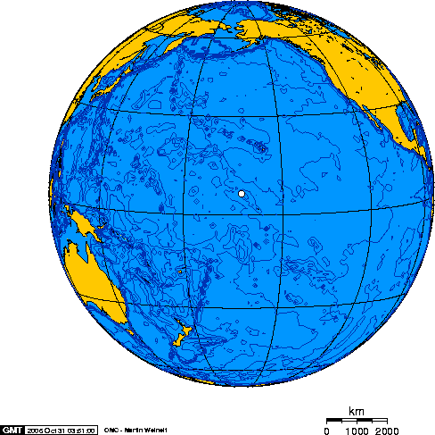
 Orthographic projection over Kingman Reef.
Kingman Reef (
 /ˈkɪŋmən/) is a largely submerged, uninhabited triangular shaped reef, 9.5 nautical miles (18 km) east-west and 5 nautical miles (9 km) north-south,[1] located in the North Pacific Ocean, roughly half way between the Hawaiian Islands and American Samoa at 6°23′N 162°25′W / 6.383°N 162.417°W.[2][3] It is the northernmost of the Northern Line Islands and lies 36 nautical miles (67 km) northwest of the next closest island (Palmyra Atoll), and 930 nautical miles (1,720 km) south of Honolulu.[2]
The reef encloses a lagoon up to 270 feet (82 m) deep in its western part.[1] The total area within the outer rim of the reef is 76 km2 (29 sq mi). There are two small strips of dry land composed of coral rubble and giant clamshells on the eastern rim with areas of 2 acres (8,000 m2) and 1 acre (4,000 m2)[4] having a coastline of 3 kilometres (2 mi).[2] The highest point on the reef is less than 5 feet (1.5 m) above sea level,[4] which is wetted or awash most of the time, making Kingman Reef a maritime hazard. It has no natural resources and supports no economic activity.[2]
Contents
Political status
Kingman Reef has the status of an unincorporated U.S. possession of the United States, administered from Washington, DC by the U.S. Department of Interior. The atoll is closed to the public. For statistical purposes, Kingman Reef is grouped as part of the United States Minor Outlying Islands. In January 2009, Kingman Reef was designated a marine national monument.
The pre-20th century names Danger Reef, Caldew Reef, Maria Shoal and Crane Shoal refer to this atoll, which by then was entirely submerged at high tide. Thomas Hale Streets described its state in the 1870s, when it had:
... hardly, as yet, assumed the distinctive features of an island. It is entirely under water at high tide, and but a few coral heads project here and there above the surface at low water. In the course of time, however, it will undoubtedly be added to the [northern Line Islands].[5]
History
Kingman Reef was discovered by the American Captain Edmund Fanning of the ship Betsey on June 14, 1798. Captain W. E. Kingman (whose name the island bears) described it on November 29, 1853. It was claimed for the United States under the name "Danger Reef" by the Guano Islands Act of 1856.[6]
Lorrin A. Thurston formally annexed Kingman to the United States on May 10, 1922 by reading this declaration on shore:
Be it known to all people: That on the tenth of May, A.D. 1922, the undersigned agent of the Island of Palmyra Copra Co., Ltd., landed from the motorship Palmyra doth, on this tenth day of May, A.D. 1922, take formal possession of this island, called Kingman Reef, situated in longitude 162 degrees 18' west and 6 degrees 23' north, on behalf of the United States of America and claim the same for said company.
The lagoon was used in 1937 and 1938 as a halfway station between Hawai'i and American Samoa by Pan American Airways flying boats (Sikorsky S-42B).[7] Pan Am wanted to expand flights into the Pacific and include Australia and New Zealand to their "Clipper" air routes. In 1935 it was decided that the lagoon at Kingman Reef was suitable for overnight stops en route from the U.S to New Zealand via Samoa. Kingman Reef became the stopover to and from Pago Pago, American Samoa, located 1,600 miles (2,600 km) further south. A supply ship, the North Wind, was stationed at Kingman Reef to provide fuel, lodging, and meals. The S42B Pan American Clipper II, piloted by Captain Edwin Musick, landed at Kingman on its first flight on March 23, 1937. Several successful flights followed, however the flight on January 11, 1938 ended in tragedy. Shortly after the early morning take off from Pago Pago, bound for New Zealand the Clipper exploded. The right outboard engine developed an oil leak and the plane burst into flames while dumping fuel, and there were no survivors. As a result of the tragedy, Pan Am ended flights to New Zealand via Kingman Reef and Pago Pago. A new route was established in July 1940 by way of Canton Island and New Caledonia.
On December 29, 1934 the US Navy assumed jurisdiction over Kingman Reef.[8] On September 1, 2000 the Navy relinquished its control over Kingman Reef to the US Department of the Interior and on January 18, 2001 the Secretary of the Interior signed Secretary’s Order 3223 establishing Kingman Reef as a National Wildlife Refuge including 1,958 km2 (484,000 acres). The National Wildlife Refuge is composed of the emergent coral rubble spits and all waters out to 12 nautical miles (22 km). In January 2009, Kingman Reef was designated a marine national monument.[4]
Amateur radio expeditions
Since the early 1940s Kingman Reef has had very little human contact, though amateur radio operators from around the world have occasionally visited the reef to put it "on the air" in what is known as a DX-pedition. In 1974, a group of amateurs using the callsign KP6KR sailed to the reef and set up a temporary radio station and antenna tower. Other groups visited the island in subsequent years, including 1977, 1980, 1981, 1988 and 1993.
Most recently, a group of 15 amateur radio operators from the Palmyra DX Group visited the reef in October 2000. Using the FCC-issued special event callsign K5K, the group made more than 80,000 individual contacts with amateurs around the world over a period of 10 days.[9]
Ecology
 Dry strip of land on Kingman Reef. Note coconut palm seedling.
Kingman Reef supports a vast variety of marine life. Giant clams are abundant in the shallows, and there are approximately 38 genera and 130 species of stony corals present on the reef. This is more than three times the species diversity of corals found in the main Hawaiian Islands. The ecosystem of the reef and its subsequent food chain are known for the distinct quality of being primarily predator-based. The percentage of the total fish biomass on the reef is made up of 85% apex predators, creating a high level of competition for food and nutrients among local organisms — particularly sharks, jacks and other carnivores. The threatened green sea turtles that frequent nearby Palmyra atoll travel to Kingman Reef to forage and bask on the coral rubble spits at low tide.
Above sea level the reef is usually barren of macroorganisms, however. Mainly constructed of dead and dried coral skeletons, providing only calcite as a source of nutrients, the small and narrow strips of dry land are only habitable by a handful of species for short periods of time. Most flora which begin to grow above water — primarily coconut palms — die out quickly due to the fierce tides and lack of resources necessary to sustain plant life.
See also
- List of Guano Island claims
References
- ^ a b Jane's Oceania profile of Kingman Reef
- ^ a b c d United States Pacific Island Wildlife Refuges - CIA World Factbook Last updated April 7, 2010.
- ^ Coordinates are near the dry land spits.
- ^ a b c Kingman Reef National Wildlife Refuge
- ^ Streets, Thomas H. (1877): "Some Account of the Natural History of the Fanning Group of Islands". American Naturalist 11(2): 65–72. p.65.
- ^ Bryan, E.H. Jr. (1941): American Polynesia and the Hawaiian Chain (1st ed.). Tongg Puplishing Company, Honolulu, Hawaii. p.154.
- ^ Pan Am Clipper Flying Boats
- ^ Office of Insular Affairs, Department of the Interior
- ^ The Kingman Reef/Palmyra DX Group proudly presents Kingman Reef 2000
External links
Wikimedia Atlas of Kingman Reef
- K5K Amateur Radio Expedition to Kingman Reef
- Kennedy Warne: "An Uneasy Eden" — National Geographic Magazine, July 2008
History of the United States by political division States - Alabama
- Alaska
- Arizona
- Arkansas
- California
- Colorado
- Connecticut
- Delaware
- Florida
- Georgia
- Hawaii
- Idaho
- Illinois
- Indiana
- Iowa
- Kansas
- Kentucky
- Louisiana
- Maine
- Maryland
- Massachusetts
- Michigan
- Minnesota
- Mississippi
- Missouri
- Montana
- Nebraska
- Nevada
- New Hampshire
- New Jersey
- New Mexico
- New York
- North Carolina
- North Dakota
- Ohio
- Oklahoma
- Oregon
- Pennsylvania
- Rhode Island
- South Carolina
- South Dakota
- Tennessee
- Texas
- Utah
- Vermont
- Virginia
- Washington
- West Virginia
- Wisconsin
- Wyoming
Federal district Insular areas - American Samoa
- Guam
- Northern Mariana Islands
- Puerto Rico
- U.S. Virgin Islands
Outlying islands - Bajo Nuevo Bank
- Baker Island
- Howland Island
- Jarvis Island
- Johnston Atoll
- Kingman Reef
- Midway Atoll
- Navassa Island
- Palmyra Atoll
- Serranilla Bank
- Wake Island
Protected areas of the United States by political division States - Alabama
- Alaska
- Arizona
- Arkansas
- California
- Colorado
- Connecticut
- Delaware
- Florida
- Georgia
- Hawaii
- Idaho
- Illinois
- Indiana
- Iowa
- Kansas
- Kentucky
- Louisiana
- Maine
- Maryland
- Massachusetts
- Michigan
- Minnesota
- Mississippi
- Missouri
- Montana
- Nebraska
- Nevada
- New Hampshire
- New Jersey
- New Mexico
- New York
- North Carolina
- North Dakota
- Ohio
- Oklahoma
- Oregon
- Pennsylvania
- Rhode Island
- South Carolina
- South Dakota
- Tennessee
- Texas
- Utah
- Vermont
- Virginia
- Washington
- West Virginia
- Wisconsin
- Wyoming
Federal district Insular areas - American Samoa
- Guam
- Northern Mariana Islands
- Puerto Rico
- U.S. Virgin Islands
Outlying islands Midway Atoll · Navassa Island
Pacific Remote Islands Marine National Monument (Baker Island · Howland Island · Jarvis Island · Johnston Atoll · Kingman Reef · Palmyra Atoll · Wake Island)Categories:- Kingman Reef
- Islands claimed under the Guano Islands Act
- Pacific Remote Islands Marine National Monument
- Coral reefs of the United States


Wikimedia Foundation. 2010.