- Honolulu
-
This article is about the urbanized area in Hawaii. For the City and County of Honolulu, see Honolulu County, Hawaii. For other uses, see Honolulu (disambiguation).
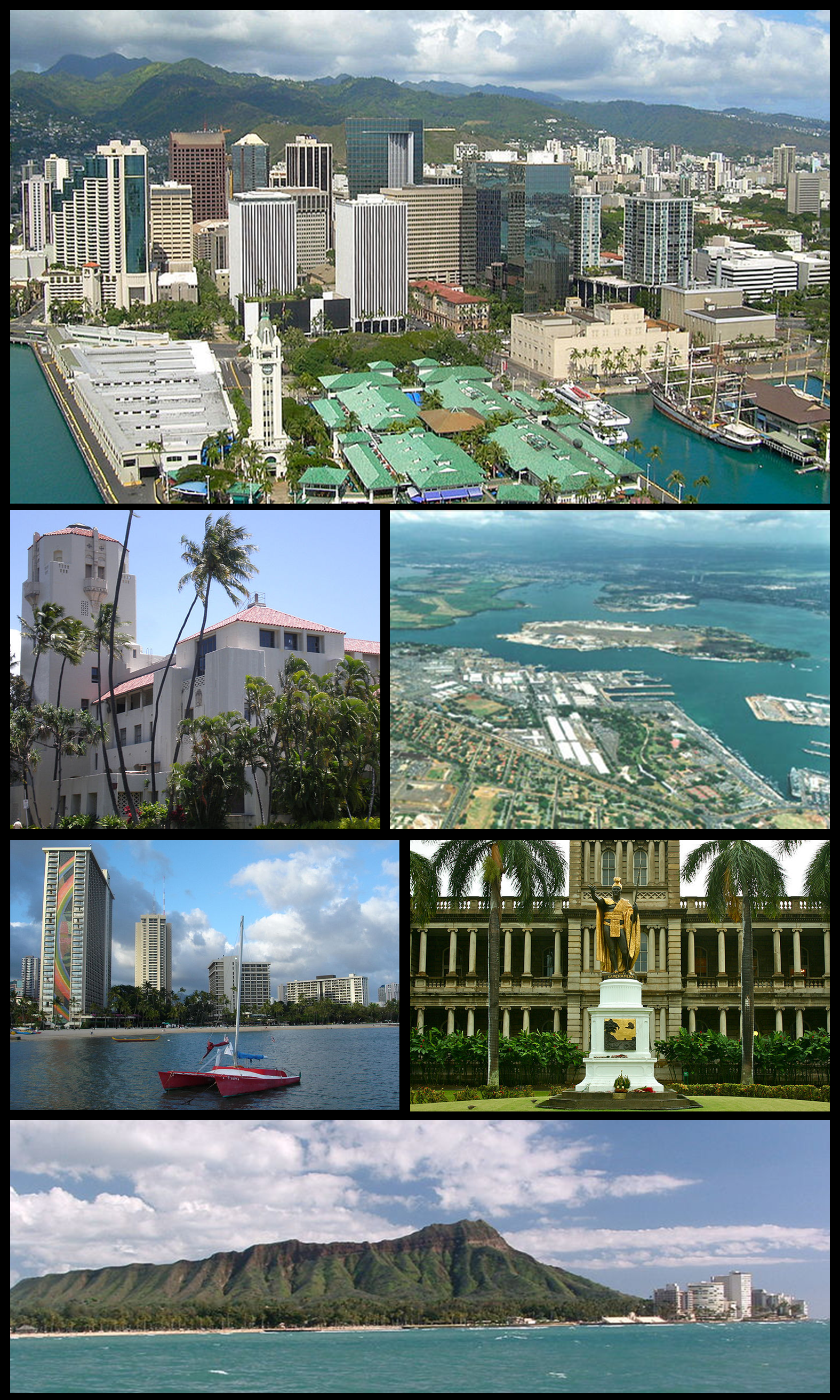
Honolulu, Hawaii — CDP — Clockwise: Aerial view of Downtown Honolulu, Pearl Harbor right outside the city, statue of King Kamehameha I in downtown, Diamond Head, waterfront on Waikiki Beach, and Honolulu Hale
Nickname(s): Crossroads of the Pacific, Sheltered Bay, The Big Pineapple, Paradise Location in Honolulu County and the state of Hawaii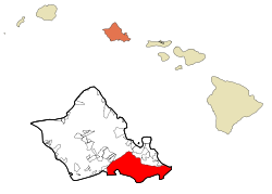 Location in Honolulu County and the state of Hawaii
 Honolulu, Hawaii
Coordinates: 21°18′32″N 157°49′34″W / 21.30889°N 157.82611°WCoordinates: 21°18′32″N 157°49′34″W / 21.30889°N 157.82611°W Country United States State Hawaii County Honolulu Area – CDP 105 sq mi (272.1 km2) – Land 85.7 sq mi (222.0 km2) – Water 19.3 sq mi (50.1 km2) Elevation 0 ft (Sea Level 0 m) Population (2009) – CDP 374,658 (53rd) – Estimate (July 2006[1]) 377,357 – Metro 953,207 Time zone Hawaii-Aleutian Standard Time (UTC-10) Zip Code 96801-96850 Area code(s) 808 FIPS code 15-17000 GNIS feature ID 0366212 Honolulu (English pronunciation: /hoʊnoʊ’lu:lu/) is the capital and the most populous city of the U.S. state of Hawaii.a[›] Honolulu is the southernmost major U.S. city. Although the name "Honolulu" refers to the urban area on the southeastern shore of the island of Oahu, the city and county government are consolidated as the City and County of Honolulu which covers the entire island. For statistical purposes, the U.S. Census Bureau recognizes the urban part of Honolulu as a census-designated place.[2] Honolulu is a major financial center of the islands of the Pacific Ocean. The population of the Census-designated place was 377,357 at the 2000 census, while the population of the city and county was 953,207 at the 2010 census. Honolulu is the most populous state capital relative to state population. In the Hawaiian language, Honolulu means "sheltered bay" or "place of shelter". The city has been the capital of the Hawaiian islands since 1845 and gained historical recognition following the Japanese attack on Pearl Harbor near the city on December 7, 1941, and as the birthplace of Barack Obama, the 44th and current President of the United States.[3]
Contents
History
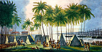 Port of Honolulu, as seen by Russian artist Louis Choris in 1816.
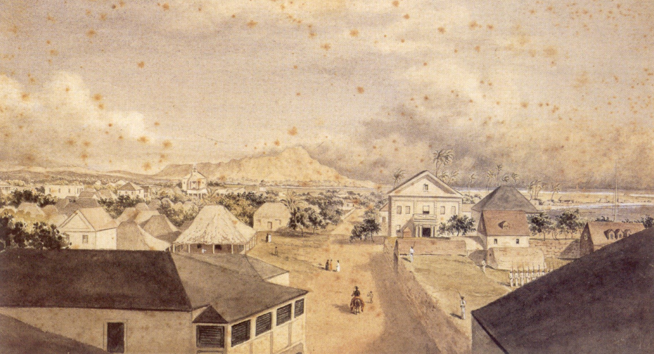
 Queen Street, Honolulu, 1856, by George Henry Burgess
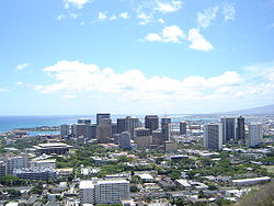 View of downtown from Punchbowl Crater
Evidence of the first settlement of Honolulu by the original Polynesian migrants to the archipelago comes from oral histories and artifacts. These indicate that there was a settlement where Honolulu now stands in the 11th century.[4] However, after Kamehameha I conquered Oʻahu in the Battle of Nuʻuanu at Nuʻuanu Pali, he moved his royal court from the Island of Hawaiʻi to Waikīkī in 1804. His court relocated in 1809 to what is now downtown Honolulu.[5] The capital was moved back to Kailua-Kona in 1812.
In 1794, Captain William Brown of Great Britain was the first foreigner to sail into what is now Honolulu Harbor.[6] More foreign ships followed, making the port of Honolulu a focal point for merchant ships traveling between North America and Asia.[7]
In 1845, Kamehameha III moved the permanent capital of the Hawaiian Kingdom from Lahaina on Maui to Honolulu. He and the kings that followed him transformed Honolulu into a modern capital,[8] erecting buildings such as St. Andrew's Cathedral, ʻIolani Palace, and Aliʻiōlani Hale. At the same time, Honolulu became the center of commerce in the islands, with descendants of American missionaries establishing major businesses in downtown Honolulu.[9]
Despite the turbulent history of the late 19th century and early 20th century, such as the overthrow of the Hawaiian monarchy in 1893, Hawaiʻi's subsequent annexation by the United States in 1898, followed by a large fire in 1900, and the Japanese attack on Pearl Harbor in 1941, Honolulu remained the capital, largest city, and main airport and seaport of the Hawaiian Islands.[10]
An economic and tourism boom following statehood brought rapid economic growth to Honolulu and Hawaiʻi. Modern air travel brings, as of 2007, 7.6 million visitors annually to the islands, with 62.3% entering at Honolulu International Airport.[11] Today, Honolulu is a modern city with numerous high-rise buildings, and Waikīkī is the center of the tourism industry in Hawaiʻi, with thousands of hotel rooms. The UK consulting firm Mercer, in a 2009 assessment "conducted to help governments and major companies place employees on international assignments", ranked Honolulu 29th worldwide in quality of living; the survey factored in political stability, personal freedom, sanitation, crime, housing, the natural environment, recreation, banking facilities, availability of consumer goods, education, and public services including transportation.[12]
Geography
According to the United States Census Bureau, the CDP has a total area of 105.1 sq mi (272 km2). 85.7 sq mi (222 km2) of it is land and 19.4 sq mi (50 km2) of it (18.42%) is water.
The closest location on the mainland to Honolulu is the Point Arena, California Lighthouse, at 2,045 nautical miles (3,787 km).[13] (Nautical vessels require some additional distance to circumnavigate Makapu'u Point.) However, part of the Aleutian Islands of Alaska are slightly closer than California.
Climate
Honolulu experiences a tropical savanna climate (Köppen classification As) with a mostly dry summer season. Honolulu has lots of sunshine most of the year. Temperatures vary little throughout the months, with average high temperatures of 80–90 °F (27–32 °C) and lows of 65–75 °F (14–19 °C) throughout the year. Temperatures rarely exceed 85 °F (32 °C), with lows in the upper-50's °F (~15 °C) occurring once or twice a year. Waters off the coast of Honolulu average 77 °F (27 °C) in the summer months and 67 °F (25 °C) in the winter months.[14]
Annual average precipitation is 18.3 inches (460 mm), which mainly occurs during the winter months of October through March, with very little rainfall during the summer. Honolulu has an average of 270 sunny days and 98 wet days per year.[15]
Climate data for Honolulu (Honolulu International Airport) Month Jan Feb Mar Apr May Jun Jul Aug Sep Oct Nov Dec Year Record high °F (°C) 88
(31)88
(31)89
(32)91
(33)93
(34)92
(33)94
(34)93
(34)95
(35)94
(34)93
(34)89
(32)95
(35)Average high °F (°C) 80.4
(26.9)80.7
(27.1)81.7
(27.6)83.1
(28.4)84.9
(29.4)86.9
(30.5)87.8
(31.0)88.9
(31.6)88.9
(31.6)87.2
(30.7)84.3
(29.1)81.7
(27.6)84.71
(29.28)Daily mean °F (°C) 73.0
(22.8)73.0
(22.8)74.3
(23.5)75.6
(24.2)79.2
(26.2)79.5
(26.4)80.8
(27.1)81.8
(27.7)81.5
(27.5)80.2
(26.8)77.7
(25.4)74.8
(23.8)77.62
(25.34)Average low °F (°C) 65.7
(18.7)65.4
(18.6)66.9
(19.4)68.2
(20.1)69.6
(20.9)72.1
(22.3)73.8
(23.2)74.7
(23.7)74.2
(23.4)73.2
(22.9)71.1
(21.7)67.8
(19.9)70.23
(21.24)Record low °F (°C) 52
(11)53
(12)55
(13)56
(13)60
(16)65
(18)66
(19)67
(19)66
(19)61
(16)57
(14)54
(12)52
(11)Rainfall inches (mm) 2.73
(69.3)2.35
(59.7)1.89
(48)1.11
(28.2)0.78
(19.8)0.43
(10.9)0.50
(12.7)0.46
(11.7)0.74
(18.8)2.18
(55.4)2.27
(57.7)2.85
(72.4)18.29
(464.6)Avg. rainy days (≥ 0.01 in) 8.8 7.9 9.0 8.6 7.3 5.8 7.2 5.4 6.9 7.3 9.1 9.7 93 Sunshine hours 213.9 214.7 260.4 252.0 282.1 285.0 306.9 303.8 279.0 244.9 201.0 198.4 3,042.1 Source no. 1: NOAA (normals, 1971–2000) [16] Source no. 2: HKO (sun, 1961–1990) [17] Government
 Completed in 1928, Honolulu Hale is the city and county seat
The municipal offices of the City and County of Honolulu, including Honolulu Hale, the seat of the city and county, are located in the census-designated place.[18] The Hawaii state government buildings are also located in the CDP.
The Honolulu District is located on the southeast coast of Oahu between Makapuu and Halawa. The district boundary follows the Koolau crestline, so Makapuu Beach is in the Koolaupoko District. On the west, the district boundary follows Halawa Stream, then crosses Red Hill and runs just west of Aliamanu Crater, so that Aloha Stadium, Pearl Harbor (with the USS Arizona Memorial), and Hickam Air Force Base are actually all located in the island's Ewa District.
The Hawaii Department of Public Safety operates the Oahu Community Correctional Center, the jail for the island of Oahu, in Honolulu CDP.[19]
The United States Postal Service operates post offices in Honolulu CDP. The main Honolulu Post Office is located by the international airport at 3600 Aolele Street.[20] Federal Detention Center, Honolulu, operated by the Federal Bureau of Prisons, is in the CDP.[21]
Diplomatic missions
Several countries have diplomatic facilities in Honolulu CDP in the City and County of Honolulu. They include consulates of Japan,[22] South Korea,[23] Philippines,[24] Federated States of Micronesia,[25] Australia,[26] and the Marshall Islands.[27]
Neighborhoods and districts
 Honolulu as seen from the International Space Station
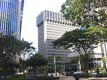 Downtown at Bishop and King streets, with First Hawaiian Center building (left) and Bank of Hawaii (right)
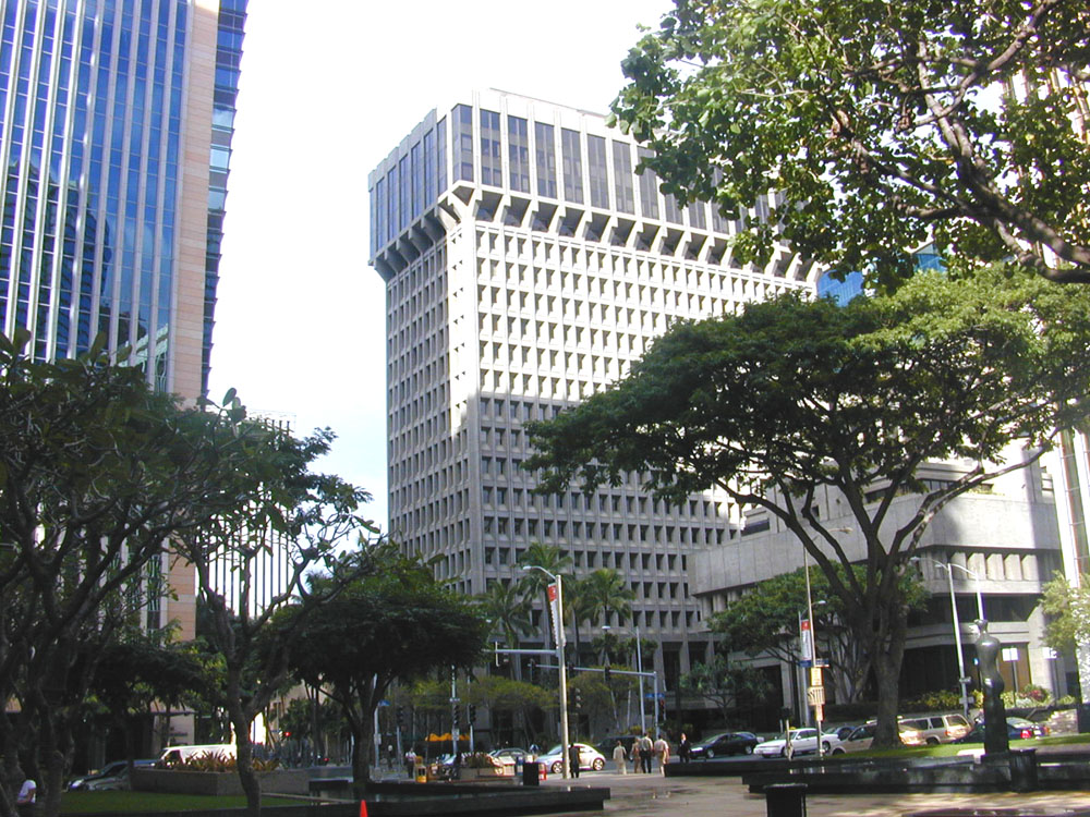
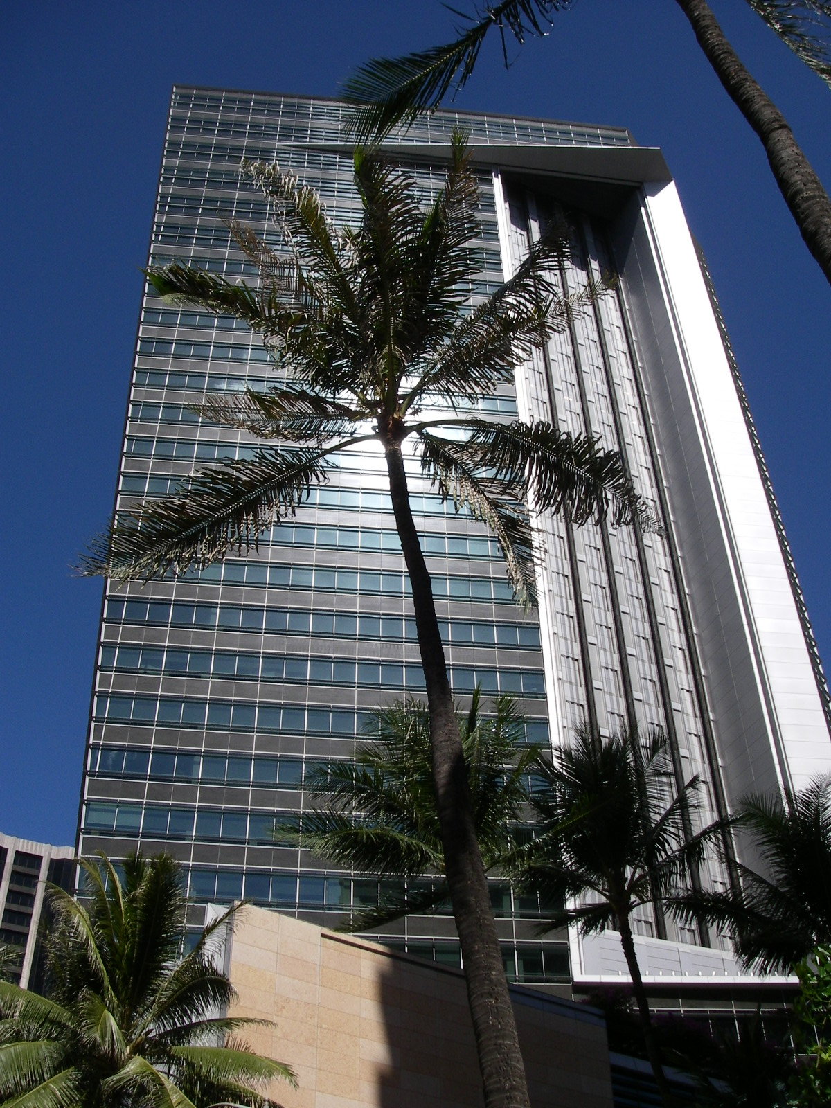
- Downtown Honolulu is the financial, commercial, and governmental center of Hawaii. On the waterfront is Aloha Tower, which for many years was the tallest building in Hawaii. Currently the tallest building is the 438-foot (134 m) tall First Hawaiian Center, located on King and Bishop Streets. The downtown campus of Hawaii Pacific University is also located there.
- The Arts District Honolulu in downtown/Chinatown is on the eastern edge of Chinatown. It is a 12-block area bounded by Bethel & Smith Streets and Nimitz Highway and Beretania Street – home to numerous arts and cultural institutions. It is located within the Chinatown Historic District, which includes the former Hotel Street Vice District.[28]
- The Capitol District is the eastern part of Downtown Honolulu. It is the current and historic center of Hawaii's state government, incorporating the Hawaii State Capitol, Iolani Palace, Honolulu Hale (City Hall), State Library, and the statue of King Kamehameha I, along with numerous government buildings.
- Kakaʻako is a light-industrial district between Downtown and Waikīkī that has seen a large-scale redevelopment effort in the past decade. It is home to two major shopping areas, Ward Warehouse and Ward Centre. The John A. Burns School of Medicine, part of the University of Hawaiʻi at Manoa is also located there. A Memorial to the Ehime Maru Incident victims is built at Kakaako Waterfront Park.
- Ala Moana is a district between Kakaʻako and Waikīkī and the home of Ala Moana Center, the "World's largest open air shopping center" and the largest shopping mall in Hawaii.[29] Ala Moana Center boasts over 300 tenants and is a very popular location among tourists. Also in Ala Moana is the Honolulu Design Center and Ala Moana Beach Park, the second largest park in Honolulu.
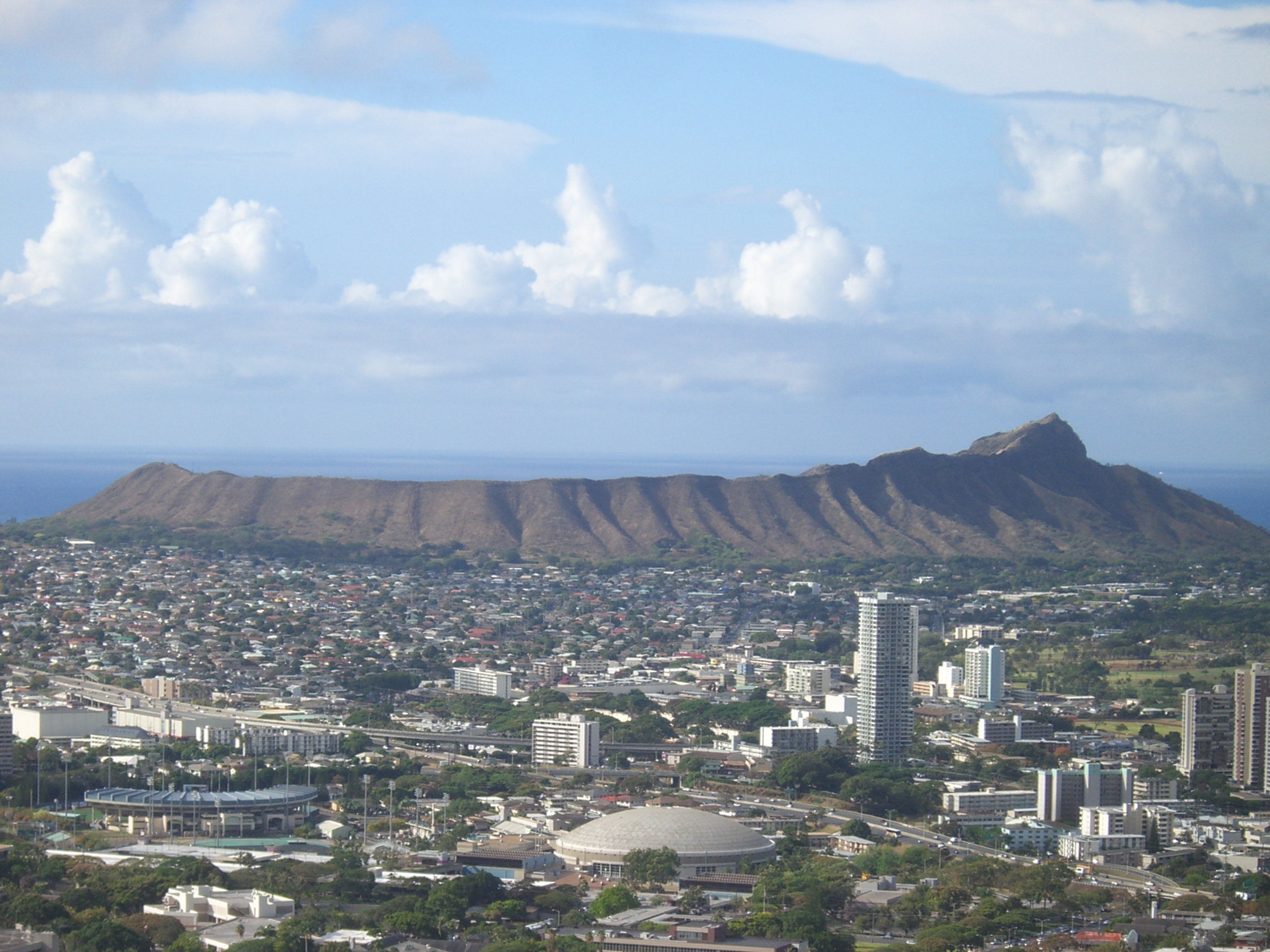
- Waikīkī is the tourist district of Honolulu, located between the Ala Wai Canal and the Pacific Ocean next to Diamond Head. Numerous hotels, shops, and nightlife opportunities are located along Kalakaua and Kuhio Avenues. It is a popular location for visitors and locals alike and attracts millions of visitors every year. A majority of the hotel rooms on Oahu are located in Waikīkī.
- Manoa and Makiki are residential neighborhoods located in adjacent valleys just inland of downtown and Waikīkī. Manoa Valley is home to the main campus of the University of Hawaiʻi. President Barack Obama lived in Makiki with his maternal grandparents until graduating from Punahou School, apart from four years in Indonesia with his mother and stepfather.
- Nuʻuanu and Pauoa are upper-middle-class residential districts located inland of downtown Honolulu. The National Memorial Cemetery of the Pacific is located in Punchbowl Crater fronting Pauoa Valley.
- Palolo and Kaimuki are neighborhoods east of Manoa and Makiki, inland from Diamond Head. Palolo Valley parallels Manoa and is a residential neighborhood. Kaimuki is primarily a residential neighborhood with a commercial strip centered on Waialae Avenue running behind Diamond Head. Chaminade University is located in Kaimuki.
- Waialae and Kahala are upper-class districts of Honolulu located directly east of Diamond Head, where there are many high-priced homes. Also found in these neighborhoods are the Waialae Country Club and the five-star Kahala Hotel & Resort.
- East Honolulu includes the residential communities of ʻĀina Haina, Niu Valley, and Hawaiʻi Kai. These are considered upper-middle-class neighborhoods. The upscale gated communities of Waiʻalae ʻiki and Hawaiʻi Loa Ridge are also located here.
- Kalihi and Palama are working-class neighborhoods with a number of government housing developments. Lower Kalihi, toward the ocean, is a light-industrial district.
- Salt Lake and Aliamanu are (mostly) residential areas built in extinct tuff cones along the western end of the Honolulu District, not far from the Honolulu International Airport.
- Moanalua is two neighborhoods and a valley at the western end of Honolulu, and home to Tripler Army Medical Center.
Demographics
Historical populations Census Pop. %± 1890 22,907 — 1900 39,306 71.6% 1910 52,183 32.8% 1920 83,327 59.7% 1930 137,582 65.1% 1940 179,326 30.3% 1950 248,034 38.3% 1960 294,194 18.6% 1970 324,871 10.4% 1980 365,048 12.4% 1990 365,272 0.1% 2000 371,657 1.7% 2010 390,738 5.1% Population 1890–2000.[30]
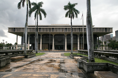
Population Est. 2009.[31] State of Hawaii's Capitol building
2010 Census data
The population of Honolulu was 390,738 according to the 2010 U.S. Census. Of 390,738 residents, 192,781 (49.3%) are male and 197,957 (50.7%) are female. The median age for males was 40.5 and 43.5 for females; the overall median age was 41.9. Approximately 84.2% of the total population was 16 years and over; 82.1% were 18 years and over, 78.5% were 21 years and over, 21.8% were 62 years and over, and 18.1% were 65 years and over.
In terms of race and ethnicity, 19.5% (76,145 residents) were White, 1.5% (5,718 residents) were Black or African American, 0.2% (834 residents) were American Indian or Alaska Native, 53.7% (209,747 residents) were Asian, 7.6% (29,744 residents) were Native Hawaiian and Other Pacific Islander, 0.8% (3,270 residents) were from Some Other Race, and 16.7% (65,250 residents) were from Two or More Races. Hispanics and Latinos of any race made up 5.3% (20,883 residents) of the population.
Asian Americans represent the majority of Honolulu's population. Japanese Americans represent 20.6% (80,514) of the population; Filipino Americans represent 11.8% (45,965) of the population. Chinese American made up 10.3% of the population and numbered at 40,101 individuals. Native Hawaiians made up just 3.1% of the population and numbered at 12,017 individuals. There were 5,188 Samoan Americans whom made up 1.3% of the population. People of Guamanian or Chamorro descent made up 0.2% of the population and numbered at just 917 residents. [32]
Common race combinations for those of more than one race include those who reported themselves as White and Asian (18,348), White and Native Hawaiian and Other Pacific Islander (6,106), Asian and Native Hawaiian and Other Pacific Islander (13,527), and those who are White, Asian, and Native Hawaiian and Other Pacific Islander (15,204). [33]
Economy

The largest city and airport in the Hawaiian Islands, Honolulu acts as a natural gateway to the islands' large tourism industry, which brings millions of visitors and contributes $10 billion annually to the local economy.[34] Honolulu's location in the Pacific also makes it a large business and trading hub, particularly between the East and the West. Other important aspects of the city's economy include military defense, research and development, and manufacturing.[34]
Among the companies based in Honolulu are:
Go! Mokulele,[35] Hawaiian Airlines,[36] Island Air,[37] and Aloha Air Cargo are headquartered in the CDP.[38][39] Prior to its dissolution, Aloha Airlines was headquartered in the CDP.[40]
Since the housing collapse, Honolulu has faced a decrease in its rent of about 3.4%, but has recently evened out. This stands in relation with the national average of a 4% decrease in rent. [41]
Since no national bank chains have any branches in Hawaii, many visitors and new residents use different banks. First Hawaiian Bank is the largest and oldest bank in Hawaii and their headquarters are at the First Hawaiian Center, the tallest building in the State of Hawaii.
Transportation
Air
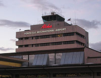
Located on the western end of the CDP, Honolulu International Airport (HNL) is the principal aviation gateway to the state of Hawaii. Kalaeloa Airport is primarily a commuter facility used by unscheduled air taxis, general aviation and transient and locally-based military aircraft.
 Honolulu International Airport old control tower
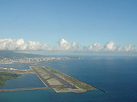 Honolulu International Airport reef runway
Highways
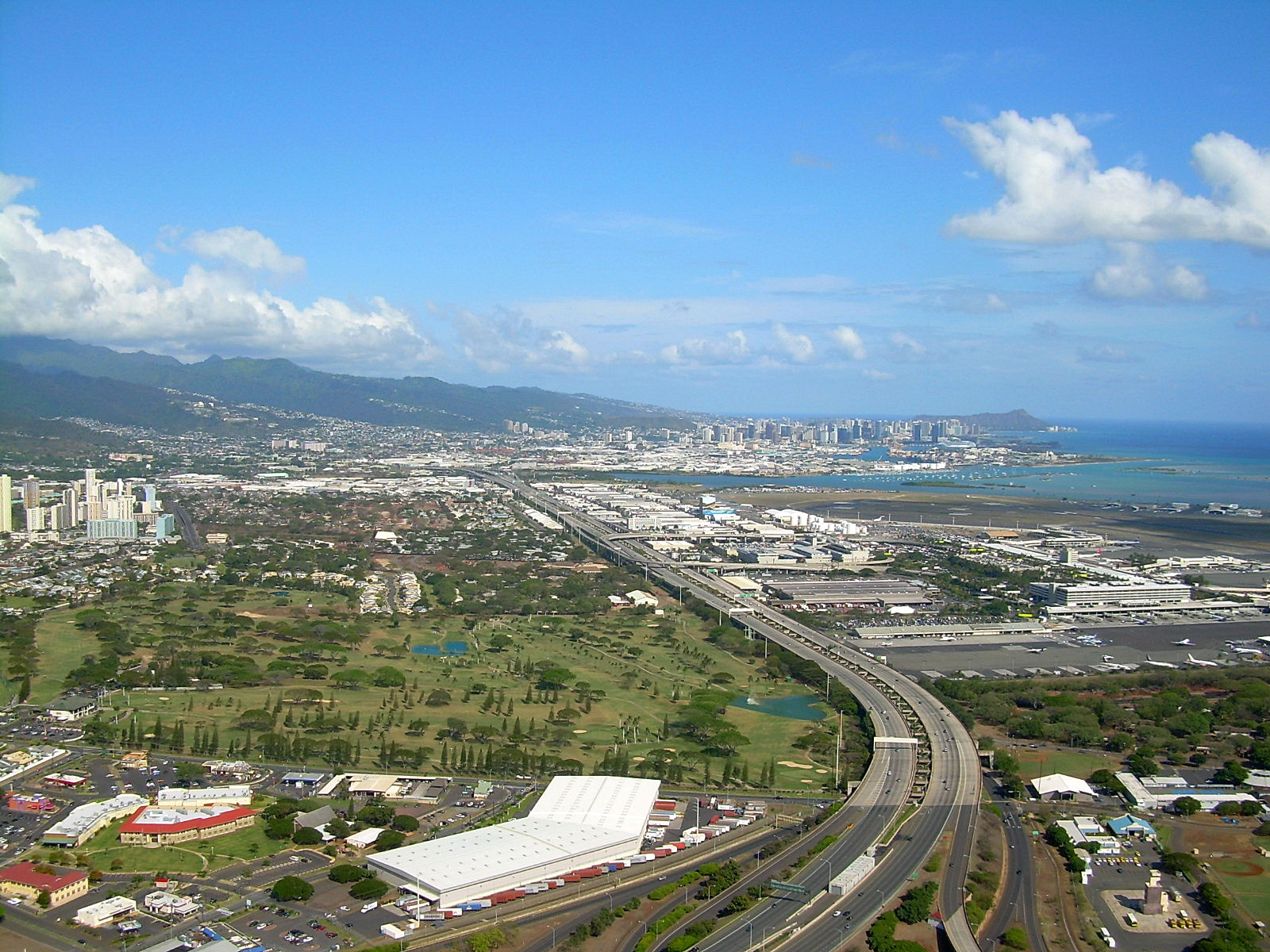
 Aerial view of H-1 (looking east) from Honolulu Airport heading into downtown Honolulu
Honolulu has the nation’s second highest metropolitan travel time during peak commute hours, second only to Los Angeles. The following freeways, part of the Interstate Highway System serve Honolulu:
 Interstate H-1, which, coming into the city from the west, passes Hickam Air Force Base and Honolulu International Airport, runs just north of Downtown and continues eastward through Makiki and Kaimuki, ending at Waialae/Kahala. H-1 connects to Interstate H-2 from Wahiawa and Interstate H-3 from Kaneohe, west of the CDP.
 Interstate H-201—also known as the Moanalua Freeway and sometimes numbered as its former number, Hawaii State Rte. 78—connects two points along H-1: at Aloha Stadium and Fort Shafter. Close to H-1 and Aloha Stadium, H-201 has an exchange with the western terminus of Interstate H-3 to the windward side of Oahu (Kaneohe). This complex of connecting ramps, some directly between H-1 and H-3, is in Halawa.
Other major highways that link Honolulu proper with other parts of the Island of Oahu are:
- Pali Highway, State Rte. 61, crosses north over the Koolau range via the Pali Tunnels to connect to Kailua and Kaneohe on the windward side of the Island.
- Likelike Highway, State Rte. 63, also crosses the Koolau to Kaneohe via the Wilson Tunnels.
- Kalanianaole Highway, State Rte. 72, runs eastward from Waialae/Kahala to Hawaii Kai and around the east end of the island to Waimanalo Beach.
- Kamehameha Highway, State Rte. 99, runs westward from near Hickam Air Force Base to Aiea and beyond, eventually running through the center of the island and ending in Kaneohe.
Like most major American cities, the Honolulu metropolitan area experiences heavy traffic congestion during rush hours, especially to and from the western suburbs of Kapolei, Ewa, Aiea, Pearl City, Waipahu, and Mililani.
There is a Hawaii Electric Vehicle Demonstration Project (HEVDP).[42]
Public transport
Honolulu Authority for Rapid Transportation (HART)
In November 2010, voters approved a charter amendment to create a public transit authority to oversee the planning, construction, operation and future extensions to Honolulu's rail system (see below). Operations began on July 1, 2011. HART will have a 10-member board of directors that includes three members appointed by the mayor, three members selected by the Honolulu City Council, and the city and state transportation directors.[43]
Bus
Main article: TheBus (Honolulu)Established by former Mayor Frank F. Fasi as the replacement for the Honolulu Rapid Transit Co. Ltd.(HRT), Honolulu's TheBus system has been twice honored by the American Public Transportation Association bestowing the title of "America's Best Transit System" for 1994–1995 and 2000–2001. TheBus operates 107 routes serving Honolulu and outlying areas on Oahu with a fleet of 531 buses, and is run by the non-profit corporation Oahu Transit Services in conjunction with the city Department of Transportation Services. Honolulu is ranked 4th for highest per-capita use of mass transit in the United States.[44]
Rail
Main article: Honolulu High-Capacity Transit Corridor ProjectCurrently, there is no urban rail transit system in Honolulu, although electric street railways were operated in Honolulu by the Honolulu Rapid Transit Company Ltd. prior to World War II. Honolulu Ltd.'s predecessors were the Honolulu Rapid Transit and Land Company (began 1903) and Hawaiian Tramways (began 1888).[45]
The City and County of Honolulu is currently constructing a 20-mile (32 km) transit line that will connect Honolulu with outlying suburban areas to the west of the city on the southwestern part of Oʻahu. The Honolulu High-Capacity Transit Corridor Project is aimed at alleviating traffic congestion for Leeward Oʻahu commuters while being integral in the westward expansion of the metropolitan area. The project however has been criticized for its cost, delays and potential environmental impacts.
Cultural institutions
 With symbolic native-styled architectural features, First Hawaiian Center is the tallest building in Hawaii and home to a Contemporary Museum gallery
Performing arts
Established in 1900, the Honolulu Symphony is the oldest US symphony orchestra west of the Rocky Mountains. Other classical music ensembles include the Hawaii Opera Theatre. Honolulu is also a center for Hawaiian music. The main music venues include the Neal Blaisdell Center Concert Hall and Arena, the Waikiki Shell, and the Hawaii Theatre.
Honolulu also includes several venues for live theater, including the Diamond Head Theatre.
Visual arts
There are various institutions for the visual arts. The Honolulu Academy of Arts is endowed with the largest collection of Asian and Western art in Hawaii. It also has the largest collection of Islamic art, housed at the Shangri La estate. The academy hosts a film and video program dedicated to arthouse and world cinema in the museum's Doris Duke Theatre, named for the academy's historic patroness Doris Duke.
The Contemporary Museum is the only contemporary art museum in the state. It has two locations: main campus in Makiki and a multi-level gallery in downtown Honolulu at the First Hawaiian Center.
The Hawaii State Art Museum (also downtown) boasts pieces by local artists as well as traditional Hawaiian art. The museum is administered by the Hawaii State Foundation on Culture and the Arts.
Honolulu also annually holds the Hawaii International Film Festival (HIFF). It showcases some of the best films from producers all across the Pacific Rim and is the largest "East meets West" style film festival of its sort in the United States.
Natural museums
The Bishop Museum is the largest of Honolulu's museums. It is endowed with the state's largest collection of natural history specimens and the world's largest collection of Hawaiiana and Pacific culture artifacts.[46] The Honolulu Zoo is the main zoological institution in Hawaii while the Waikiki Aquarium is a working marine biology laboratory. The Waikiki Aquarium is partnered with the University of Hawaii and other universities worldwide. Established for appreciation and botany, Honolulu is home to several gardens: Foster Botanical Garden, Liliʻuokalani Botanical Garden, Walker Estate, among others.
Sports
Honolulu's climate lends itself to year-round activities. In 2004, Men's Fitness magazine named Honolulu the fittest city in the United States.[47] Honolulu has three large road races:
- The Great Aloha Run is held annually on Presidents' Day.
- The Honolulu Marathon, held annually on the second Sunday in December, draws more than 20,000 participants each year, about half to two thirds of them from Japan.
- The Honolulu Triathlon is an Olympic distance triathlon event governed by USA Triathlon. Held annually in May since 2004, there is an absence of a sprint course.
Ironman Hawaii was first held in Honolulu, it was the first ever Ironman and is also the World Champs.
Fans of spectator sports in Honolulu generally support the football, volleyball, basketball, rugby union, rugby league and baseball programs of the University of Hawaii at Manoa.[48] High school sporting events, especially football, are especially popular.
Honolulu has no professional sports teams. It was the home of the Hawaii Islanders (Pacific Coast League, 1961–1987), The Hawaiians (World Football League, 1974–1975), Team Hawaii (North American Soccer League, 1977), and the Hawaiian Islanders (af2, 2002–2004).
The NCAA football Hawaii Bowl is played in Honolulu. Honolulu has also hosted the NFL's annual Pro Bowl each February since 1980, though the 2010 Pro Bowl was played in Miami.[49] In 2011, the 2011 Pro Bowl returned once again to Honolulu. From 1993 to 2008, Honolulu hosted Hawaii Winter Baseball, featuring minor league players from Major League Baseball, Nippon Professional Baseball, Korea Baseball Organization, and independent leagues.
Venues
Venues for spectator sports in Honolulu include:
- Les Murakami Stadium at UH-Manoa (baseball)
- Stan Sheriff Center at UH-Manoa (basketball and volleyball)
- Neal Blaisdell Center Arena (basketball)
Aloha Stadium, a venue for American football and soccer (football), is located in the Halawa CDP.[50]
Media
Main article: Media in Honolulu, HawaiiHonolulu is served by one daily newspaper (the Honolulu Star-Advertiser), Honolulu Magazine, several radio stations and television stations, among other media.
Honolulu, and the island of Oahu has also been the location for many film and television projects, including Hawaii Five-0, Lost, and others.
Tourist attractions
 Diamond Head, Hawaii From Round Top Drive
Notable residents
Notable people born in Honolulu, and current and former residents of Honolulu.
- Neil Abercrombie, 7th and current Governor of Hawaii
- Bernice Pauahi Bishop, Hawaiian princess, philanthropist, aliʻi, and Kamehameha descendant
- Charles Reed Bishop businessman, philanthropist, founder of the Bishop Museum
- John A. Burns, second Governor of Hawaii
- Tia Carrere, singer, actress
- Alexander Cartwright, "father of baseball"
- Joseph Campbell, writer, lecturer
- James Dole, known as the "Pineapple King'", developer of the Pineapple industry in Hawaii, namesake of the Dole Food Company.
- Sanford B. Dole, lawyer, jurist, politician in Honolulu early 1900's
- Amelia Earhart, American aviation pioneer and author
- Willi Hennig, biologist
- Daniel Inouye, senior United States Senator
- Dwayne Johnson, actor
- King Kalakaua last reigning king of the Kingdom of Hawaiʻi
- Duke Kahanamoku, Olympic athlete, surfer, actor
- Nicole Kidman, actress
- Daniel Dae Kim, actor
- Princess Kaʻiulani, crown princess, heir to the throne of the Kingdom of Hawaiʻi
- Queen Liliuokalani, last Queen of the Hawaiian Islands
- Linda Lingle, 6th Governor of Hawaii
- Lois Lowry, author
- King Lunalilo, King to the Kingdom of Hawaii
- Ferdinand Marcos, Filipino dictator
- Bruno Mars, singer and songwriter
- Barack Obama, 44th and current President of the United States
- Pierre Omidyar, eBay, creator and founder
- Ed Parker, martial artist, author
- Syngman Rhee, first president of South Korea
- Nicole Scherzinger, singer, dancer, model
- Robert Louis Stevenson, novelist, poet, essayist and travel writer
- Thomas Tamas, sport shooter
- Lorrin A. Thurston lawyer, politician in Honolulu early 1900's
Education
Colleges and universities
Colleges and universities in the Honolulu CDP include Honolulu Community College, Kapiolani Community College, the University of Hawaii at Manoa, Chaminade University, and Hawaii Pacific University.[39] UH Manoa houses the main offices of the University of Hawaii System.[51]
Public primary and secondary schools
Hawaii Department of Education operates public schools in Honolulu. Public high schools within the CDP include Wallace Rider Farrington, Kaiser, Kaimuki, Kalani, Moanalua, William McKinley, and Theodore Roosevelt.[39]
Private primary and secondary schools
Private schools include Academy of the Pacific, Damien Memorial School, Hawaii Baptist Academy, Iolani School, Kamehameha Schools, Maryknoll School, Mid-Pacific Institute, La Pietra, Punahou School, Sacred Hearts Academy, Saint Francis School, Saint Louis School and the University of Hawaii Lab School, Saint Patrick School, Trinity Christian School.
Public libraries
Hawaii State Public Library System operates public libraries. The Hawaii State Library in the CDP serves as the main library of the system,[52] while the Library for the Blind and Physically Handicapped, also in the CDP, serves handicapped and blind people.[53]
Branches in the CDP include Aina Haina,[54] Hawaii Kai,[55] Kaimuki,[56] Kalihi-Palama,[57] Manoa,[58] McCully,[59] Salt Lake-Moanalua,[60] and Waikiki.[61]
See also
- List of cities with the most high-rise buildings
- List of tallest buildings in Honolulu
References
^ a: The US Census technically considers Honolulu a Census-designated place, not a city.
- ^ Quickfacts.census.gov
- ^ "Cities with 100,000 or More Population in 2000 ranked by Population per Square Mile, 2000 in Alphabetic Order". United States Census Bureau, Population Division. 2008-07-10. http://www.census.gov/statab/ccdb/cit1040a.txt. Retrieved 2008-07-13.
- ^ "Certification of Live Birth: Barack Hussein Obama II, August 4, 1961, 7:24 PM, Honolulu". Department of Health, State of Hawaii. The White House. April 27, 2011. http://www.whitehouse.gov/sites/default/files/rss_viewer/birth-certificate-long-form.pdf. Retrieved April 27, 2011.
- ^ Honolulu History – HelloHonolulu.com
- ^ History – Honolulu
- ^ Honolulu History, Hawaii | Travelgrove.com
- ^ Honolulu: History – Native Hawaiians Meet Westerners, Begin Trading Goods
- ^ About Infoplease, Part of Family Education Network
- ^ About the City, Official Web Site for The City and County of Honolulu
- ^ Honolulu History
- ^ "2007 Annual Visitor Research Report". Department of Business, Economic Development, and Tourism, State of Hawaii. 1 July 2008. http://hawaii.gov/dbedt/info/visitor-stats/visitor-research/2007-annual-research.pdf. Retrieved 2009-05-30.
- ^ "Quality of Living global city rankings 2009 – Mercer survey". Mercer. 28 April 2009. http://www.mercer.com/referencecontent.htm?idContent=1173105. Retrieved 2009-05-08.
- ^ Microsoft Streets and Trips 2007 Software, Copyright 2006 by Microsoft Corp. et al.
- ^ Weather.com
- ^ Weatherbase.com
- ^ "NCDC: U.S. Climate Normals". National Oceanic and Atmospheric Administration. http://cdo.ncdc.noaa.gov/climatenormals/clim20/hi/511919.pdf. Retrieved 2010-04-29.
- ^ "Climatological Normals of Honolulu". Hong Kong Observatory. http://www.hko.gov.hk/wxinfo/climat/world/eng/australia/pacific/honolulu_e.htm. Retrieved 2010-05-12.
- ^ Honolulu.gov[dead link]
- ^ "oahu-community-correctional-center Oahu Community Correctional Center." Hawaii Department of Public Safety. Retrieved on May 19, 2010.
- ^ "Post Office Location – Honolulu." United States Postal Service. Retrieved on May 21, 2009.
- ^ "FDC Honolulu Contact Information." Federal Bureau of Prisons. Retrieved on December 30, 2009.
- ^ "Visa & Travel." Consulate-General of Japan in Honolulu. Accessed August 17, 2008.
- ^ "Location." Consulate-General of South Korea in Honolulu. Retrieved on January 10, 2009.
- ^ "Other Philippine Missions in the U.S.." Consulate-General of the Philippines in Chicago. Retrieved on January 10, 2009.
- ^ "Department of Foreign Affairs, Overseas Embassies, Consulates, and Missions." Department of Foreign Affairs (Federated States of Micronesia). Retrieved on January 10, 2009.
- ^ "Australian Consulate-General in Honolulu, United States of America." Department of Foreign Affairs and Trade. Retrieved on January 10, 2009.
- ^ "Foreign Mission." Republic of the Marshall Islands. Retrieved on January 28, 2009.
- ^ Artsdistricthonolulu.com
- ^ Ala Moana Center: Hawaii's Premier Shopping, Entertainment, and Dining Destination
- ^ "Census Of Population And Housing". U.S. Census Bureau. http://www.census.gov/prod/www/abs/decennial/index.htm. Retrieved 2011-05-07.
- ^ "Annual Estimates of the Resident Population for Incorporated Places Over 100,000, Ranked by July 1, 2009 Population: April 1, 2000 to July 1, 2009". U.S. Census Bureau. http://www.census.gov/popest/cities/tables/SUB-EST2009-01.csv. Retrieved 2011-05-07.
- ^ http://factfinder2.census.gov/faces/tableservices/jsf/pages/productview.xhtml?pid=DEC_10_DP_DPDP1&prodType=table
- ^ http://factfinder2.census.gov/faces/tableservices/jsf/pages/productview.xhtml?pid=DEC_10_PL_P1&prodType=table
- ^ a b "Honolulu Economy". City-Data.com. Advameg Inc.. 2009. http://www.city-data.com/us-cities/The-West/Honolulu-Economy.html. Retrieved 2011-01-26.
- ^ "Contact Us." Mesa Air Group. Retrieved on February 23, 2010.
- ^ "Corporate Headquarters." Hawaiian Airlines. Retrieved on May 20, 2009.
- ^ "Contact Information[dead link]." Island Air. Retrieved on May 20, 2009.
- ^ "Locations." Aloha Air Cargo. Retrieved on May 21, 2009.
- ^ a b c "Honolulu CDP, HI." U.S. Census Bureau. Retrieved on May 21, 2009.
- ^ "Aloha Airlines, Inc." BusinessWeek. Retrieved on May 21, 2009.
- ^ "Study: Average Honolulu Rents Down". http://bizbites.honadvblogs.com/2009/11/11/study-average-honolulu-rents-down/. Retrieved 28 October 2010.
- ^ "Hawaii Center for Advanced Transportation Technologies". High Technology Development Corporation. http://www.htdc.org/programsservices/hcatt.html. Retrieved 2009-11-13.
- ^ [1], Honolulu Rail Transit-HART
- ^ National Transit Database, Top Transit Cities (2006)
- ^ Hawaii's History in 1888 – Hawaii History – 1888
- ^ Welcome to the Bishop Museum
- ^ Pacific.bizjournals.com
- ^ University of Hawaii at Manoa
- ^ Arnett, Paul; Reardon, Dave (December 30, 2008). "Miami tackles Pro Bowl". Honolulu Star-Bulletin. http://www.starbulletin.com/news/20081230_Miami_tackles_Pro_Bowl.html?page=all&c=y. Retrieved 2008-12-30.
- ^ "Halawa CDP, Hawaii." U.S. Census Bureau. Retrieved on May 21, 2009.
- ^ Magin, Janis L. "Land deals could breathe new life into Moiliili." Pacific Business News. Sunday July 1, 2007. 1. Retrieved on October 5, 2011. "Dobelle at that time had even suggested moving the University of Hawaii system offices from the Manoa campus to office space in Moiliili, something the current administration is not actively considering."
- ^ "Hawaii State Library." Hawaii State Public Library System. Retrieved on May 22, 2009.
- ^ "Library for the Blind and Physically Handicapped." Hawaii State Public Library System. Retrieved on May 22, 2009.
- ^ "Aina Haina public Library." Hawaii State Public Library System. Retrieved on May 22, 2009.
- ^ "Hawaii Kai Library." Hawaii State Public Library System. Retrieved on May 22, 2009.
- ^ "Kaimuki Public Library." Hawaii State Public Library System. Retrieved on May 22, 2009.
- ^ "Kalihi-Palama Public Library." Hawaii State Public Library System. Retrieved on May 22, 2009.
- ^ "Manoa Public Library." Hawaii State Public Library System. Retrieved on May 22, 2009.
- ^ "McCully Public Library." Hawaii State Public Library System. Retrieved on May 22, 2009.
- ^ "Salt Lake-Moanalua Public Library." Hawaii State Public Library System. Retrieved on May 22, 2009.
- ^ "Waikiki Public Library." Hawaii State Public Library System. Retrieved on May 22, 2009.
External links
- Honolulu travel guide from Wikitravel
- City & County of Honolulu official site
- Hawaii Visitors and Convention Bureau
- Listings of jazz performing arts in Honolulu
- Honolulu informational travel guide
Capitals of non-sovereign territories shown in SmallCapsAustralasia Melanesia Micronesia Polynesia Hagåtña, Guam6
Majuro, Marshall Islands
Ngerulmud, Palau
Palikir, FS Micronesia
Saipan, Northern Mariana Islands6
South Tarawa, Kiribati
Yaren, Nauru (de facto)Adamstown, Pitcairn Islands7
Alofi, Niue8
Apia, Samoa
Avarua, Cook Islands8
Funafuti, Tuvalu
Hanga Roa, Easter Island9
Honolulu, Hawaii10
Mata-Utu, Wallis and Futuna4
Nukuʻalofa, Tonga
Nukunonu, Tokelau11
Pago Pago, American Samoa6
Papeete, French Polynesia41 Territory of Australia. 2 Often included in Polynesia. 3 Often included in Southeast Asia. 4 Overseas collectivity of France. 5 Often included in Australasia. 6 Insular area of the United States. 7 Overseas Territory of the United Kingdom.8 In free association with New Zealand. 9 Territory of Chile. 10 U.S. state.11 New Zealand dependent territory.Categories:- Honolulu, Hawaii
- Capitals of former nations
- Census-designated places in Honolulu County, Hawaii
- County seats in Hawaii
- Populated places established in 1809
- Populated places in the United States with Asian American majority populations


Wikimedia Foundation. 2010.