- Crawcrook
-
Coordinates: 54°57′59″N 1°47′23″W / 54.9663°N 1.7898°W
Crawcrook 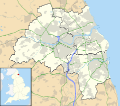
 Crawcrook
Crawcrook shown within Tyne and WearPopulation 8,000 (2001 Census) OS grid reference NZ134635 Metropolitan borough Gateshead Metropolitan county Tyne and Wear Region North East Country England Sovereign state United Kingdom Post town RYTON Postcode district NE40 Dialling code 0191 Police Northumbria Fire Tyne and Wear Ambulance North East EU Parliament North East England UK Parliament Blaydon List of places: UK • England • Tyne and Wear Crawcrook is a semi-rural village close to the western border of the metropolitan county of Tyne and Wear in England. Traditionally an independent village in County Durham it has since been incorporated into the Metropolitan Borough of Gateshead.
Contents
Location
Crawcrook lies midway between Prudhoe in Northumberland and Ryton, also in Tyne and Wear.
Local politics
In local government, Crawcrook is located in the 'Crawcrook, Greenside and Clara Vale ward'. The ward is at the far west of the borough and borders Northumberland. The Crawcrook and Greenside ward is served by three councillors, 1 Labour and 2 Liberal Democrats. Gateshead Council is Labour controlled.
Crawcrook is located within the parliamentary constituency of Blaydon. Its current MP is Labour's Dave Anderson.
History
At the turn of the twentieth century, and in common with the nearby areas of Greenside, Clara Vale and Stargate, Crawcrook was a village with a vibrant coal industry. With major pits such as Emma and Clara, as well as several smaller pits, Crawcrook became a major coal mining centre. However the coal industry collapsed in the village during the 1950s and 1960s. As has happened to a number of other northern English villages employment in tertiary industries has replaced the coal industry. However, Crawcrook's coal mining heritage is still evident; a number of the old miners' homes still exist in the surrounding area, including Clifford Terrace near to Crawcrook's main street, and the Simpson Memorial Home in nearby Barmoor. Old wagonways used to transport coal are also still present, although they are now maintained as footpaths.
During the 1970s and 1980s, with the creation of the Kepier Chare and Westburn private housing estates, Crawcrook grew significantly in size and became largely suburbanised and is being used increasingly as a commuter village for the conurbation of Tyneside.
Amenities and Transport links
Unlike many villages of a similar semi-rural character, Crawcrook has maintained its broad range of amenities. Crawcrook main street has several shops including a library, a co-operative food store, a newly upgraded Nisa Local Store and two petrol stations. It also has a selection of independent shops including a family run freezer centre/bargain store, a greengrocers, two butchers, two gentlemen's barbers, a hairdressing salon, a tanning salon, a number of pubs, a chiropodist, a doctor's surgery, two veterinary practices and a restaurant. There are also several churches in the village from a number of denominations including Catholic, Pentecostal, Church of the Holy Spirit[disambiguation needed] and Methodist. After the closure of Kepier Chare school, the village now has only two primary schools; St Agnes Roman Catholic school and Emmaville school. During 2007, Emmaville school was extended to allow former pupils from Kepier Chare to attend there. There is also a separate private nursery located next to the Doctors Surgery.
The area is also well served by public transport, with regular bus links to Hexham, the MetroCentre, Gateshead and Newcastle Upon Tyne as well as nearby towns and villages such as Ryton, Prudhoe, Chopwell, High Spen and Clara Vale.
Crawcrook has its own village park, located in the Garden House Estate area of the village. Created in the 1950s it consists of toddler play equipment, a tennis court/five a side football area, and a bowling green.
Other recreational facilities nearby include four golf courses, Tyneside golf club at Ryton, Ryton golf club at Clara Vale, Close House golf club in Wylam, and Prudhoe golf club in Prudhoe. Golf courses slightly further away include Whickham golf club, at Whickham, Garesfield golf club at High Spen and Stocksfield golf club in Stocksfield.
Education
There are two primary schools in the village. St Agnes RC school, the school of Crawcrook's Roman Catholic parish and Emmaville primary school. Both schools perform exceedingly well compared to other schools in the Gateshead Local Education Authority and nationally.
There was a third school, Kepier Chare school. However, in 2007 it was closed with all remaining pupils transferred to Emmaville school.
Surrounding Area
Within less than a mile of Crawcrook's main street and its residential areas, lies farmland and rich countryside, particularly to the west and north of the village. To the west of the village these include farmland and Sled Lane, with its woodland and ponds; Bradley Gardens, a Victorian walled garden and, to the north, more farmland as well as the meadows between Crawcrook and Wylam.
Other notable features of Crawcrook's environment include its landed estates, in particular Bradley Hall, and its sand quarries, that have partly encroached on some of its countryside to the north-west of the village. Further down the Tyne valley there are picturesque villages and towns such as Prudhoe, Stocksfield and Corbridge.
External links
Categories:- Villages in Tyne and Wear

Wikimedia Foundation. 2010.