- Nevado Mismi
-
Mismi 
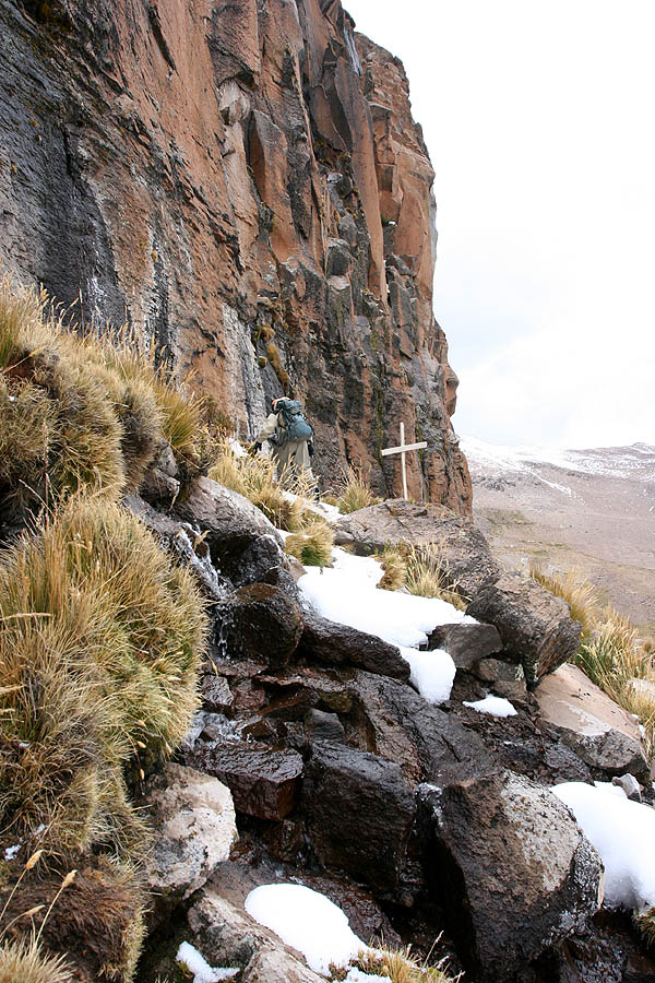
The Amazon originates from a cliff at the Nevado Mismi, with a sole sign of a wooden cross.Elevation 5,597 m (18,363 ft) Location Peru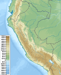
 Mismi
MismiRange Andes Coordinates 15°31′31″S 71°41′27″W / 15.52528°S 71.69083°WCoordinates: 15°31′31″S 71°41′27″W / 15.52528°S 71.69083°W Geology Type Stratovolcano Nevado Mismi is a 5,597-metre (18,363 ft) mountain peak of volcanic origin located in the Andes mountain range of Peru. A glacial stream on the Mismi was firmly identified as the most distant source of the Amazon River in 1996;[1] this finding was confirmed in 2001[2] and again in 2007.[3] The waters from Nevado Mismi flow into the Quebradas Carhuasanta and Apacheta, which flow into the Río Apurímac which is a tributary of the Ucayali which later joins the Marañón to form the Amazon proper.
Contents
Location
Nevado Mismi is about 160 km west of Lake Titicaca and 700 km southeast of Peru's capital city, Lima, in the Arequipa Region. It is one of the highest points of Colca Canyon. There are several glaciers on the peak.
The Cousteau Amazon Expedition
In 1982 Jean-Michel Cousteau led a large scale scientific exploration of the Amazon from its mouth to its origin. The “Cousteau Amazon Expedition”[4] cost eleven million dollars and culminated in a six-hour television documentary titled “Cousteau’s Amazon” released in 1983. It offered study information to last years and gave insights into the biology and geology of the largest river system on earth. This expedition was broken into three separate groups and the upper Amazon section was covered by “The Flying Expedition” tasked with exploring the upper third to Arequipa from the river's origin.
Traditionally, explorers and geographers define the origin of a river system by tracking the longest tributaries while heading upstream, as volume can change dramatically from month to month. In a system as complex as the Amazon basin with dozen of streams as candidates in previously poorly mapped areas, no consensus could plausibly be substantiated for some time, and the origin was left to speculation. Half a dozen sites claimed title to “The Origin of the Amazon“ and until 1982 several were in the running.
Using an international team of twelve and bringing in expeditionary specialists from Germany, France, Argentina, Peru and the USA, Jean-Michel Cousteau put together resources and logistics spanning a thousand miles of unknown jungle.
The Upper Amazon expedition (The Flying Expedition) included an Eastern European multi-axled reticulated Land Rover for use on land, a float plane Papagaiu, for air support and reconnaissance, and the Peruvian Air Force offered a high elevation helicopter to reach the upper levels of the Cordillera de Chilca mountain range in Peru.
Expedition support bases were established in Cuzco, in the mountains, in Arequipa on the Pacific coast, and high in the Cordillera de Chilca at Caylloma for the quest to find the origin of the Amazon. Many locations were remote, making it necessary to surmount language, terrain and logistical difficulties, as the mountain team made their way up the Río Selinque to the flanks of Nevado Mismi. At this mountain's base, Jean Michael dispatched a team of German alpinists who climbed the 18,000 foot volcano and returned in two days. During their descent, they found melt water dropping into a fissure. This cleft varied from two meters to half a meter wide, angling down the slope. This stream flowed nearly fifty meters before disappearing, emerging again lower down to flow between stones and continue its course. They discovered that within the fissure, the water was deep enough to float a small craft and realized that they were presented with an opportunity. Utilizing pack llamas, kayaker Caril Ridley was brought to the site, and in June 1982, navigating by kayak, became the first person to run the origins of the Amazon. Later expeditions refined our understanding of the river's many origins and its subsequent course to the Atlantic Ocean.
National Geographic Society Expedition
In 2001, it was verified that the main headwater of the Amazon River has its glacial source on Nevado Mismi. An expedition of the National Geographic Society discovered that Carhuasanta stream flowing into Río Apurímac originates on the mountain's northern slopes and then runs its course through other tributaries and rivers to help form the main Amazon River. The fact that the headwaters of Río Apurímac are the source of the Amazon River was confirmed by Brazilian scientists in 2007, who pointed at Nevado Mismi as the most probable source of the Amazon.[3]
Walking the Amazon
Ed Stafford walked the length of the Amazon River, starting at Nevado Mismi, completing the journey in August 2010.
Jason Varndell, Patrick Hutton, Andrew Ellis & James Ellis form another team following the Amazon from source to sea. (http://amazonsourcetosea.wordpress.com)
See also
- Ripon Falls, considered to be the source of the Nile river
References
- ^ Source of the Amazon River Identified (Jacek Palkiewicz)
- ^ "Explorers Pinpoint Source of the Amazon". National Geographic News. Dec. 21, 2000. http://news.nationalgeographic.com/news/2000/12/1221amazon.html. Retrieved 2010-12-05.
- ^ a b "Amazon river ‘longer than Nile’". BBC News. June 16, 2007. http://news.bbc.co.uk/2/hi/americas/6759291.stm. Retrieved 2010-12-05.
- ^ One Cold Day
External links
- Landscapes of the Soul - photos and story of a solo hike to the Source of the Amazon via the continental divide.
Categories:- Mountains of Peru
- Upper Amazon
- Arequipa Region
- Peru geography stubs

Wikimedia Foundation. 2010.