- Hunnum
-
Coordinates: 55°00′36″N 2°00′22″W / 55.010°N 2.006°W
Onnum (Halton Chesters) 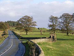
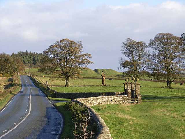
The gateway to Halton Castle is located near the middle of the former fort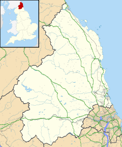
 Onnum (Halton Chesters)
 Onnum (Halton Chesters) shown within Northumberland
OS grid reference NY998685 List of places: UK • England • Northumberland Hunnum (also known as Onnum, and with the modern name of Halton Chesters) was a Roman fort north of the modern-day village of Halton, Northumberland. The name “Onnum” means “The Rock”, and probably refers to Down Hill situated to the east of it. It was the fifth fort on Hadrian's Wall, after Segedunum (Wallsend), Pons Aelius (Newcastle), Condercum and Vindobala. It is situated about seven and a half miles west of Vindobala, and is two and a half miles north of Corstopitum. The site of the fort is bisected by the B6318 Military Road, which runs along the route of the wall at that point.
Contents
Description
The fort guards Dere Street as it crosses the Roman Wall through the valley immediately to the west of it. The original fort was an oblong, measuring 460 feet (140 m) north to south by 410 feet (120 m) east to west, but at a later date the section south of the Wall was extended to the west making the south wall of the fort 570 feet (170 m) long and giving the fort an L-shaped appearance. The areas occupied by the northern and southern sections are 4.3 and 4.8 acres (19,000 m2) respectively. There were four main gates, at the main points of the compass, with double portals with guard chambers. At various times some of the portals have been blocked up and both portals of the west gate were blocked almost at once. There were towers at each corner of the fort, and also on either side of the main gates. It is believed that the fort was built between 122 AD and 126 AD.
The Vallum passed some short distance south of the fort, and was crossed by a road leading from the south gate to vicus just south of the Vallum.
Garrison
A dedicatory slab from the west gate of the fort tells us that the Sixth Legion were responsible for the initial building work. The fort was initially garrisoned, probably, by a cohort of 500 partly mounted troops. In the third century it held a regiment of cavalry, the Ala I Pannoniorum Sabiniana, also called Ala Sabiniana, and named after Sabinus who first raised it
Excavations
The field north of the Military Road containing the northern section of the fort was first ploughed in 1827, and a fine bath-house was found. This contained dry and moist hot rooms, a warm room and cold rooms, as well as a dressing room. Such a large bath-house is a rarity on the Wall
References
- J. Collingwood Bruce, Roman Wall (1863), Harold Hill & Son, ISBN 0 90046 332 5
- Frank Graham, The Roman Wall, Comprehensive History and Guide (1979), Frank Graham, ISBN 0 85983 140 X
- http://www.roman-britain.org/places/onnum.htm
- http://www.hadrians-wall.info/hadrianswall/onnum/onnum.htm
External Links
Wall Forts (East to West) Segedunum • Pons Aelius • Condercum • Vindobala • Onnum • Cilurnum • Procolita • Vercovicium • Aesica • Magnis • Banna • Camboglanna • Uxelodunum • Aballava • Coggabata • Maia
Outpost Forts Stanegate Forts Corstopitum • Newbrough • Vindolanda • Haltwhistle Burn • Magnis • Throp • Nether Denton • Castle Hill Boothby • Brampton Old Church • LuguvaliumSupply Forts Categories:- Roman forts in England
- Roman sites in Northumberland
- Forts of Hadrian's Wall
- Former populated places in England


Wikimedia Foundation. 2010.