- Vindolanda
-
Vindolanda Chesterholm, Northumberland, England 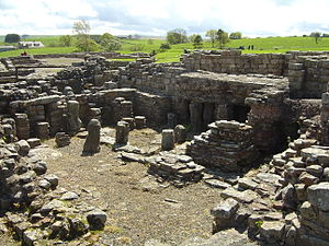
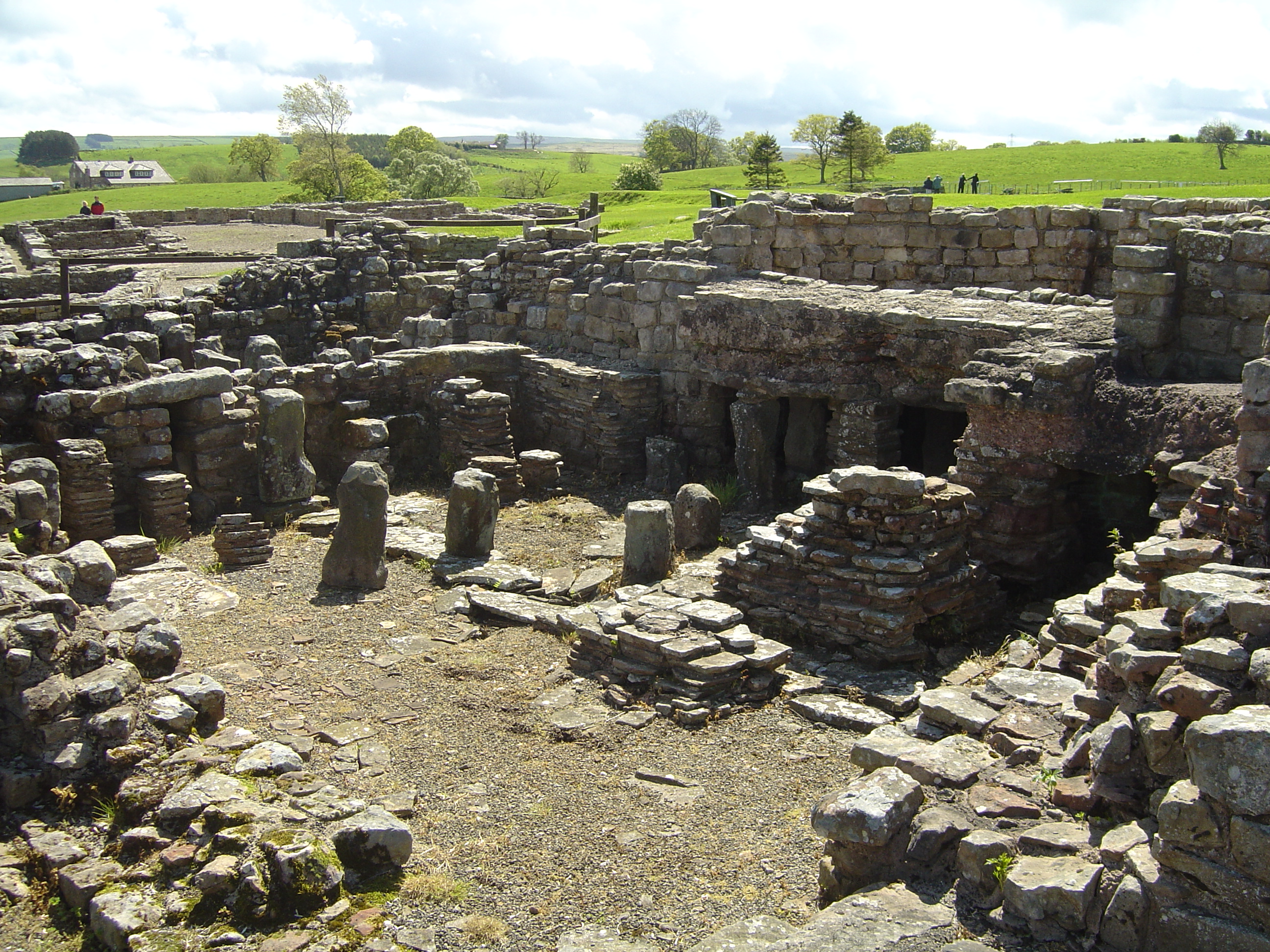
Military bathhouse at Vindolanda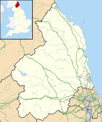
 Shown within Northumberland
Type Roman fort Coordinates grid reference NY7766 Current
conditionRuined Open to
the publicYes Controlled by Vindolanda Trust Vindolanda[1] was a Roman auxiliary fort (castrum) just south of Hadrian's Wall in northern England. Located near the modern village of Bardon Mill, it guarded the Stanegate, the Roman road from the River Tyne to the Solway Firth. It is noted for the Vindolanda tablets, among the most important finds of military and private correspondence (written on wooden tablets) found anywhere in the Roman Empire.
Contents
Early accounts
The first post-Roman record of the ruins at Vindolanda was made by the antiquarian William Camden, in his Britannia (1586). Occasional travellers reached the site over the next two hundred years, and the accounts they left are useful because they predate much of the stone-stealing that has damaged the site. The military bath-house was still partly roofed when Christopher Hunter visited the site in 1702. In about 1715 an excise officer named John Warburton found an altar there, which he removed. In 1814 the first real archaeological work was begun, by the Rev. Anthony Hedley. Hedley died in 1835, before writing up his discoveries. Little more was done for a long time, although in 1914 a workman found another altar at the site, set up by the civilians living at the fort in honour of the Divine House and Vulcan. Several names for the site are used in the early records, including Chesters on Caudley, Little Chesters, the Bower, and Chesterholm; the altar found in 1914 confirmed that the true Roman name for the site was "Vindolanda", which had been in dispute as one early source referred to it as "Vindolana".[2]
Garrison
The garrison were auxiliary infantry or cavalry units, not components of Roman legions. From the early third century AD onwards, this was the Fourth Cohort of Gauls. It had been presumed that this title was by this time purely nominal, with auxiliary troops being recruited locally, but an inscription found in a recent season of excavations suggests that native Gauls were still to be found in the regiment and that they liked to distinguish themselves from British soldiers.[3] The inscription reads:
CIVES GALLI
DE GALLIAE
CONCORDES
QUE BRITANNIOf which a free translation would be "The troops from Gaul dedicate this statue to the goddess Gallia with the full support of the British-born troops".[3]
Fort and town
The fort was originally constructed in turf and timber before Hadrian's Wall was built around 122 AD,[4] and was repaired and rebuilt several times. Later, apparently after a period of abandonment when the garrison transferred to a fort on the Wall itself (probably Vercovicium, now known as Housesteads), a new stone fort was built approximately on the same site. This fort, and the civilian community abutting it, called a vicus, remained in existence until the end of the Roman period in Britain in 410. Scattered finds suggest that some type of settlement, possibly including an early church, survived well into the fifth century.
The vicus contains several rows of buildings, each containing several one-room chambers. Most of them are not connected to the existing drainage system. The one that is may have been a butchery where, for health reasons, an efficient drain would have been important.
To the south of the fort are the remains of a large Roman bath.
Along the interior side of the south wall of the stone fort, several semi-circular stone structures of indeterminate nature and design are located.

This article is part of the series on:
Military of ancient Rome (portal)
753 BC – AD 476Structural history Roman army (unit types and ranks, legions, auxiliaries, generals) Roman navy (fleets, admirals) Campaign history Lists of wars and battles Decorations and punishments Technological history Military engineering (castra, siege engines, arches, roads) Political history Strategy and tactics Infantry tactics Frontiers and fortifications (limes, Hadrian's Wall) Excavation
In the 1930s, the house at Chesterholm where the museum is now located was purchased by archaeologist Eric Birley, who was interested in excavating the site. The excavations have been continued by his sons, Robin and Anthony, and his grandson, Andrew Birley, into the present day. They are undertaken each summer, and some of the archaeological deposits reach depths of six meters. The anoxic conditions at these depths have preserved thousands of artifacts that normally disintegrate in the ground,[5] thus providing an opportunity to gain a fuller understanding of Roman life – military and otherwise – on the northern frontier.
In 2010, the remains of a girl thought to be between the ages of 8 and 10 years old, with her hands tied, were uncovered in a shallow pit in what was the barrack room. She is believed to have been murdered about 1,800 years ago.[6]
Along with ongoing excavations (in season) and excavated remains, a full size replica of a section of Hadrian's Wall in both stone and timber can be seen on the site.
Site museum
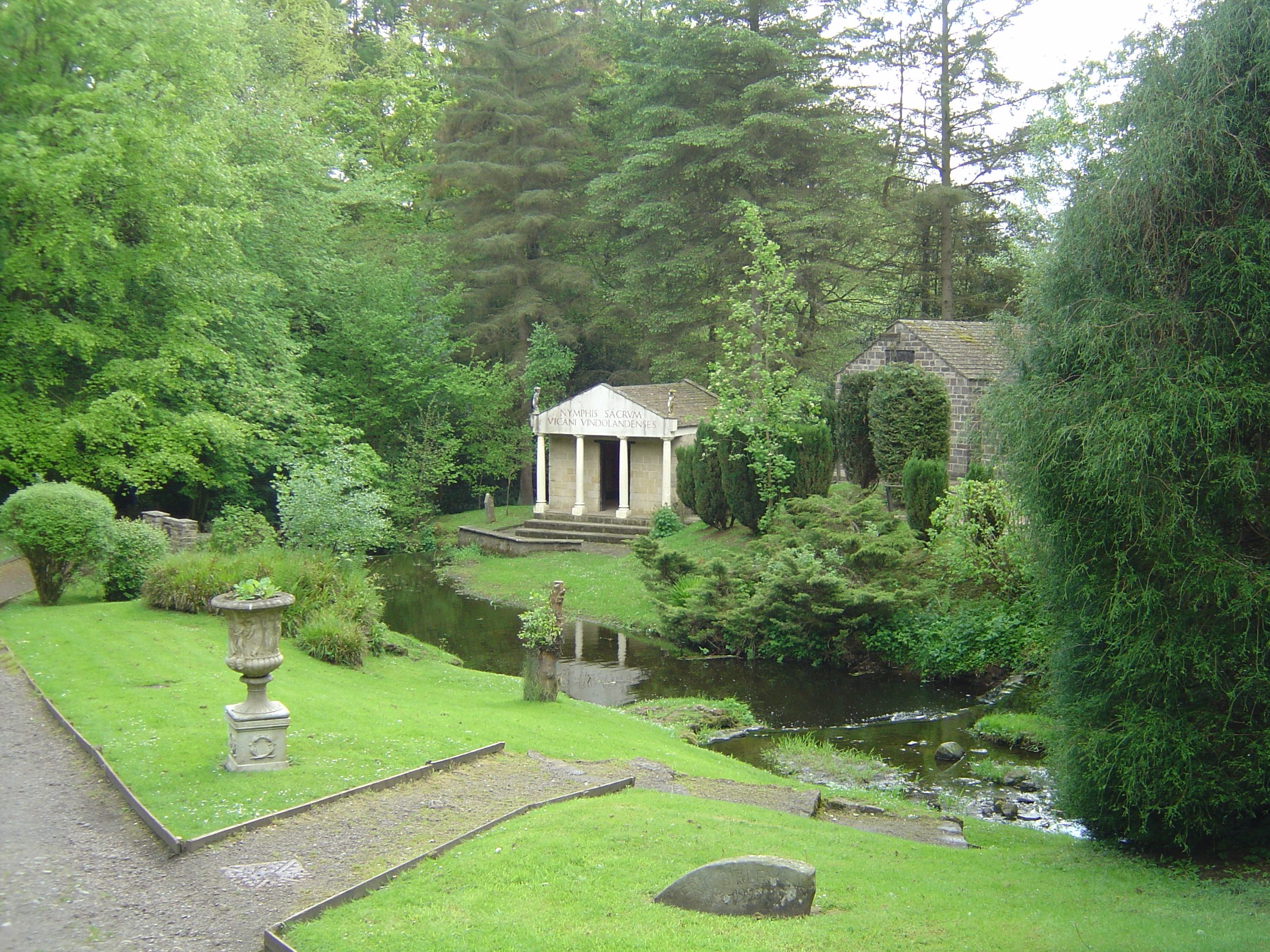
 Gardens outside the museum
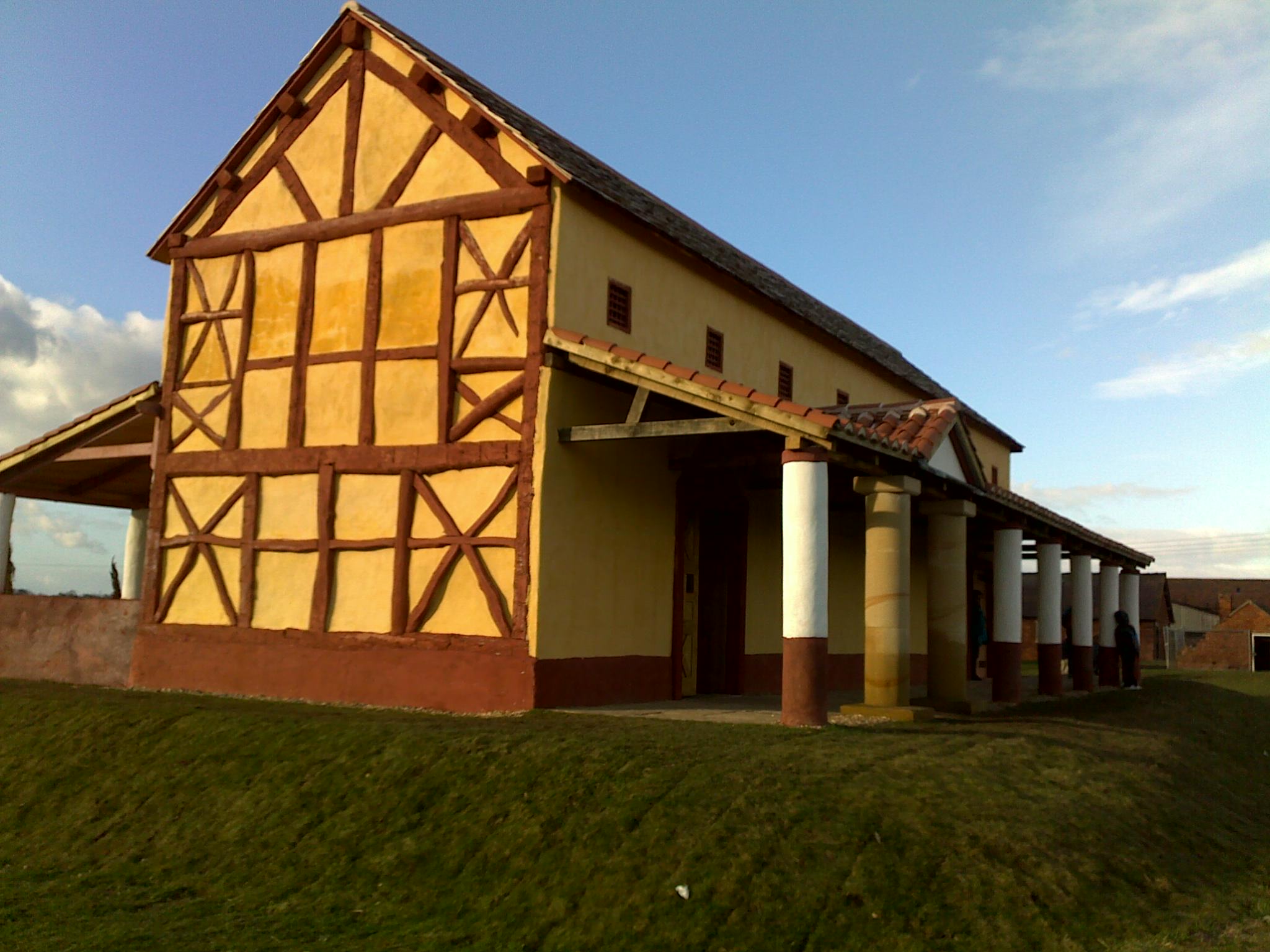
The Vindolanda site museum conserves and displays finds from the site. The museum is set in gardens, which include full-sized reconstructions of a Roman temple, a Roman shop, Roman house and Northumbrian croft, all with audio presentations. Exhibits include Roman boots, shoes, armour, jewellery and coins, infra-red photographs of the writing tablets and, from 2011, a small selection of the tablets themselves, on loan from the British Museum. 2011 saw the reopening of the refurbished museum at Vindolanda, and also the Roman Army Museum at Carvoran, after 6.3 million pounds had been spent on revamping these museums with a Heritage Lottery Grant.
A spectacular find in 2006 was the richly detailed bronze and silver brooch (fibula) modeled with the figure of Mars, on which Quintus Sollonius, a Gaul to judge by his name, had carefully punched his name before he lost it in the early second century; nothing comparably fine has been recovered along the Wall.[7]
Vindolanda Trust
In 1970, the Vindolanda Trust, a registered charity, was founded to administer the site and its museum, and in 1997, the Trust took over the running of the Roman Army Museum at Carvoran, another Hadrian's Wall fort, which it had acquired in 1972. Current trustees include the Rt Hon Dr David Clark, Baron Clark of Windermere.
See also
- Vindolanda tablets
- History of Northumberland
- Minimus, Latin textbooks for primary-school children, using stories based in Vindolanda
- Vercovicium, an auxiliary fort nearby at Housesteads.
References
- ^ The name is Celtic meaning something like 'fair/blessed'-'enclosure/meadow/prairie/grassy plain' (the modern Welsh word would be something like gwynlan, and the modern Gaelic word fionnlann [and the Old Gaelic word Fiondland] ).
- ^ Birley, Vindolanda, pp. 24–29.
- ^ a b Selkirk, A. "A ritual statue from Vindolanda." Current Archaeology 205: 4-5 (2006)
- ^ C.Michael Hogan. 2007. Vindolanda Roman Fort, The Megalithic Portal, ed. A.Burnham [1]
- ^ The bacteria responsible for degrading organic matter require oxygen.
- ^ "Northumberland Roman fort's child murder mystery". BBC News. 16 September 2010. http://www.bbc.co.uk/news/uk-england-tyne-11324607.
- ^ BBC News, "Brooch casts light on Roman Wall" 17 May 2006 Retrieved 11 August 2007
Further reading
- Birley, R., Vindolanda : a Roman frontier post on Hadrian's Wall, London: Thames and Hudson, (1977)
External links
- Vindolanda Trust
- BBC page on Vindolanda
- Directions and further details about Vindolanda and the remaining sections of Hadrian's Wall
- Hadrian's Wall Discussion Forum
Wall Forts (East to West) Segedunum • Pons Aelius • Condercum • Vindobala • Onnum • Cilurnum • Procolita • Vercovicium • Aesica • Magnis • Banna • Camboglanna • Uxelodunum • Aballava • Coggabata • Maia
Outpost Forts Stanegate Forts Corstopitum • Newbrough • Vindolanda • Haltwhistle Burn • Magnis • Throp • Nether Denton • Castle Hill Boothby • Brampton Old Church • LuguvaliumSupply Forts Roman visitor sites in the UK Villas Bignor • Brading • Chedworth • Crofton • Dover Painted House • Littlecote • Lullingstone • Fishbourne • Newport • Piddington • Rockbourne • Wroxeter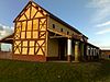
Forts & Military Arbeia • Binchester • Birdoswald • Caerleon • Chesters • Housesteads • Lunt • Carvoran Roman Army Museum • Pevensey Castle • Portchester Castle • Richborough • Segedunum • VindolandaTowns Roman Museums Canterbury Roman Museum • Carvoran Roman Army Museum • Corinium Museum • Jewry Wall Museum • Ribchester • Senhouse Roman Museum • Trimontium Trust (Melrose) • Verulamium MuseumOther sites Bath Roman Baths • Caerleon Roman Baths • Verulamium Roman Theatre • Welwyn Roman Baths • York Roman BathsCategories:- Archaeological sites in Northumberland
- History of Northumberland
- Roman forts in England
- Former populated places in England
- Museums in Northumberland
- Museums of Ancient Rome in the United Kingdom
- Archaeology museums in England


Wikimedia Foundation. 2010.