- Nursted
-
Coordinates: 50°59′08″N 0°54′56″W / 50.98552°N 0.91550°W
Nursted 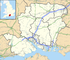
 Nursted
Nursted shown within HampshireOS grid reference SU762212 Parish Buriton District East Hampshire Shire county Hampshire Region South East Country England Sovereign state United Kingdom Police Hampshire Fire Hampshire Ambulance South Central EU Parliament South East England List of places: UK • England • Hampshire Nursted is a hamlet in the East Hampshire district of Hampshire, England. It is 1.8 miles (2.7km) southeast of Petersfield, on the B21466 road. The hamlet sits directly on the Hampshire/West Sussex border.
The nearest railway station is Petersfield, 1.8 miles (2.7km) northwest of the village.
External links
 Media related to Nursted at Wikimedia Commons
Towns, villages and hamlets in the East Hampshire District of Hampshire, England 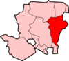 Adhurst · Alton · Arford · Ashley · Barford · Beech · Bentley · Bentworth · Binsted · Blackmoor · Blacknest · Blendworth · Bordean · Bordon · Bradley · Bramshott · Bucks Horn Oak · Buriton · Burkham · Catherington · Chalton · Chawton · Clanfield · Cold Ash Hill · Colemore · Conford · Ditcham · Durford Wood · East Meon · East Tisted · East Worldham · Empshott · Farringdon · Finchdean · Flexcombe · Four Marks · Froxfield Green · Froyle · Golden Pot · Grayshott · Greatham · Griggs Green · Hartley Mauditt · Hawkley · Headley · Headley Down · High Cross · Holybourne · Hollywater · Horndean · Idsworth · Isington · Kingsley · Kitwood · Langrish · Lasham · Lindford · Liphook · Liss · Liss Forest · Longmoor · Lovedean · Lower Wield · Medstead · Monkwood · Neatham · Newton Valence · North Street · Nursted · Oakhanger · Oakshott · Passfield · Petersfield · Priors Dean · Privett · Ramsdean · Ropley · Ropley Dean · Rowland's Castle · Selborne · Shalden · Sheet · Sleaford · Soldridge · South Hay · Southrope · Standford · Stansted · Steep · Steep Marsh · Stroud · Thedden · Upper Wield · West Liss · West Tisted · West Worldham · Weston · Wheatley · Whitehill · Wivelrod · WyckCategories:
- Villages in Hampshire
- Hampshire geography stubs
- East Hampshire


Wikimedia Foundation. 2010.