- Neatham
-
Coordinates: 51°09′41″N 0°56′30″W / 51.161426°N 0.94153918°W
Neatham 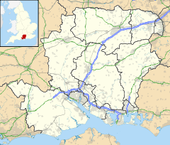
 Neatham
Neatham shown within HampshireOS grid reference SU7411240774 District East Hampshire Shire county Hampshire Region South East Country England Sovereign state United Kingdom Post town ALTON Postcode district GU34 4 Dialling code 01420 Police Hampshire Fire Hampshire Ambulance South Central EU Parliament South East England UK Parliament Alton List of places: UK • England • Hampshire Neatham is a Roman hamlet in the civil parish of Holybourne in the East Hampshire district of Hampshire, England. Its nearest town is Alton, which lies 1.6 miles (2.6 km) south-west from the hamlet.
Contents
History
Roman period – Vindomis
The lost Roman settlement of Vindomis is believed to be at Neatham. Its strategic importance lay in its being at the crossing of important roads: one from Winchester towards London and the other from Chichester to Silchester, a large Roman town to the north of present-day Basingstoke. The name Vindomis might be translated as ‘(The mansio) of the wine country’ (although this may equally be a Celtic name, with the prefix VINDO-'white'). Vindomis may well have been the administrative centre of a large estate associated with the potteries.[1] The population at this time is estimated at have been 2,500.
Saxon period – Neatham
After the Romans left, it became a Saxon settlement, called Neatham, indicating the presence of a cattle market. For several centuries, Neatham remained the chief place in the area and the focal point of the Neatham Hundred, which included a large part of north-east Hampshire.
Norman period
At the time of the Domesday Book, Neatham was recorded as belonging to the Crown. The population was 96.[2] After the founding of Waverley Abbey in 1128, King Steven made a gift of Neatham for the Abbey to establish a Grange and an Oratory, with a community of 12 monks, independent of the parish of Holybourne. Eventually, Neatham was eclipsed by Alton and, in the 12th century, the area was renamed the Alton Hundred.
Tudor period
When Henry VIII dissolved the monasteries, Neatham went into lay hands and became part of the parish of Binsted.
Modern day
In the 1980s, Neatham elected to be joined to Holybourne. Neatham is now a hamlet comprising a Manor House, a Grange, a mill, and a dozen cottages. Today, the hamlet lies along the Alton bypass between Alton and Farnham. Its Grade I buildings and mills still remain.
Notable buildings
- Neatham Grange
- Mill House (C.19)[3]
- Upper Neatham Mill
- Neatham Mill
- Neatham Manor
References
- ^ The distribution of Alice Holt/Farnham ware pp57–58 Original PDF
- ^ Hampshire Treasures Volume 6 (East Hampshire) Page 47 - Binsted
- ^ a b c d Hampshire Treasures Volume 6 (East Hampshire) p49
- ^ a b Hampshire Treasures Volume 6 (East Hampshire) p48
- ^ Hampshire Treasures Volume 6 (East Hampshire) p50
External links
- VINDOMIS? Minor Romano-British Settlement: Neatham, Hampshire?
- Neatham
- PROPOSED CONSERVATION AREAS AT LOWER NEATHAM MILL AND ISINGTON
Towns, villages and hamlets in the East Hampshire District of Hampshire, England 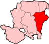 Adhurst · Alton · Arford · Ashley · Barford · Beech · Bentley · Bentworth · Binsted · Blackmoor · Blacknest · Blendworth · Bordean · Bordon · Bradley · Bramshott · Bucks Horn Oak · Buriton · Burkham · Catherington · Chalton · Chawton · Clanfield · Cold Ash Hill · Colemore · Conford · Ditcham · Durford Wood · East Meon · East Tisted · East Worldham · Empshott · Farringdon · Finchdean · Flexcombe · Four Marks · Froxfield Green · Froyle · Golden Pot · Grayshott · Greatham · Griggs Green · Hartley Mauditt · Hawkley · Headley · Headley Down · High Cross · Holybourne · Hollywater · Horndean · Idsworth · Isington · Kingsley · Kitwood · Langrish · Lasham · Lindford · Liphook · Liss · Liss Forest · Longmoor · Lovedean · Lower Wield · Medstead · Monkwood · Neatham · Newton Valence · North Street · Nursted · Oakhanger · Oakshott · Passfield · Petersfield · Priors Dean · Privett · Ramsdean · Ropley · Ropley Dean · Rowland's Castle · Selborne · Shalden · Sheet · Sleaford · Soldridge · South Hay · Southrope · Standford · Stansted · Steep · Steep Marsh · Stroud · Thedden · Upper Wield · West Liss · West Tisted · West Worldham · Weston · Wheatley · Whitehill · Wivelrod · WyckCategories:
- East Hampshire
- Villages in Hampshire


Wikimedia Foundation. 2010.