- Cerbat, Arizona
-
Cerbat, Arizona — Ghost Town — Location in the state of Arizona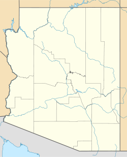
 Cerbat, Arizona
Coordinates: 35°18′11″N 114°08′23″W / 35.30306°N 114.13972°WCoordinates: 35°18′11″N 114°08′23″W / 35.30306°N 114.13972°W Country United States State Arizona County Mohave Elevation[1] 3,865 ft (1,178 m) Time zone MST (no DST) (UTC-7) Post Office Opened: December 23, 1872 Post Office Closed: June 15, 1912 Cerbat is a ghost town just west of the Cerbat Mountains in Mohave County, Arizona. Mining in the area began in the late 1860s and a camp was established soon after. Cerbat was built in a canyon 38 miles (61 km) from Hardyville, Arizona. The town was prosperous and contained several mining and public buildings along with cabins for over 100 settlers, as well as a school, a doctor's office and a lawyer's office. In the 1870s the town was connected by dirt road to Fort Rock, Camp Hualapai and Prescott, Arizona. Cerbat was the third seat of Mohave County until 1877 when Mineral Park took the title.
As of 2010[update], a cemetery and a few wooden buildings and stone foundations, including a large mill and the post office, remain. The post office was completed on December 23, 1872 and was closed on June 15, 1912.
From June 25, 1890 to October 24, 1902 the town was known as Campbell.[2]
References
- ^ U.S. Geological Survey Geographic Names Information System: Cerbat
- ^ Sherman, James E; Barbara H. Sherman (1969). Ghost Towns of Arizona. University of Oklahoma Press. ISBN 0-8061-0843-6.
Municipalities and communities of Mohave County, Arizona County seat: Kingman Cities 
Town CDPs Arizona Village | Desert Hills | Dolan Springs | Fort Mohave | Golden Valley | Kaibab‡ | Mesquite Creek | Mohave Valley | Mojave Ranch Estates | New Kingman-Butler | Peach Springs | Willow Valley
Unincorporated
communitiesBeaver Dam | Chloride | Hackberry | Littlefield | Meadview | Nothing | Oatman | Scenic | Topock | Valentine | Walapai | White Hills | Wikieup | Yucca
Indian reservations Ghost towns Alamo Crossing | Aubrey Landing | Cedar | Cerbat | Mohave City | Santa Claus | Wolf Hole
Footnotes ‡This populated place also has portions in an adjacent county or counties
Categories:- Ghost towns in Arizona
- Former populated places in Mohave County, Arizona
- Arizona geography stubs
- United States ghost town stubs


Wikimedia Foundation. 2010.