- Chloride, Arizona
-
For other uses, see Chloride (disambiguation).
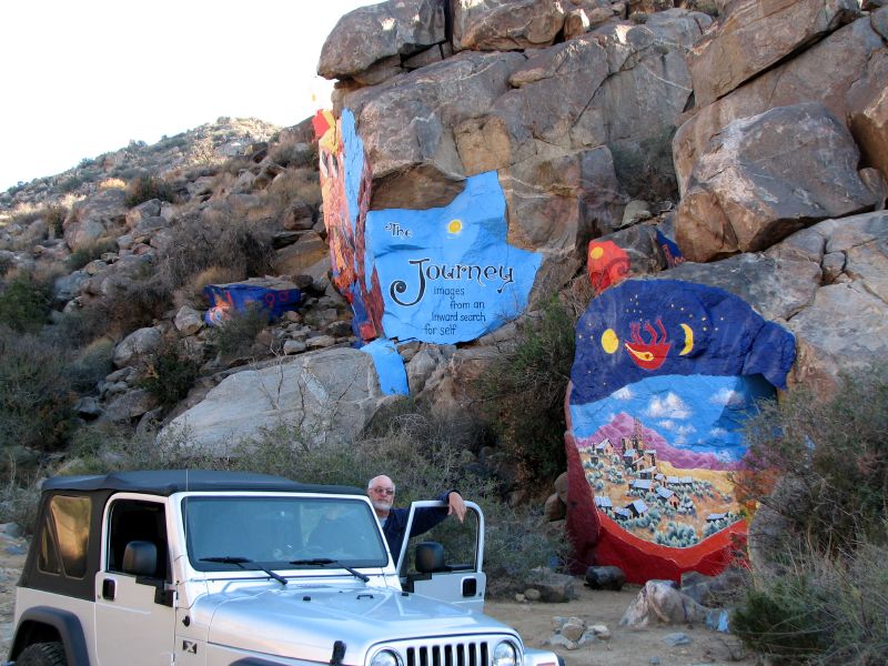
Chloride, Arizona The Chloride Murals
 Chloride, Arizona
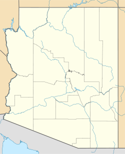
Coordinates: 35°24′52″N 114°11′58″W / 35.41444°N 114.19944°WCoordinates: 35°24′52″N 114°11′58″W / 35.41444°N 114.19944°W Country United States State Arizona County Mohave Elevation[1] 4,022 ft (1,226 m) Time zone MST (no DST) (UTC-7) Chloride is a onetime silver mining camp in Mohave County, Arizona, and is considered the oldest continuously inhabited mining town in the state.[2] Chloride has a ZIP Code of 86431; in 2000, the population of the 86431 ZCTA was 352.[3]
History
Prospectors first located mineral resources in the area in the 1840s, including silver, gold, lead, zinc, and turquoise. Chloride was founded about 1863, but mining was not widespread until the 1870s after a treaty was signed with the Hualapai Indians. The railway from Kingman, called the Arizona and Utah Railway, was inaugurated on August 16, 1899 - the last silver spike was driven by Miss May Krider.[4] The town eventually grew to a peak of around 5,000 inhabitants, and at one time Chloride was the county seat. By 1917 the population had fallen to 2,000, and by 1944 it was nearly a ghost town.
In the 1960s the community was briefly a counterculture magnet, with Roy Purcell, once a hippie artist, leaving behind the Chloride Murals [5] outside of town. The Chloride Murals were restored from their 1960's condition in 2006 by the same artist, now widely known for his western etchings and other art which he refined while working as a curator for the Southern Nevada Museum in Henderson, Nevada and which were sold worldwide from nearby Las Vegas, Nevada casinos and shops.
References
- ^ U.S. Geological Survey Geographic Names Information System: Chloride
- ^ "Chloride History". Chloride Chamber of Commerce. http://www.chloridearizona.com/history.php. Retrieved 2007-09-03.
- ^ "86431 - Population Finder - American FactFinder". Factfinder.census.gov. http://factfinder.census.gov/servlet/SAFFPopulation?_event=Search&_zip=86431. Retrieved 2010-08-04.
- ^ Arizona: Weekly Republican, Aug 17, 1899; Mohave County Miner, Kingman, Aug 19, 1899.
- ^ Roy Purcell opened his Purcell Galleries of Fine Art in 2004 in Tubac AZ and restored the Chloride Murals in 2006.
External links
- Chloride Chamber of Commerce
- Community website
- Chloride entry from Desert USA
- Photo gallery from Western Mining History
Municipalities and communities of Mohave County, Arizona County seat: Kingman Cities 
Town CDPs Arizona Village | Desert Hills | Dolan Springs | Fort Mohave | Golden Valley | Kaibab‡ | Mesquite Creek | Mohave Valley | Mojave Ranch Estates | New Kingman-Butler | Peach Springs | Willow Valley
Unincorporated
communitiesBeaver Dam | Chloride | Hackberry | Littlefield | Meadview | Nothing | Oatman | Scenic | Topock | Valentine | Walapai | White Hills | Wikieup | Yucca
Indian reservations Ghost towns Alamo Crossing | Aubrey Landing | Cedar | Cerbat | Mohave City | Santa Claus | Wolf Hole
Footnotes ‡This populated place also has portions in an adjacent county or counties
Categories:- Unincorporated communities in Mohave County, Arizona
- Populated places established in 1863


Wikimedia Foundation. 2010.