- Chulumani
-
Chulumani  Location in Bolivia
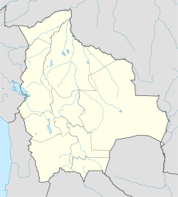
 Chulumani
Coordinates: 16°41′S 67°52′W / 16.683°S 67.867°WCoordinates: 16°41′S 67°52′W / 16.683°S 67.867°W Country  Bolivia
Department La Paz Department Province Sud Yungas Province Municipality Chulumani Municipality Elevation 5,577 ft (1,700 m) Population [1] - Total 2,724 Situated four hours from La Paz, Chulumani is the capital of the Sud Yungas region in Bolivia. Agriculture dominates the area, which produces bananas, coffee, and coca leaves. Chulumani is subtropical with warm temperatures and high humidity.
Although the city is not as popular for tourists as Coroico, Chulumani is also part of the world famous Yungas Road. On the drive to Chulumani one can admire the 'Castillo de los Patos' which is situated beside the Chaco waterfall. A few kilometers away from Chulumani is the Apa-Apa Ecological Reserve [1].
One must be careful while driving to Chulumani, as well as Coroico, as the road is quite narrow in many areas. If one encounters an oncoming vehicle while the road is narrow, there are certain rules to follow. First, the vehicle heading uphill has the right of way, as stopping and starting back up might be difficult on certain types of terrain. Also, if the road is wide enough for two vehicles to pass each other, the drivers must switch the cars' positions on the road, so the drivers can tell how far off the cliff or the mountain their respective vehicles cars are.
Many travel sites have advice for touring the area. Lonely Planet adds, "The only time Chulumani breaks its pervasive tranquility is during the week following August 24, when it stages the riotous Fiesta de San Bartolomé." [2][3]
References
- ^ www.ine.gov.bo - National Institute of Statistics of Bolivia (Spanish)
- ^ “Introducing Chulumani.” www.lonelyplanet.com. April 12, 2009.
- ^ http://www.ine.gov.bo/pdf/boletin/np_2005_75.pdf
 La Paz Department
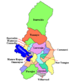
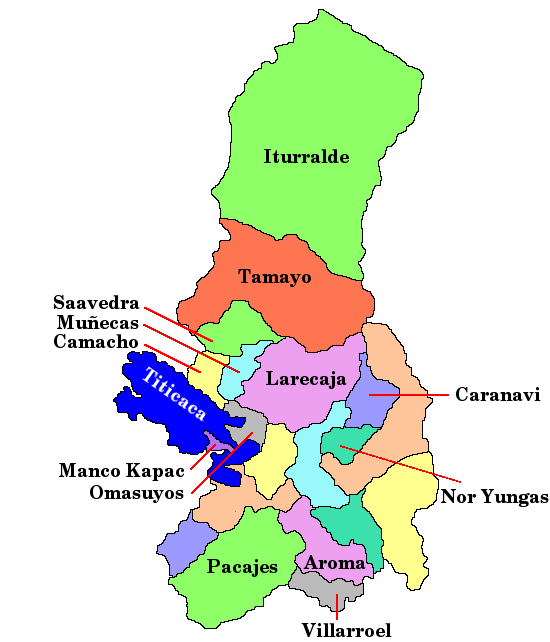
Capital: La Paz Provinces Abel Iturralde • Aroma • Bautista Saavedra • Caranavi • Camacho • Franz Tamayo • Gualberto Villarroel • Ingavi • Inquisivi • José Manuel Pando • Larecaja • Loayza • Los Andes • Manco Kapac • Murillo • Muñecas • Nor Yungas • Omasuyos • Pacajes • Sud Yungas
Municipalities
(and seats)Achacachi (Achacachi) • Achocalla (Achocalla) • Alto Beni (Caserío Nueve) • Ancoraimes (Ancoraimes) • Apolo (Apolo) • Aucapata (Aucapata) • Ayata (Ayata) • Ayo Ayo (Ayo Ayo) • Batallas (Batallas) • Cairoma (Cairoma) • Cajuata (Cajuata) • Calacoto (Calacoto) • Calamarca (Calamarca) • Caquiaviri (Caquiaviri) • Caranavi (Caranavi) • Catacora (Catacora) • Chacarilla (Chacarilla) • Charaña (Charaña) • Chulumani (Chulumani) • Chuma (Chuma) • Collana (Collana) • Colquencha (Colquencha) • Colquiri (Colquiri) • Comanche (Comanche) • Combaya (Combaya) • Copacabana (Copacabana) • Coripata (Coripata) • Coro Coro (Coro Coro) • Coroico (Coroico) • Curva (Curva) • Desaguadero (Desaguadero) • El Alto (El Alto) • Escoma (Escoma) • General Juan José Pérez (Charazani) • Guanay (Guanay) • Guaqui (Guaqui) • Huarina (Huarina) • Ichoca (Ichoca) • Inquisivi (Inquisivi) • Irupana (Irupana) • Ixiamas (Ixiamas) • Jesús de Machaca (Jesús de Machaca) • La Asunta (La Asunta) • La Paz (La Paz) • Laja (Laja) • Licoma Pampa (Licoma) • Luribay (Luribay) • Malla (Malla) • Mapiri (Mapiri) • Mecapaca (Mecapaca) • Mocomoco (Mocomoco) • Nazacara de Pacajes (Nazacara) • Palca (Palca) • Palos Blancos (Palos Blancos) • Papel Pampa (Papel Pampa) • Patacamaya (Patacamaya) • Pelechuco (Pelechuco) • Pucarani (Pucarani) • Puerto Acosta (Puerto Acosta) • Puerto Carabuco (Puerto Carabuco) • Puerto Pérez (Puerto Perez) • Quiabaya (Quiabaya) • Quime (Quime) • San Andrés de Machaca (San Andrés de Machaca) • San Buenaventura (San Buenaventura) • San Pedro de Curahuara (San Pedro de Curahuara de Carangas) • San Pedro de Tiquina (San Pedro de Tiquina) • Santiago de Callapa (Callapa) • Santiago de Huata (Santiago de Huata) • Santiago de Machaca (Santiago de Machaca) • Sapahaqui (Sapahaqui) • Sica Sica (Sica Sica) • Sorata (Sorata) • Tacacoma (Tacacoma) • Taraco (Taraco) • Teoponte (Teoponte) • Tiwanaku (Tiwanaku) • Tipuani (Tipuani) • Tito Yupanqui (Tito Yupanqui) • Umala (Umala) • Umanata (Umanata) • Viacha (Viacha) • Waldo Ballivián (Tumarapi) • Yaco (Yaco) • Yanacachi (Yanacachi)
Mountains Alpamayo Chico • Condoriri • Anallajsi • Ancohuma • Chachacomani • Chacaltaya • Illampu • Illimani • Huayna Potosí • MururataProtected areas Apolobamba • Cotapata • Madidi • Pilón Lajas
Categories:- Populated places in the La Paz Department, Bolivia
- La Paz Department, Bolivia geography stubs


Wikimedia Foundation. 2010.