- St Peter's Church, Stainforth
-
St Peter's Church, Stainforth 
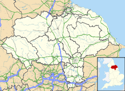
St Peter's Church, Stainforth, from the westLocation in North Yorkshire Coordinates: 54°06′06″N 2°16′33″W / 54.1018°N 2.2758°W OS grid reference SD 821 674 Location Stainforth, North Yorkshire Country England Denomination Anglican Website St Peter, Stainforth History Dedication Saint Peter Consecrated 29 September 1842 Architecture Status Parish church Functional status Active Heritage designation Grade II Designated 13 September 1988 Architect(s) Edmund Sharpe Architectural type Church Style Gothic Revival Groundbreaking 1839 Completed 1873 Specifications Materials Stone, slate roofs Administration Parish St Peter Stainforth Deanery Bowland Archdeaconry Craven Diocese Bradford Province York Clergy Vicar(s) Revd Roger Graham Wood St Peter's Church, Stainforth, is in the village of Stainforth, North Yorkshire, England. It is an active Anglican parish church in the deanery of Bowland, the archdeaconry of Craven, and the diocese of Bradford. It benefice is united with those of St Oswald, Horton-in-Ribblesdale and St John the Evangelist, Langcliffe.[1] The church has been designated by English Heritage as a Grade II listed building.[2]
Contents
History
Before this church was built, Stainforth was part of the parish of St Alkelda, Giggleswick. The church was built at the instigation of three sisters from a local gentry family, the Dawsons. It was constructed between 1839 and 1842 to a design by the Lancaster architect Edmund Sharpe. The church was consecrated by Rev Charles Longley, the Bishop of Ripon on 29 September 1842. It was "thoroughly improved" in 1873.[3]
Architecture
St Peter's is constructed in squared rubble stone with ashlar dressings and slate roofs. Its plan consists of a four-bay nave, a porch at the southeast, a lower single-bay chancel with a northeast vestry, and a west tower.[2] The architectural style is "impeccably" Perpendicular.[3] The tower is in three stages that are separated by string courses, and it has buttresses at the corners. The top string course is embellished with three carved heads. On the west side of the tower is a doorway, above which is a single-light window with a cinquefoil head. On each side of the top stage is a two-light bell opening with slate louvres and cinquefoil heads. The tower is surmounted by an embattled parapet with gargoyles.[2] There are clock faces on the west and east sides.[3] Along the wall of the nave, the bays are separated by buttresses, each of which contains a three-light window. The chancel has a four-light east window and an embattled parapet. The vestry has a chimney disguised as a turret.[2] The stained glass in the east window and some of the other windows is by William Wailes. Above the east window is the heraldic shield of the Dawson family.[3] The two-manual organ was made by Nicholson.[4] The ring consists of three bells, all cast in 1842 by Thomas Mears II at Whitechapel Bell Foundry, but these are no longer ringable.[5]
See also
- List of architectural works by Edmund Sharpe
References
- ^ Stainforth: St Peter, Langcliffe, Church of England, http://www.achurchnearyou.com/stainforth-st-peter/, retrieved 27 July 2011
- ^ a b c d "Church of St Peter, Stainforth", The National Heritage List for England (English Heritage), 2011, http://list.english-heritage.org.uk/resultsingle.aspx?uid=1132314, retrieved 27 July 2011
- ^ a b c d Hughes, John M. (2010), Edmund Sharpe: Man of Lancaster, John M. Hughes, pp. 136, 138
- ^ Yorkshire, West Riding (Yorkshire, North), Stainforth, St. Peter (J00182), British Institute of Organ Studies, http://www.npor.org.uk/cgi-bin/Rsearch.cgi?Fn=Rsearch&rec_index=J00182, retrieved 27 July 2011
- ^ Stainforth, S Peter, Dove's Guide for Church Bell Ringers, http://dove.cccbr.org.uk/detail.php?searchString=stainforth&Submit=+Go+&DoveID=STAINFORTH, retrieved 27 July 2011
Categories:- Church of England churches in North Yorkshire
- Grade II listed churches
- Grade II listed buildings in North Yorkshire
- 19th-century Church of England church buildings
- Anglican congregations established in the 19th century
- Gothic Revival architecture in England
- Edmund Sharpe buildings
- Diocese of Bradford
Wikimedia Foundation. 2010.

