- Churcham
-
Coordinates: 51°51′50″N 2°20′10″W / 51.864°N 2.336°W
Churcham 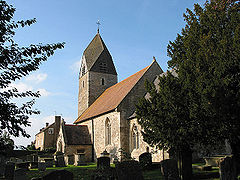
St Andrew's Church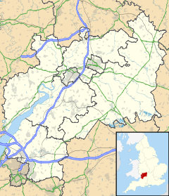
 Churcham
Churcham shown within GloucestershirePopulation 669 (2001) OS grid reference SO7618 Parish Churcham District Forest of Dean Shire county Gloucestershire Ceremonial county Gloucestershire Region South West Country England Sovereign state United Kingdom Post town GLOUCESTER Postcode district GL2 Dialling code 01452 Police Gloucestershire Fire Gloucestershire Ambulance Great Western EU Parliament South West England UK Parliament Forest of Dean List of places: UK • England • Gloucestershire Churcham is a small village and civil parish in the Forest of Dean District of Gloucestershire in England, located 4 miles (6.4 km) west of Gloucester. It has a population of 669.[1]
Churcham has two schools: Churcham Primary School, a small C of E school with 59 pupils in two classes, and The School of the Lion, an independent Christian school, for students aged 4-19.
There are a number of businesses situated in Churcham and the surrounding area. Churcham Business Park, completed in April 2004, provides a base for several.
References
- ^ Office for National Statistics : Census 2001 : Parish Headcounts : Forest of Dean Retrieved 20 January 2010
External links
 Media related to Churcham at Wikimedia Commons
- Churcham Parish Council
- Churcham Village Website - a community project
- Churcham Primary School
- The School of the Lion
- Churcham Business Park
- Quoakle - the graphical directory
- Greenfields Garden Services
- Handcrafted Wooden Products
Ceremonial county of Gloucestershire Unitary authorities Boroughs or districts Major settlements Berkeley | Bradley Stoke | Cheltenham | Chipping Campden | Chipping Sodbury | Cinderford | Cirencester | Coleford | Dursley | Fairford | Filton | Gloucester | Kingswood | Lechlade | Lydney | Minchinhampton | Mitcheldean | Moreton-in-Marsh | Nailsworth | Newent | Northleach | Painswick | Patchway | Stonehouse | Stow-on-the-Wold | Stroud | Tetbury | Tewkesbury | Thornbury | Winchcombe | Wotton-under-Edge | Yate
See also: List of civil parishes in GloucestershireRivers Topics History | MuseumsCategories:- Villages in Gloucestershire
- Civil parishes in Gloucestershire
- Forest of Dean
- Gloucestershire geography stubs


Wikimedia Foundation. 2010.