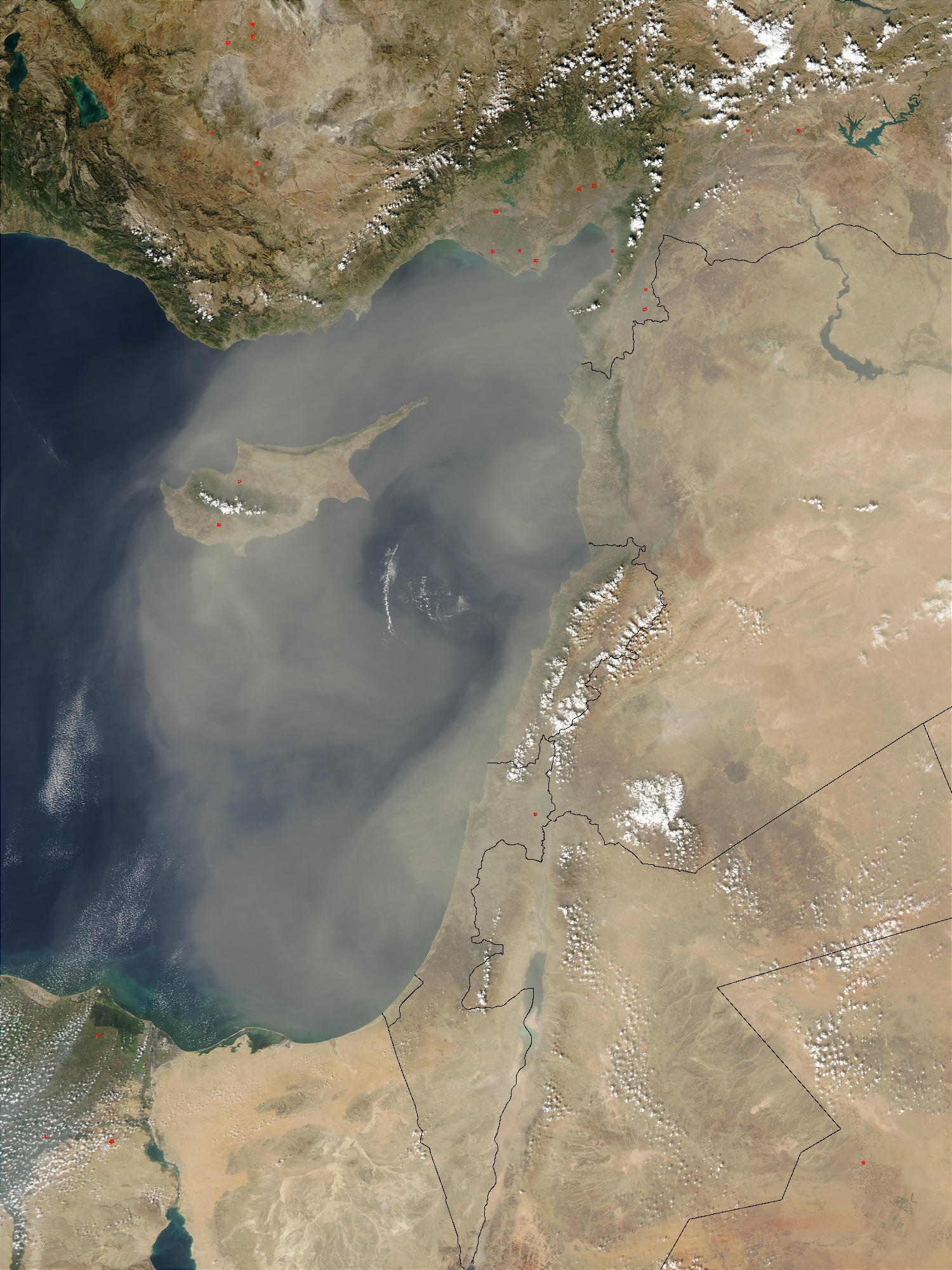
- Climate of Cyprus
-
Cyprus has a Subtropical climate - Mediterranean and Semi-arid type (in the north-eastern part of island) - according to Köppen climate classification signes Csa and Bsh,[1][2] with very mild winters (on the coast) and warm to hot summers. Snow is possible only in the Troodos mountains in the central part of island. Rain occurs mainly in winter, with summer being generally dry.
Contents
Temperatures
Cyprus has the warmest climate (and warmest winters) in the Mediterranean part of the European Union. The average annual temperature on the coast is around 24 °C (75 °F) during the day and 14 °C (57 °F) at night. Generally – summer's/holiday season lasts about 8 months, begins in April with average temperatures of 21–23 °C (70–73 °F) during the day and 11–13 °C (52–55 °F) at night, ends in November with average temperatures of 22–23 °C (72–73 °F) during the day and 12–14 °C (54–57 °F) at night, although also in remaining 4 months temperatures sometimes exceeds 20 °C (68 °F). Among all cities in the Mediterranean part of the European Union, Limassol has the warmest winters, in the period January–February average temperature is 17–18 °C (63–64 °F) during the day and 8–9 °C (46–48 °F) at night, in other coastal locations in Cyprus is generally 16–17 °C (61–63 °F) during the day and 7–9 °C (45–48 °F) at night. In March and December in Limassol average temperatures is 19–20 °C (66–68 °F) during the day and 10–11 °C (50–52 °F) at night, in other coastal locations in Cyprus is generally 17–19 °C (63–66 °F) during the day and 8–11 °C (46–52 °F) at night. Middle of summer is usually hot - in the July and August on the coast the average temperature is usually around 33 °C (91 °F) during the day and around 23 °C (73 °F) at night (inside the island, in the highlands average temperature exceeds 35 °C (95 °F)) while in the June and September on the coast the average temperature is usually around 30 °C (86 °F) during the day and around 20 °C (68 °F) at night. Large fluctuations in temperature are rare. Temperatures inside the island are more stringent, with colder winters and more hot summers compared with the coast of the island.[3]
Temperature of sea
Average annual temperature of sea is 21–22 °C (70–72 °F), from 17 °C (63 °F) in February to 27–28 °C (81–82 °F) in August (depending on the location). In total 7 months - from May to November - the average sea temperature exceeds 20 °C (68 °F).[4]
Sea temperature Jan3 Feb Mar Apr May Jun Jul Aug Sep Oct Nov Dec Paphos [1] 18 17 17 18 20 24 26 27 26 24 22 19 Larnaca [2] 18 17 17 18 20 24 26 27 27 25 22 19 Limassol [3] 18 17 17 18 20 24 26 27 27 25 22 19 Argaka [4] Ayia Napa [5] Coral Bay [6] Famagusta [7] Kyrenia [8] Latchi [9] Nissi Bay [10] Peyia [11] Polis [12] Protaras [13] Sunshine
Sunshine hours on the coast is 3,300 to 3,500 per year, from average 5-6 hours of sunshine / day in December to average 12-13 hours in July.[4] This is about double that of cities in the northern half of Europe, for comparison: London - 1,461,[5] however in winter up to some times more sunshine, for comparison: London has 37 hours[5] while coastal locations in Cyprus has around 180 hours of sunshine in December (that is, as much as in May in London).
Charts of selected locations
On the coast
Climate data for Paphos airport - near sea (Satellite view) Month Jan Feb Mar Apr May Jun Jul Aug Sep Oct Nov Dec Year Average high °C (°F) 17.0
(62.6)16.9
(62.4)18.5
(65.3)21.3
(70.3)24.4
(75.9)27.7
(81.9)29.9
(85.8)30.4
(86.7)28.8
(83.8)26.6
(79.9)22.4
(72.3)18.6
(65.5)23.6 Daily mean °C (°F) 12.5
(54.5)12.3
(54.1)13.6
(56.5)16.3
(61.3)19.5
(67.1)22.8
(73.0)25.2
(77.4)25.7
(78.3)23.8
(74.8)21.5
(70.7)17.5
(63.5)14.2
(57.6)18.7 Average low °C (°F) 8.0
(46.4)7.6
(45.7)8.7
(47.7)11.3
(52.3)14.5
(58.1)17.8
(64.0)20.4
(68.7)21.0
(69.8)18.8
(65.8)16.4
(61.5)12.6
(54.7)9.7
(49.5)13.9 Precipitation mm (inches) 80.2
(3.157)64.2
(2.528)34.3
(1.35)18.7
(0.736)5.30
(0.2087)1.60
(0.063)0.30
(0.0118)0.00
(0)3.80
(0.1496)18.0
(0.709)66.4
(2.614)93.9
(3.697)386.7
(15.224)Avg. precipitation days (≥ 1 mm) 9.9 8.0 5.5 4.1 1.3 0.3 0.1 0.0 0.6 2.5 5.8 8.7 46.6 Sunshine hours 195.3 211.7 244.9 270.0 344.1 381.0 390.6 365.8 315.0 285.2 225.0 186.0 3,414.6 Source: Meteorological Service (Cyprus)[6] Climate data for Larnaca airport - near sea (Satellite view) Month Jan Feb Mar Apr May Jun Jul Aug Sep Oct Nov Dec Year Average high °C (°F) 16.8
(62.2)16.8
(62.2)19.1
(66.4)22.5
(72.5)26.5
(79.7)30.3
(86.5)32.4
(90.3)32.7
(90.9)30.9
(87.6)28.1
(82.6)22.6
(72.7)18.3
(64.9)24.7 Daily mean °C (°F) 12.1
(53.8)11.8
(53.2)13.9
(57.0)17.1
(62.8)21.2
(70.2)25.0
(77.0)27.3
(81.1)27.6
(81.7)25.4
(77.7)22.6
(72.7)17.5
(63.5)13.7
(56.7)19.6 Average low °C (°F) 7.5
(45.5)6.9
(44.4)8.7
(47.7)11.7
(53.1)16.0
(60.8)19.8
(67.6)22.2
(72.0)22.6
(72.7)19.9
(67.8)17.1
(62.8)12.5
(54.5)9.2
(48.6)14.5 Precipitation mm (inches) 77.6
(3.055)40.9
(1.61)34.4
(1.354)17.7
(0.697)8.80
(0.3465)2.70
(0.1063)0.60
(0.0236)0.40
(0.0157)7.10
(0.2795)13.8
(0.543)53.1
(2.091)94.5
(3.72)351.5
(13.839)Avg. precipitation days (≥ 1 mm) 7.9 5.7 4.5 3.1 0.7 0.3 0.1 0.1 0.5 2.1 4.7 8.0 37.6 Sunshine hours 195.3 208.8 238.7 267.0 331.7 378.0 387.5 365.8 312.0 275.9 216.0 179.8 3,356.5 Source: Meteorological Service (Cyprus)[7] Climate data for Polis (Satellite view) Month Jan Feb Mar Apr May Jun Jul Aug Sep Oct Nov Dec Year Average high °C (°F) 16.4
(61.5)16.3
(61.3)18.5
(65.3)21.5
(70.7)26.1
(79.0)30.5
(86.9)33.5
(92.3)33.3
(91.9)29.9
(85.8)26.5
(79.7)21.9
(71.4)17.8
(64.0)24.3 Daily mean °C (°F) 12.1
(53.8)11.8
(53.2)13.5
(56.3)16.3
(61.3)20.4
(68.7)24.7
(76.5)27.6
(81.7)27.6
(81.7)24.6
(76.3)21.4
(70.5)17.2
(63.0)13.6
(56.5)19.2 Average low °C (°F) 7.9
(46.2)7.3
(45.1)8.6
(47.5)11.1
(52.0)14.7
(58.5)18.8
(65.8)21.6
(70.9)21.8
(71.2)19.3
(66.7)16.3
(61.3)12.4
(54.3)9.4
(48.9)14.1 Precipitation mm (inches) 79.9
(3.146)67.1
(2.642)37.6
(1.48)24.7
(0.972)7.20
(0.2835)1.50
(0.0591)0.20
(0.0079)0.00
(0)4.40
(0.1732)21.8
(0.858)55.3
(2.177)94.4
(3.717)394.2
(15.52)Avg. precipitation days (≥ 1 mm) 10.1 8.3 6.5 4.2 1.8 0.2 0.1 0.0 0.6 2.9 5.7 9.1 49.4 Sunshine hours 192.2 211.7 254.2 291.0 359.6 387.0 399.9 378.2 318.0 279.0 219.0 182.9 3,472.7 Source: Meteorological Service (Cyprus)[8] Climate data for Paralimni - ~4km from sea, elevation: 70 m (Satellite view) Month Jan Feb Mar Apr May Jun Jul Aug Sep Oct Nov Dec Year Average high °C (°F) 16.0
(60.8)16.1
(61.0)18.7
(65.7)22.2
(72.0)26.8
(80.2)30.8
(87.4)33.1
(91.6)33.3
(91.9)31.2
(88.2)27.7
(81.9)21.7
(71.1)17.3
(63.1)24.6 Daily mean °C (°F) 12.3
(54.1)12.0
(53.6)14.2
(57.6)17.4
(63.3)21.8
(71.2)25.7
(78.3)28.2
(82.8)28.5
(83.3)26.1
(79.0)22.8
(73.0)17.6
(63.7)13.7
(56.7)20.0 Average low °C (°F) 8.6
(47.5)7.9
(46.2)9.7
(49.5)12.5
(54.5)16.8
(62.2)20.6
(69.1)23.4
(74.1)23.7
(74.7)20.9
(69.6)18.0
(64.4)13.4
(56.1)10.1
(50.2)15.5 Precipitation mm (inches) 70.0
(2.756)62.0
(2.441)35.0
(1.378)15.0
(0.591)7.50
(0.2953)2.50
(0.0984)0.50
(0.0197)0.30
(0.0118)1.20
(0.0472)25.0
(0.984)45.0
(1.772)87.0
(3.425)351.0
(13.819)Avg. precipitation days (≥ 1 mm) 8.2 5.6 4.7 3.5 1.2 0.3 0.1 0.1 0.6 2.5 4.9 7.3 38.9 Source: Meteorological Service (Cyprus)[9] Climate data for Limassol - ~1 km from sea (Satellite view) Month Jan Feb Mar Apr May Jun Jul Aug Sep Oct Nov Dec Year Average high °C (°F) 17.6
(63.7)17.8
(64.0)20.0
(68.0)22.9
(73.2)26.9
(80.4)30.8
(87.4)33.2
(91.8)33.3
(91.9)31.3
(88.3)28.6
(83.5)23.5
(74.3)18.9
(66.0)25.4 Daily mean °C (°F) 13.2
(55.8)13.1
(55.6)15.2
(59.4)18.0
(64.4)21.8
(71.2)25.5
(77.9)27.8
(82.0)28.0
(82.4)26.0
(78.8)23.2
(73.8)18.5
(65.3)14.5
(58.1)20.4 Average low °C (°F) 8.8
(47.8)8.5
(47.3)10.4
(50.7)13.1
(55.6)16.7
(62.1)20.1
(68.2)22.4
(72.3)22.7
(72.9)20.6
(69.1)17.7
(63.9)13.5
(56.3)10.1
(50.2)15.4 Precipitation mm (inches) 86.7
(3.413)66.9
(2.634)35.8
(1.409)18.4
(0.724)05.1
(0.201)01.4
(0.055)0.0
(0)0.0
(0)02.9
(0.114)13.1
(0.516)77.5
(3.051)99.7
(3.925)407.5
(16.043)Avg. precipitation days (≥ 1 mm) 9.3 7.1 5.6 3.3 1.1 0.2 0.0 0.0 0.3 1.9 5.5 8.8 43.1 Source: Meteorological Service (Cyprus)[10] Inside the island
Climate data for Nicosia, elevation: 162 m (Satellite view) Month Jan Feb Mar Apr May Jun Jul Aug Sep Oct Nov Dec Year Average high °C (°F) 15.5
(59.9)15.9
(60.6)19.2
(66.6)24.0
(75.2)29.7
(85.5)34.3
(93.7)37.2
(99.0)36.9
(98.4)33.5
(92.3)29.0
(84.2)22.1
(71.8)17.0
(62.6)26.2 Daily mean °C (°F) 10.6
(51.1)10.6
(51.1)13.1
(55.6)17.1
(62.8)22.3
(72.1)26.9
(80.4)29.7
(85.5)29.4
(84.9)26.2
(79.2)22.3
(72.1)16.3
(61.3)12.0
(53.6)19.7 Average low °C (°F) 5.7
(42.3)5.2
(41.4)7.0
(44.6)10.2
(50.4)14.8
(58.6)19.4
(66.9)22.2
(72.0)21.9
(71.4)18.8
(65.8)15.6
(60.1)10.4
(50.7)7.1
(44.8)13.2 Precipitation mm (inches) 54.7
(2.154)41.6
(1.638)28.3
(1.114)19.9
(0.783)23.5
(0.925)17.6
(0.693)5.80
(0.2283)1.30
(0.0512)11.7
(0.461)17.4
(0.685)54.6
(2.15)65.8
(2.591)342.2
(13.472)Avg. precipitation days (≥ 1 mm) 7.3 6.5 5.4 3.5 2.7 1.3 0.5 0.1 0.6 2.8 4.7 7.7 43.1 Sunshine hours 182.9 200.1 238.7 267.0 331.7 369.0 387.5 365.8 312.0 275.9 213.0 170.5 3,314.1 Source: Meteorological Service (Cyprus)[11] Climate data for Saittas near Moniatis and Trimiklini, elevation: 640 m (Satellite view) Month Jan Feb Mar Apr May Jun Jul Aug Sep Oct Nov Dec Year Average high °C (°F) 13.6
(56.5)13.9
(57.0)17.1
(62.8)21.5
(70.7)27.0
(80.6)31.5
(88.7)34.6
(94.3)34.3
(93.7)31.2
(88.2)26.8
(80.2)20.2
(68.4)15.2
(59.4)23.9 Daily mean °C (°F) 8.4
(47.1)8.5
(47.3)10.9
(51.6)14.8
(58.6)19.6
(67.3)23.8
(74.8)26.8
(80.2)26.5
(79.7)23.4
(74.1)19.7
(67.5)14.1
(57.4)10.0
(50.0)17.2 Average low °C (°F) 3.2
(37.8)3.1
(37.6)4.7
(40.5)8.0
(46.4)12.2
(54.0)16.1
(61.0)18.9
(66.0)18.7
(65.7)15.7
(60.3)12.5
(54.5)8.1
(46.6)4.7
(40.5)10.5 Precipitation mm (inches) 117.6
(4.63)89.0
(3.504)70.3
(2.768)38.4
(1.512)20.1
(0.791)27.2
(1.071)4.9
(0.193)10.3
(0.406)11.7
(0.461)25.7
(1.012)93.9
(3.697)144.0
(5.669)653.2
(25.717)Avg. precipitation days (≥ 1 mm) 10.3 9.1 8.4 5.5 2.7 2.1 0.7 1.1 1.4 3.3 7.0 9.2 60.9 Sunshine hours 142.6 168.2 213.9 261.0 310.0 351.0 362.7 347.2 300.0 248.0 165.0 124.0 2,993.6 Source: Meteorological Service (Cyprus)[12] Climate data for Prodromos in Troodos Mountains, elevation: 1380 m (Satellite view) Month Jan Feb Mar Apr May Jun Jul Aug Sep Oct Nov Dec Year Average high °C (°F) 6.3
(43.3)6.6
(43.9)10.3
(50.5)15.1
(59.2)20.5
(68.9)25.0
(77.0)28.1
(82.6)27.9
(82.2)24.4
(75.9)19.6
(67.3)12.8
(55.0)8.0
(46.4)17.1 Daily mean °C (°F) 3.5
(38.3)3.5
(38.3)6.6
(43.9)10.7
(51.3)15.8
(60.4)20.1
(68.2)23.3
(73.9)23.1
(73.6)19.6
(67.3)15.4
(59.7)9.5
(49.1)5.3
(41.5)13.0 Average low °C (°F) 0.7
(33.3)0.3
(32.5)2.8
(37.0)6.3
(43.3)11.1
(52.0)15.2
(59.4)18.4
(65.1)18.2
(64.8)14.9
(58.8)11.3
(52.3)6.2
(43.2)2.5
(36.5)9.0 Precipitation mm (inches) 133.4
(5.252)123.6
(4.866)82.3
(3.24)56.9
(2.24)26.0
(1.024)40.0
(1.575)12.1
(0.476)10.0
(0.394)9.5
(0.374)24.0
(0.945)102.5
(4.035)169.7
(6.681)790.1
(31.106)Avg. precipitation days (≥ 1 mm) 12.4 11.2 9.8 6.7 3.7 2.1 0.7 0.7 1.4 3.5 7.4 11.2 70.7 Sunshine hours 130.2 150.8 195.3 231.0 275.9 315.0 328.6 310.0 255.0 220.1 165.0 136.4 2,713.3 Source: Meteorological Service (Cyprus)[13] Precipitation
The higher mountain areas are cooler and moister than the rest of the island. They receive the heaviest annual rainfall, which may be as much as 1,000 millimeters (39.4 in). Sharp frost also occurs in the higher districts, which are usually blanketed with snow during the first months of the year. Precipitation increases from 450 millimeters (17.7 in) up the south-western windward slopes to nearly 1,100 millimeters (43.3 in) at the top of the Troodos massif. The narrow ridge of the Kyrenia range, stretching 160 km (99 mi) from west to east along the extreme north of the island produces a relatively small increase in rainfall of around 550 millimeters (21.7 in) along its ridge at an elevation of 1,000 meters (3,281 ft). Plains along the northern coast and in the Karpass Peninsula area average 400 to 450 millimeters (15.7 to 17.7 in) of annual rainfall. The least rainfall occurs in the Mesaoria, with 300 to 400 millimeters (11.8 to 15.7 in) a year. Variability in annual rainfall is characteristic for the island, however, and droughts are frequent and sometimes severe. Statistical analysis of rainfall in Cyprus reveals a decreasing trend of rainfall amounts in the last 30 years. Earthquakes, usually not destructive, occur from time to time.
Rainfall in the warmer months contributes little or nothing to water resources and agriculture. Autumn and winter rainfall, on which agriculture and water supply generally depend, is somewhat variable from year to year.
Other information
The Mediterranean climate, warm and rather dry, with rainfall mainly between November and March, favors agriculture. In general, the island experiences mild wet winters and dry hot summers. Variations in temperature and rainfall are governed by altitude and, to a lesser extent, distance from the coast. Hot, dry summers from mid-May to mid-September and rainy, rather changeable winters from November to mid-March are separated by short autumn and spring seasons.
In summer the island is mainly under the influence of a shallow trough of low pressure extending from the great continental depression centred over Western Asia. It is a season of high temperatures with almost cloudless skies.
In winter Cyprus is near the track of fairly frequent small depressions which cross the Mediterranean Sea from west to east between the continental anticyclone of Eurasia and the generally low pressure belt of North Africa. These depressions give periods of disturbed weather usually lasting for a day or so and produce most of the annual precipitation, the average rainfall from December to February being about 60% of the average annual total precipitation for the island as a whole, which is 500 millimeters (19.7 in).
Humidity
Relative humidity of the air is on average between 60% and 80% in winter and between 40% and 60% in summer with even lower values over inland areas around midday. Fog is infrequent and visibility is generally very good. Sunshine is abundant during the whole year and particularly from April to September when the average duration of bright sunshine exceeds 11 hours per day.
Winds
Winds are generally light to moderate and variable in direction. Strong winds may occur sometimes, but gales are infrequent over Cyprus and are mainly confined to exposed coastal areas as well as areas at high elevation.
Temperature and precipitation charts
Paphos Climate chart (explanation) J F M A M J J A S O N D 8017864178341991921115.324151.628180.33020030213.82919182716662313941910Average max. and min. temperatures in °C Precipitation totals in mm Source: World Meteorological Organization Imperial conversion J F M A M J J A S O N D 3.263462.562461.465480.770520.276580.1826408669087700.184660.780622.673553.76549Average max. and min. temperatures in °F Precipitation totals in inches Larnaca Climate chart (explanation) J F M A M J J A S O N D 7817841177341991823128.827162.730200.632220.433237.1312014281753231395189Average max. and min. temperatures in °C Precipitation totals in mm Source: World Meteorological Organization Imperial conversion J F M A M J J A S O N D 3.162461.662441.466480.773530.380610.1876809072091730.388680.583632.173553.76549Average max. and min. temperatures in °F Precipitation totals in inches Limassol Climate chart (explanation) J F M A M J J A S O N D 87189671893620101823135.127171.4312003322033232.931211329187824141001910Average max. and min. temperatures in °C Precipitation totals in mm Source: World Meteorological Organization Imperial conversion J F M A M J J A S O N D 3.464482.664471.468510.773560.280620.1876809272092730.188690.583643.174563.96650Average max. and min. temperatures in °F Precipitation totals in inches Nicosia Climate chart (explanation) J F M A M J J A S O N D 4815547165371962224102230157341913722737226341922281531221058177Average max. and min. temperatures in °C Precipitation totals in mm Source: World Meteorological Organization Imperial conversion J F M A M J J A S O N D 1.960411.961411.566440.976500.986580.39366098710.398710.292650.983591.271502.36344Average max. and min. temperatures in °F Precipitation totals in inches Troodos Mountains Climate chart (explanation) J F M A M J J A S O N D 133611247082103571562621114025151228181028189.5241524201110313617083Average max. and min. temperatures in °C Precipitation totals in mm Source: http://www.cyprus-weather.org Imperial conversion J F M A M J J A S O N D 5.343344.945323.250372.25943170521.677590.582640.482640.475590.96852455436.74637Average max. and min. temperatures in °F Precipitation totals in inches References
- ^ Peel, M. C. and Finlayson, B. L. and McMahon, T. A. (2007). "Updated world map of the Köppen–Geiger climate classification". Hydrol. Earth Syst. Sci. 11: 1633–1644. ISSN 1027-5606. http://www.hydrol-earth-syst-sci.net/11/1633/2007/hess-11-1633-2007.html. (direct: Final Revised Paper)
- ^ CIA Factbook - Geographic location
- ^ "Meteorological Service - Climatological and Meteorological Reports". http://www.moa.gov.cy/moa/MS/MS.nsf/DMLclimet_reports_en/DMLclimet_reports_en?OpenDocument&Start=1&Count=1000&Expand=1.
- ^ a b "Cyprus Climate Guide". http://www.weather2travel.com/climate-guides/cyprus/. Retrieved 5 June 2009.
- ^ a b "Met Office: Climate averages 1971-2000". Met Office. http://www.metoffice.gov.uk/climate/uk/averages/19712000/sites/greenwich.html.
- ^ "Meteorological Service - Climatological and Meteorological Reports". http://www.moa.gov.cy/moa/MS/MS.nsf/DMLclimet_reports_en/DMLclimet_reports_en?OpenDocument&Start=1&Count=1000&Expand=1.
- ^ "Meteorological Service - Climatological and Meteorological Reports". http://www.moa.gov.cy/moa/MS/MS.nsf/DMLclimet_reports_en/DMLclimet_reports_en?OpenDocument&Start=1&Count=1000&Expand=1.
- ^ "Meteorological Service - Climatological and Meteorological Reports". http://www.moa.gov.cy/moa/MS/MS.nsf/DMLclimet_reports_en/DMLclimet_reports_en?OpenDocument&Start=1&Count=1000&Expand=1.
- ^ "Meteorological Service - Climatological and Meteorological Reports". http://www.moa.gov.cy/moa/MS/MS.nsf/DMLclimet_reports_en/DMLclimet_reports_en?OpenDocument&Start=1&Count=1000&Expand=1.
- ^ "Meteorological Service - Climatological and Meteorological Reports". http://www.moa.gov.cy/moa/MS/MS.nsf/DMLclimet_reports_en/DMLclimet_reports_en?OpenDocument&Start=1&Count=1000&Expand=1.
- ^ "Meteorological Service - Climatological and Meteorological Reports". http://www.moa.gov.cy/moa/MS/MS.nsf/DMLclimet_reports_en/DMLclimet_reports_en?OpenDocument&Start=1&Count=1000&Expand=1.
- ^ "Meteorological Service - Climatological and Meteorological Reports". http://www.moa.gov.cy/moa/MS/MS.nsf/DMLclimet_reports_en/DMLclimet_reports_en?OpenDocument&Start=1&Count=1000&Expand=1.
- ^ "Meteorological Service - Climatological and Meteorological Reports". http://www.moa.gov.cy/moa/MS/MS.nsf/DMLclimet_reports_en/DMLclimet_reports_en?OpenDocument&Start=1&Count=1000&Expand=1.
Categories:- Climate by country
- Geography of Cyprus
Wikimedia Foundation. 2010.