- Coolafancy
-
Coolafancy
Cúl na Fuinse— Village — Main Street, Coolafancy Location in Ireland
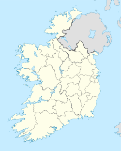
 Coolafancy
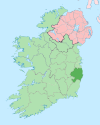
Coordinates: 52°45′50″N 6°25′55″W / 52.764°N 6.432°WCoordinates: 52°45′50″N 6°25′55″W / 52.764°N 6.432°W Country Ireland Province Leinster County County Wicklow Elevation 136 m (446 ft) Population (2002) - Total 422 population of Coolboy region Irish Grid Reference T054691 Coolafancy (Irish: Cúl na Fuinse) is a village in County Wicklow in Ireland. It is located roughly between Tinahely and Carnew, close to the neighbouring village of Coolboy. The area of Coolafancy is often referred to as Crosspatrick on maps. Coolafancy contains the only primary national school in the area, St. Mary's National School. The school serves the village itself and also the village of Coolboy and surrounding areas like Hillbrook, Coolroe, Cummer and Cummerduff.
The name Coolafancy is sometimes written as Coolnafancy or simply Coolfancy.
On the Central Statistics Office censuses, the village of Coolafancy is listed as a part of the Coolboy area, thus its population is the same.
Contents
Location and access
It is located on the R748 road which links the town of Aughrim with Carnew (via the R747 road). The village is situated near the southern point of the Wicklow Way which winds through the Wicklow Mountains.
See the Street View of Coolafancy on Google Maps
History
The history of Coolafancy as with so many other areas nearby was dominated by the Fitzwilliam family in the 19th century. The family lived in nearby Coolattin House. The Coolattin estate once comprised 88,000 acres (360 km2), had 20,000 tenants and occupied almost a quarter of County Wicklow.
The village currently only has a Roman Catholic church, it once had a Church of Ireland church named Crosspatrick Church which stood until 1973.
Things to do
The area is incredibly scenic, being located very close by to Annagh Hill, Croghan Mountain, and Kilcavan Gap.
See also
References
Crosspatrick Civil Parish (from "Lewis's Topographical Dictionary of Ireland, 1837") http://www.from-ireland.net/wick/lewis/crosspatrick.htm
Places in County Wicklow County town: Wicklow Towns Arklow · Bray · Greystones · Wicklow
Villages Aghavannagh · Annamoe · Ashford · Aughrim · Avoca · Ballinaclash · Baltinglass · Blessington · Carnew · Charlesland · Coolafancy · Coolboy · Delgany · Donard · Dunlavin · Enniskerry · Glendalough · Glenealy · Grangecon · Greenan · Hollywood · Kilcoole · Killincarrig · Kilmacanogue · Kilpedder · Kilquade · Kiltegan · Knockananna · Lacken · Laragh · Newcastle · Newtownmountkennedy · Rathdangan · Rathdrum · Rathnew Redcross · Roundwood · Shillelagh · Stratford-on-Slaney · Tinahely · Valleymount · Woodenbridge
Townlands List of townlands in County Wicklow · Category:Mountains and hills of County Wicklow · Category:Rivers of County Wicklow · Category:Geography of County Wicklow Categories:- Untranslated Irish place names
- Towns and villages in County Wicklow


Wikimedia Foundation. 2010.