- Coolaroo railway station
-
Coolaroo 
Station information Code CLO Distance from
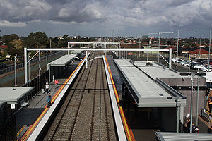
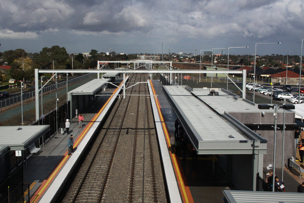
Flinders Street19.3 km[1] Operator Metro Trains Melbourne Lines Craigieburn # Platforms 2 Status Unmanned station Metlink profile Link Melway map Link Google map Link Metcard / Myki Zone 2 Coolaroo is a suburban railway station located on the Craigieburn railway line in the Melbourne suburb of Coolaroo, Victoria. The station opened to passengers on Sunday 6 June 2010,[2] and serves around 25,000 people living in the suburbs of Coolaroo, Dallas and Meadow Heights.[3]
The station features:[4]
- a bus interchange
- car parking and 'park-and-ride' facilities
- side platform layout
- pedestrian overpass and lifts.
History
The State Government set aside $38 million for the construction of the station in the 2007-2008 budget,[4] an amount criticised by the Public Transport Users Association as excessive.[5] Completion was expected in 2010,[4] with the project re-announced as part of the state government Victorian Transport Plan of December 2008.[3] Leighton Contractors were awarded the construction contract.[6] Although long proposed, the station was built separately to the 2007 extension of suburban trains and electrification from Broadmeadows to Craigieburn.[4]
Work on the slewing of the parallel standard gauge track commenced in December 2008 and was completed by January 2009 to allow construction of the city-bound platform.[citation needed] Work on the lift wells was underway by August, with the main span of the footbridge lifted into place in October 2009.[7] In November 2009 it was made public that the city-bound platform had been built 150mm too low, with the building contractors responsible for rectifying the issue at a cost of approximately $100,000.[8]
The station was opened by State Premier John Brumby and Public Transport Minister Martin Pakula on 6 June 2010. Trains used the station from the first service that day.[9]
References
- ^ Connex Melbourne - Working Timetable System Description page 51 (June 2006)
- ^ "More peak hour services for Melbourne’s south east". Media Release: Minister for Public Transport. 28 April 2010. http://www.premier.vic.gov.au/newsroom/10156.html. Retrieved 2010-04-28.
- ^ a b "Coolaroo Train Project". Victorian Transport Plan. www4.transport.vic.gov.au. http://www4.transport.vic.gov.au/vtp/projects/coolaroo.html. Retrieved 2008-12-08.[dead link]
- ^ a b c d Department of Infrastructure - New metropolitan railway stations
- ^ "Hume Leader - 'Rail pledge quizzed' - 21 November 2006". http://www.humeleader.com.au/article/2006/11/20/7455_hov_news.html. Retrieved 2007-07-30.
- ^ "Working Victoria - Coolaroo Station". www.workingvictoria.vic.gov.au. http://www.workingvictoria.vic.gov.au/projects/coolaroo-station-. Retrieved 2009-11-26.
- ^ "Northern side of the new footbridge at Coolaroo, having been lifted into place that morning". Wongm's Rail Gallery. October 3, 2009. http://railgallery.wongm.com/craigieburn-line/E100_9429.jpg.html. Retrieved 2010-04-28.
- ^ Unattributed (2009-11-26). "News in brief: Platform to be raised". The Age: p. 13. http://www.theage.com.au/national/platform-to-be-raised-20091125-jrua.html. Retrieved 2009-11-26.
- ^ "Wongm's Rail Gallery - Coolaroo station opening". railgallery.wongm.com. June 6, 2010. http://railgallery.wongm.com/coolaroo-opening/. Retrieved 2010-06-08.
Station Navigation Craigieburn line ← Previous Station Broadmeadows | Roxburgh Park Next Station → Entire network Categories:- Railway stations in Melbourne
- Railway stations opened in 2010
Wikimedia Foundation. 2010.