- Coolidge Springs, California
-
Coordinates: 33°23′39″N 116°03′01″W / 33.39417°N 116.05028°W
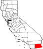
Coolidge Springs — Unincorporated community — Location in California
 Coolidge Springs
Coordinates: 33°23′39″N 116°03′01″W / 33.39417°N 116.05028°W Country United States State California County Imperial County Elevation[1] -180 ft (-55 m) Coolidge Springs is an unincorporated community in Imperial County, California.[1] It is located 1 mile (1.6 km) southwest of Desert Shores,[2] at an elevation of 180 feet (55 m) below sea level.[1]
References
Municipalities and communities of Imperial County, California Cities Brawley | Calexico | Calipatria | El Centro | Holtville | Imperial | Westmorland
CDPs Bombay Beach | Desert Shores | Heber | Niland | Ocotillo | Palo Verde | Salton City | Salton Sea Beach | Seeley | Winterhaven
Unincorporated
communitiesAcolita | Alamorio | Amos | Andrade | Anza | Araz Junction | Bard | Bertram | Bonds Corner | Boulder Park | Cactus | Citrus View | Clyde | Coolidge Springs | Coyote Wells | Curlew | Date City | Dixieland | Dunes | Edgar | Elmore Desert Ranch | Estelle | Felicity | Fondo | Frink | Fuller | Glamis | Gordons Well | Hovley | Imperial Gables | Iris | Kane Spring | Meloland | Mesquite | Moss | Mount Signal | Mundo | Munyon | Obregon | Ogilby | Orita | Paymaster Landing | Perrys Corner | Picacho | Plaster City | Pope | Rico | Rockwood | Ross Corner | Ruthven | Sandia | Slab City | Tortuga | Truckhaven | Verdant | Watermans Corner | Wiest | Wilsie | Wister
Indian
reservationsFort Yuma Indian Reservation | Torres-Martinez Indian Reservation
Ghost towns Araz | Barnes | Bernice | Bradtmoore | Butlers | Colorado | Concepcíon | Eastside | Gleason | Hazelwood | Highline | Indian Wells | Keystone | Laguna | Laparra | Lano | Mayflower | Mobile | No Mirage | Paringa | Picacho Basin | Potholes | Sackett's Wells | Sellew | Shamrock | Silsbee | Squeaky Springs
Categories:- Unincorporated communities in Imperial County, California
- Imperial County, California geography stubs


Wikimedia Foundation. 2010.