- Ogilby, California
-
Coordinates: 32°49′01″N 114°50′20″W / 32.81694°N 114.83889°W
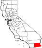
Ogilby — Unincorporated community — Location in California
 Ogilby
Coordinates: 32°49′01″N 114°50′20″W / 32.81694°N 114.83889°W Country United States State California County Imperial County Elevation[1] 364 ft (111 m) Ogilby (formerly, Oglesby)[2] is an unincorporated community in Imperial County, California.[1] Ogilby is located on the Southern Pacific Railroad 42 miles (68 km) east of El Centro,[2] and 3.8 miles north of Interstate 8 on County Road S34.[3] The name is official for federal use and a feature ID Number of 252950 has been assigned. Ogilby is defined by the US Geological Survey as a populated place at 356 feet AMSL elevation. NAD27 latitude and longitude are listed at 32°49′01″N 114°50′20″W / 32.81694°N 114.83889°W on the "Ogilby, California" 7.5-minute quadrangle (map).[4] It is included in the Imperial County Air Pollution Control District. It lies at an elevation of 364 feet (111 m).[1]
Contents
History
The Oglesby post office operated for part of 1880.[2] The Ogilby post office operated from 1890 to 1895, moving in 1892, and from 1898 to 1942.[2] The name honors E.R. Ogilby, mine promoter.[2]
Nearby
Ogilby lies along the Union Pacific Railroad tracks east of Algodones Dunes.[3] Its origin may result from the rail line, mining activity to the east, or as a path around the sand dunes before the wooden plank road in the early 1900s, and later, Interstate 8.
Ogilby Hills, to the southeast, have summits in the 600–800 foot AMSL range.[3]
A historic cemetery exists to the south and west of the railroad line at 32°48′55″N 114°50′20″W / 32.81528°N 114.83889°W.[3]
The closest city is Yuma, Arizona at about 25 miles driving distance.
The international border with Mexico lies about 9 miles in a straight line to the south. The Arizona state line lies about 7 miles southeast.[5]
Communications
There is no ZIP Code assigned to Ogilby. The area lies within area code 760.
Politics
In the state legislature Ogilby is located in the 40th Senate District, represented by Democrat Denise Moreno Ducheny, and in the 80th Assembly District, represented by Republican Bonnie Garcia. Federally, Ogilby is located in California's 51st congressional district, which has a Cook PVI of D +7[6] and is represented by Democrat Bob Filner.
See also
- Araz Junction, California
- Gordons Well, California
- Old Plank Road
- Winterhaven, California
References
- ^ a b c U.S. Geological Survey Geographic Names Information System: Ogilby, California
- ^ a b c d e Durham, David L. (1998). California's Geographic Names: A Gazetteer of Historic and Modern Names of the State. Quill Driver Books. p. 1450. ISBN 9781884995149.
- ^ a b c d "Ogilby, California," 7.5-minute quadrangle (map), US Geological Survey, 1997.
- ^ "National Geographic Names Database," US Geological Survey, 1995.
- ^ "Ogilby, California," "Grays Well NE, California," and "Araz, California," 7.5-minute quadrangles (maps), US Geological Survey.
- ^ "Will Gerrymandered Districts Stem the Wave of Voter Unrest?". Campaign Legal Center Blog. http://www.clcblog.org/blog_item-85.html. Retrieved 2007-10-20.
Municipalities and communities of Imperial County, California County seat: El Centro Cities Brawley | Calexico | Calipatria | El Centro | Holtville | Imperial | Westmorland
CDPs Bombay Beach | Desert Shores | Heber | Niland | Ocotillo | Palo Verde | Salton City | Salton Sea Beach | Seeley | Winterhaven
Unincorporated
communitiesAcolita | Alamorio | Amos | Andrade | Anza | Araz Junction | Bard | Bertram | Bonds Corner | Boulder Park | Cactus | Citrus View | Clyde | Coolidge Springs | Coyote Wells | Curlew | Date City | Dixieland | Dunes | Edgar | Elmore Desert Ranch | Estelle | Felicity | Fondo | Frink | Fuller | Glamis | Gordons Well | Hovley | Imperial Gables | Iris | Kane Spring | Meloland | Mesquite | Moss | Mount Signal | Mundo | Munyon | Obregon | Ogilby | Orita | Paymaster Landing | Perrys Corner | Picacho | Plaster City | Pope | Rico | Rockwood | Ross Corner | Ruthven | Sandia | Slab City | Tortuga | Truckhaven | Verdant | Watermans Corner | Wiest | Wilsie | Wister
Indian
reservationsFort Yuma Indian Reservation | Torres-Martinez Indian Reservation
Ghost towns Araz | Barnes | Bernice | Bradtmoore | Butlers | Colorado | Concepcíon | Eastside | Gleason | Hazelwood | Highline | Indian Wells | Keystone | Laguna | Laparra | Lano | Mayflower | Mobile | No Mirage | Paringa | Picacho Basin | Potholes | Sackett's Wells | Sellew | Shamrock | Silsbee | Squeaky Springs
Categories:- Unincorporated communities in Imperial County, California


Wikimedia Foundation. 2010.