- Crays Hill
-
Coordinates: 51°36′07″N 0°28′15″E / 51.602°N 0.4708°E
Crays Hill 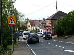
Crays Hill
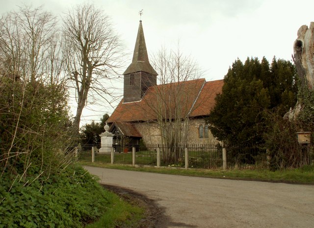
The church at Crays Hill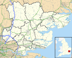
 Crays Hill
Crays Hill shown within EssexOS grid reference TQ712921 District Basildon Shire county Essex Region East Country England Sovereign state United Kingdom Post town BILLERICAY Postcode district CM11 2 Dialling code 01268 Police Essex Fire Essex Ambulance East of England EU Parliament East of England UK Parliament Billericay List of places: UK • England • Essex Crays Hill is a village in the Basildon borough of Essex, England. The local school is Crays Hill Primary School. The River Crouch passes under Church Lane.[1]
The village was listed in Domesday Book of 1086 when the Lord of the manor and tenant-in-chief was Sasselin of Layer.[2]
Crays Hill was part of the civil parish of Ramsden Crays until 1934 when it was abolished to enlarge South Hanningfield.[3]
Contents
Dale Farm
Crays Hill is the site of Dale Farm, once the largest Irish Traveller site in Europe.[4] There has been a long-running legal battle by Basildon Council to evict the travellers who have illegally built upon green belt land.[5] The council sent in police and bailiffs on 19 October 2011 to clear the disputed section of the site.[6][7]
See also
References
- ^ http://www.essexexplorer.co.uk/rivercrouch.html
- ^ "Crays Hill". Open Domesday. Anna Powell-Smith/University of Hull. http://www.domesdaymap.co.uk/place/TQ7192/crays-hill/. Retrieved 2 October 2011.
- ^ "Ramsden Crays parish". Vision of Britain. University of Portsmouth. http://www.visionofbritain.org.uk/relationships.jsp?u_id=10245620&c_id=10001043. Retrieved 2 October 2011.
- ^ http://www.thisistotalessex.co.uk/news/CRAYS-HILL-t-rid-easily-say-gipsies/article-627861-detail/article.html
- ^ http://www.thisistotalessex.co.uk/news/CRAYS-HILL-t-rid-easily-say-gipsies/article-627861-detail/article.html
- ^ [1]
- ^ Dale Farm eviction Live updates
External links
 Media related to Crays Hill at Wikimedia CommonsCategories:
- Villages in Essex
- Basildon
- Essex geography stubs


Wikimedia Foundation. 2010.