- 2009–10 South Pacific cyclone season
-
2009–10 South Pacific cyclone season 
Season summary mapFirst storm formed: December 3, 2009 Last storm dissipated: April 5, 2010 Strongest storm: Ului – 915 hPa (mbar), 215 km/h (130 mph) (10-minute sustained) Total disturbances: 15 Total depressions: 13 Tropical cyclones: 8 Severe tropical cyclones: 5 Total fatalities: 12 total Total damage: $163 million (2010 USD) South Pacific cyclone seasons
2007–08, 2008–09, 2009–10, 2010–11, 2011–12Related articles: - Timeline of the 2009–10 South Pacific cyclone season
- 2009–10 Australian region cyclone season
- 2009–10 South-West Indian Ocean cyclone season
The 2009–10 South Pacific cyclone season began on December 3, 2009 with the formation of Tropical Disturbance 01F. This was 32 days after the season had officially begun on November 1, 2009 and ended on April 30, 2010. These dates conventionally delimit the period of each year when most tropical cyclones form in the southern Pacific Ocean east of 160°E. Additionally, the regional tropical cyclone operational plan defines a tropical cyclone year separately from a tropical cyclone season; the "tropical cyclone year" began on July 1, 2009 and will end on June 30, 2010.[1] Tropical cyclones between 160°E and 120°W and north of 25°S are monitored by the Fiji Meteorological Service. Those that move south of 25°S are monitored by the Tropical Cyclone Warning Centre in Wellington, New Zealand.[1] The first tropical disturbance of the season formed on December 3, about 1015 km (700 mi) to the north of Suva, Fiji.
Seasonal outlooks
Predictions of tropical activity during 2010-11. Source/Record Season/Date TC STC Ref Average (1969-70 – 2008-09) 9 4.5 [2] Record high activity 1997-98 17 7 Record low activity 2003–04/2008–09 3 0 –––––––––––––––––––––––––––––––––––––––––– NIWA October 20, 2009 8-11 2-3 [2] RSMC Nadi October 21, 2009 8-11 2-3 [3] NIWA February 15, 2010 8-11 2-3 [4] Activity during the season 8 5 RSMC Nadi released their seasonal prediction on October 21, 2009, and reported that the El Niño conditions for this season indicated that tropical cyclone activity would be near normal with eight to eleven tropical cyclones predicted to form within the South Pacific compared to an average of nine cyclones. They also reported that a slightly higher risk existed of a tropical cyclone affecting a country to the west of the International Date Line including Fiji while a near average risk of a tropical cyclone affecting an island to the east of the dateline was predicted.[3] In March 2010, RSMC Nadi predicited that there would now be at least 10 Tropical cyclones, within the whole of the Southern Pacific.[5]
New Zealand's National Institute of Water and Atmospheric Research (NIWA) also reported in their seasonal outlook that the conditions for this season indicated that tropical cyclone activity would be near normal with eight to eleven tropical cyclones predicted to form compared to an average of nine cyclones.[2] They also reported that because of El Niño conditions that islands to the east of the International Date Line would face an increased risk of a tropical cyclone while the amount expected to move within 550 km (350 mi) of New Zealand was expected to remain about normal.[2] On February 15, 2010, NIWA issued a seasonal forecast update and maintained their forecast of 8–11 named storms.[4] They also reported that the Solomon Islands now faced an increased risk of a tropical cyclone affecting them.[4]
Seasonal summary

The 2009–10 South Pacific cyclone season was near its climatological average, with eight tropical depressions intensifying into tropical cyclones within the South Pacific to the east of 160E, while one other system intensified into a tropical cyclone after it had left the basin. Tropical Cyclone Mick was the first tropical disturbance to grace the waters of the South Pacific Ocean during the season. Tropical Cyclone Mick originally developed as a Tropical Disturbance on December 3, and gradually developed before it was christened as Tropical Cyclone Mick late on December 12. During the next couple of days the disturbance, the system accelerated towards the southeast while gradually intensifying further before peaking on December 14, with 10-minute sustained windspeeds of 110 km/h, (65 mph) and 1-minute winds of 130 km/h, (80 mph). Later that day, Mick made landfall on Viti Levu to the northeast of Nadi and as a result of land interaction, Mick rapidly weakened and became an extratropical depression early the next day. On December 6, Tropical Disturbance 02F developed about 1000 km (620 mi) to the north of Suva, Fiji.
Storm
Tropical Cyclone Mick
Category 2 tropical cyclone (Australian scale) Category 1 tropical cyclone (SSHS) 

Duration December 3 – December 15 Intensity 110 km/h (70 mph) (10-min), 975 mbar (hPa) Late on December 3, RSMC Nadi reported that Tropical Disturbance 01F had developed out of a weak area of low pressure to the northeast of Fiji. Over the next few days the disturbance gradually developed before RSMC Nadi reported that it had intensified into a tropical depression late on December 11. During the next day the system intensified further with the JTWC starting to issue warnings declaring it as Tropical Cyclone 04P. Later that day RSMC Nadi reported that Mick had intensified into a category one tropical cyclone and named it as Mick, while it was located about 225 km, (140 mi) to the west of Rotuma. During the next day Tropical Cyclone Mick accelerated towards the southeast while gradually intensifying further, before during December 14, as Mick approached the Fijian island of Viti Levu, the cyclone developed an eye. RSMC Nadi then declared that Mick had peaked with 10 minute windspeeds of 110 km/h, (65 mph) while the JTWC reported that it had peaked with 1 minute winds of 130 km/h, (80 mph). Later that day, Mick made landfall on Viti Levu to the northeast of Nadi. As a result of land interaction, Tropical Cyclone Mick rapidly weakened and became an extratropical depression early the next day. The extratropical remnants of Tropical Cyclone Mick were tracked by RSMC Nadi and TCWC Wellington for another 2 days before they dissipated early on December 18 Just inside TCWC Wellington's area of responsibility.
At least 6 fatalities have been attributed to Mick.[6]
Tropical Disturbance 02F
Tropical disturbance (Australian scale) 

Duration December 6 – December 12 Intensity Winds unknown, 1003 mbar (hPa) Late on December 6, RSMC Nadi reported that Tropical Disturbance 02F had formed about 1000 km (620 mi), to the north of Suva, Fiji. Poorly organized convection had been present around the system for the previous 24 hours and was in an environment of moderate shear. The disturbance did not organize much and dissipated on December 12.
Depression 03F
Tropical depression (Australian scale) 
Duration January 7 – January 10 Intensity 65 km/h (40 mph) (10-min), 1002 mbar (hPa) Early on January 7, RSMC Nadi reported that an extratropical depression had formed about 770 km (480 mi), to the southwest of Papeete in French Polynesia and assigned it the designation of 03F.[1][7] The depression dissipated on January 10.
Tropical Depression 04F (Olga)
Tropical depression (Australian scale) 

Duration January 18 – January 20(crossed 160°E) Intensity Winds unknown, 1002 mbar (hPa) Tropical Disturbance 04F formed on 18 January and strengthened to a Tropical Depression as it moved south-west through the Solomon Islands. On 20 January it crossed the 160°E meridian into the Australian Basin, where it developed into Tropical Cyclone Olga.
Tropical Depression 05F
Tropical depression (Australian scale) 
Duration January 23 – January 28 Intensity Winds unknown, 998 mbar (hPa) Tropical Depression 05F formed on January 23 near 11S 179E, about 200 miles (320 km) south of Funafuti, Tuvalu. It dissipated on January 28.
Tropical Cyclone Nisha
Category 1 tropical cyclone (Australian scale) Tropical storm (SSHS) 

Duration January 27 – January 31 Intensity 75 km/h (45 mph) (10-min), 990 mbar (hPa) RSMC Nadi announced the formation of Tropical Depression 06F on January 27 near 14S 172W. This was only about 320 miles (510 km) NE of the position then being given for 05F and these may have developed from the same area of disturbed weather. Later the same day JTWC designated it as a Tropical Cyclone, and the RSMC allocated the name Nisha and it had dissipated on January 31.[8]
Severe Tropical Cyclone Oli
Category 4 severe tropical cyclone (Australian scale) Category 4 tropical cyclone (SSHS) 

Duration January 29 – February 8 Intensity 185 km/h (115 mph) (10-min), 925 mbar (hPa) Main article: Cyclone OliTropical Disturbance 07F formed on January 29 near 12S 177E. It was upgraded to a depression late on the 30th. On the 1st of February, the JTWC designated 07F as 12P, and the RSMC upgraded it to Tropical Cyclone Oli. On February 3 it strengthened to become the first Severe Tropical Cyclone since Gene in early 2008.
At least one person was killed by large swells produced by the storm in French Polynesia.[9]
Tropical Depression 08F
Tropical depression (Australian scale) 

Duration February 2 – February 4 Intensity 55 km/h (35 mph) (10-min), 997 mbar (hPa) Tropical Depression 08F formed on February 2 near 15S 145W, just south of the King George Islands. However it dissipated on February 4.
Severe Tropical Cyclone Pat
Category 3 severe tropical cyclone (Australian scale) Category 2 tropical cyclone (SSHS) 

Duration February 6 – February 11 Intensity 140 km/h (85 mph) (10-min), 965 mbar (hPa) Tropical Depression 09F formed on February 6 near 8ºS 166ºW, about 375 miles (604 km) east of Tokelau. On the 7th, the JTWC designated it as Tropical Cyclone 14P, and on the 8th RSMC upgraded it to become Tropical Cyclone Pat. By the 10th it reached Severe Tropical Cyclone strength as it moved towards the southern Cook Islands, and a hurricane warning was then issued for Aitutaki and its neighbours.[10] The eye of the cyclone was reported to have passed right over Aitutaki, with continuous winds estimated locally at 100 knots for 4 hours.[11] There was extensive damage to housing and a hospital, and the Cook Island government declared a State of Disaster.[12]
Severe Tropical Cyclone Rene
Category 3 severe tropical cyclone (Australian scale) Category 3 tropical cyclone (SSHS) 

Duration February 9 – February 17 Intensity 155 km/h (100 mph) (10-min), 945 mbar (hPa) Tropical Depression 10F formed on February 9 near 13S 172W, in the vicinity of Samoa. Late on February 11, RSMC Nadi upgraded the storm to a category 1 cyclone and named it Rene.[13] It continued to strengthen as it moved south of American Samoa, and reached Category 4 on February 14. In American Samoa roads were damaged by landslides caused by the cyclone's heavy rain, and substantial damage was caused to crops.[14] It had weakened to category 3 when it passed through the Vava'u island group of Tonga, and on February 15 the eye was reported to have passed over the Tongan capital Nuku'alofa.[15] The main island of Tongatapu was left without power and water.[16]
Tropical Cyclone Sarah
Category 1 tropical cyclone (Australian scale) Tropical storm (SSHS) 

Duration February 17 – March 3 Intensity 65 km/h (40 mph) (10-min), 995 mbar (hPa) On February 17, RSMC Nadi commenced reporting on an unnumbered tropical disturbance located near 8.6ºS 162.0ºW, about 120 miles (190 km) north-northwest of Rakahanga in the Cook Islands. RSMC Nadi reported that the disturbance was moving west while the JTWC reported that the disturbance was moving east. Eventually, they both agreed on which direction it was moving and RSMC Nadi upgraded the disturbance to Tropical Depression 11F. It soon weakened, but remained identifiable until February 22 when it was again classified as a Tropical Depression. On February 26 it was at last upgraded to Tropical Cyclone Sarah and Tropical Storm by JTWC, being then about 90 miles (140 km) north of Palmerston Island.
Severe Tropical Cyclone Ului
Category 5 severe tropical cyclone (Australian scale) Category 5 tropical cyclone (SSHS) 

Duration March 9 – March 14 Out of Basin Intensity 215 km/h (130 mph) (10-min), 915 mbar (hPa) Main article: Cyclone UluiTropical Disturbance 13F formed on March 9 at 12.0ºS 167.0ºE, about 80 miles (130 km) north of Hiw Island, Vanuatu. The next day it was classified as a Tropical Depression. On March 12, 13F was upgraded to Tropical Cyclone Ului. By early on the 13th, it was a category 2 cyclone. Later that day, Ului strengthened into a category 3, making it a severe tropical cyclone. The storm continued to strengthen throughout the day and that night it became a category 5. Ului became the first category 5 South Pacific cyclone since Severe Tropical Cyclone Percy in February 2005. On March 14, Ului exited the Pacific Region and entered the Australian Region.
Severe Tropical Cyclone Tomas
Category 4 severe tropical cyclone (Australian scale) Category 4 tropical cyclone (SSHS) 

Duration March 9 – March 17 Intensity 185 km/h (115 mph) (10-min), 925 mbar (hPa) Main article: Cyclone TomasShortly after the first advisory on Tropical Disturbance 13F was issued on March 9, the FMS began monitoring a new disturbance, designated 14F, further east.[17] The following day, deep convection began to develop around the disturbance's low-level circulation, prompting the JTWC to begin monitoring it for possible cyclonic development.[18] Later on March 10, the FMS upgraded the system to a tropical depression as it continued to become better organized.[19] Located within an environment characterized by low wind shear, further intensification was anticipated as convection continued to develop over the expanding system.[20] Around 1500 UTC on March 11, the JTWC issued their first advisory on the cyclone, classifying it as Tropical Storm 19P.[21] Several hours later, the FMS upgraded the system to a Category 1 cyclone and gave it the name Tomas. Rapid intensification was expected to take place over the following 48 hours as sea surface temperatures ahead of the storm averaged 30 °C (86 °F), well-above the threshold for tropical cyclone development.[22] Throughout the day on March 12, Tomas steadily intensified,[23] and early the next day, the JTWC upgraded the storm to a Category 1 equivalent hurricane with winds of 120 km/h (75 mph).[24]
Convective banding substantially increased on March 13, allowing Tomas to become the fourth severe tropical cyclone of the season early the next morning.[25] Around the same time, the JTWC assessed the storm to have attained winds of 155 km/h (100 mph), ranking it as a Category 2 cyclone.[24] By the afternoon of March 14, Tomas had developed a banding-eye feature surrounded by deep convection. At this point, the FMS assessed the storm to have winds of 150 km/h (90 mph) and a pressure of 950 hPa (mbar).[26] The JTWC also noted further intensification, upgrading Tomas to a Category 3 equivalent storm.[24] Tomas has intensified on the night of March the 14th becoming a category 4(according to the Fiji Meteorological Service) with winds up to 170 km/h and gusts up to 215 km/h blowing roofs off some houses and damaging buildings around the eastern side of Vanua Levu.
Throughout Fiji, Cyclone Tomas wrought widespread damage, killing two people and leaving $83.4 million in losses.[27] One person was killed on Vanua Levu after being swept out to sea by large swells while trying to rescue her two sisters, a niece and a nephew near Namilamila Bay.[28]
Tropical Depression 15F
Tropical depression (Australian scale) 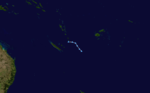
Duration March 30 – April 5 Intensity 55 km/h (35 mph) (10-min), 999 mbar (hPa) Early on March 30, RSMC Nadi reported that a Depression had formed about 445 km, (275 mi) to the southeast of Port Vila in Vanuatu. The depression dissipated completely on April 5.
Season effects
This table lists all the storms that developed in the South Pacific to the east of longitude 160°E during the 2009–2010 season. It includes their intensity on the Australian Tropical cyclone intensity scale, duration, name, landfalls, deaths, and damages. All data is taken from RSMC Nadi and or TCWC Wellington. The Damage figures are all 2010 USD
Storm
NameDates active Storm category
at peak intensityPeak 10-min
sustained windsPressure Areas affected Damage
(USD)Deaths Refs 01F/04P Mick December 3 – 15 Category 2 Tropical Cyclone 110 km/h (70 mph) 975 Fiji $20 million 4 02F N/A December 6 – 12 Tropical Disturbance Unknown 1003 None None None 03F N/A January 7 – 10 Depression 65 km/h (40 mph) 1002 None None None 04F/09P Olga January 18 – 21 Tropical Depression Unknown 1002 Solomon Islands Unknown 2 [29] 05F N/A January 23 – 28 Tropical Depression N/A 998 None None None 06F/10P Nisha January 27 – 31 Category 1 tropical cyclone 75 km/h (45 mph) 990 Samoan Islands None None [30] 07F/12P Oli January 29 – February 7 Category 4 severe tropical cyclone 185 km/h (115 mph) 925 Cook Islands, French Polynesia $70 million 1 08F N/A February 2 – 4 Tropical Depression 55 km/h (35 mph) 997 French Polynesia None None 09F/14P Pat February 6 – 11 Category 3 severe tropical cyclone 155 km/h (100 mph) 955 Cook Islands $10 million 3 10F/15P Rene February 9 – 17 Category 4 severe tropical cyclone 165 km/h (105 mph) 940 Samoan islands, Tonga $18 million None 11F N/A February 2010 Tropical Disturbance Unknown Unknown Unknown Unknown Unknown 12F/17P Sarah February 17 – March 3 Category 1 tropical cyclone 65 km/h (40 mph) 995 Cook Islands Unknown None 13F/20P Ului March 9 – 14 Category 5 severe tropical cyclone 215 km/h (130 mph) 930 Vanuatu, Solomon Islands, Australia Unknown 1 14F/19P Tomas March 9 – 18 Category 4 severe tropical cyclone 175 km/h (110 mph) 930 Fiji $43.6 million 2 [31] 15F N/A March 30 – April 5 Tropical Depression 55 km/h (35 mph) 999 None None None Season Aggregates 15 disturbances December 3 – April 5 215 km/h (130 mph) 925 >$161 million 13 See also
- List of Southern Hemisphere cyclone seasons
- Atlantic hurricane seasons: 2009, 2010
- Pacific hurricane seasons: 2009, 2010
- Pacific typhoon seasons: 2009, 2010
- North Indian Ocean cyclone seasons: 2009, 2010
References
- ^ a b c "Tropical Cyclone Operational Plan for the Southwest Indian Ocean and the Southern Pacific Ocean". RA V Tropical Cyclone Committee. World Meteorological Organization. 2009-03-10. http://www.wmo.int/pages/prog/www/tcp/documents/TCP24-English2008.pdf. Retrieved 2009-05-21.
- ^ a b c d "Tropical cyclone outlook: normal". National Institute of Water and Atmospheric Research. 2009-10-20. http://www.webcitation.org/5kkmcHNyS. Retrieved 2009-10-24.
- ^ a b Prasad, Rajendra (2009-10-21). "2009/2010 South Pacific tropical cyclone season outlook". Fiji Meteorological Service. http://www.webcitation.org/5kkmccNjW. Retrieved 2011-06-25.
- ^ a b c "Tropical cyclone outlook update: normal". National Institute of Water and Atmospheric Research. 2010-02-15. http://www.webcitation.org/5nYzV9wgP. Retrieved 2010-02-15.
- ^ Rajendra Prasad (2010-03-07). "Cyclone warning". Fiji Meteorological Service. Fiji Times. http://www.webcitation.org/5o5UW2EGw. Retrieved 2010-03-07.
- ^ "4,000 people in Fiji displaced by cyclone". Radio New Zealand International. 16 December 2009. http://www.rnzi.com/pages/news.php?op=read&id=50984. Retrieved 18 September 2011.
- ^ "International Marine Warning — Other 2010-01-07 00z". Fiji Meteorological Service. 2010-01-07. http://www.webcitation.org/5mbtre0yg. Retrieved 2010-01-07.
- ^ http://www.webcitation.org/5n6AMMGwL
- ^ Associated Press (February 5, 2010). "1 killed in Cyclone Oli in French Polynesia". Forbes. http://www.forbes.com/feeds/ap/2010/02/05/general-as-french-polynesia-tropical-weather_7332802.html. Retrieved February 5, 2010.[dead link]
- ^ "Special Weather Bulletin Number 11 for Southern Cooks on Tropical Cyclone Pat". Fiji Meteorological Service. 2010-02-10. http://www.webcitation.org/5nQj4qOus. Retrieved 2010-02-10.
- ^ "Mayor says Aitutaki storm worst in memory". Radio New Zealand International. 2010-02-11. http://www.rnzi.com/pages/news.php?op=read&id=51865. Retrieved 2010-02-11.
- ^ "Wide range of housing in Aitutaki wrecked by Cyclone Pat, but resorts escape damage". Radio New Zealand International. 2010-02-11. http://www.rnzi.com/pages/news.php?op=read&id=51880. Retrieved 2010-02-11.
- ^ "Tropical Disturbance Summary 2010-02-11 2010 UTC". RSMC Nadi. February 11, 2010. http://www.webcitation.org/5nSjzt6gw. Retrieved 11 February 2010.
- ^ "American Samoa baby born the night of the storm is named after Cyclone Rene". Radio New Zealand International. 2010-02-18. http://www.rnzi.com/pages/news.php?op=read&id=52024. Retrieved 2010-02-18.
- ^ "Damage already apparent in cyclone battered Tongan capital". Radio New Zealand International. 2010-02-15. http://www.rnzi.com/pages/news.php?op=read&id=51944. Retrieved 2010-02-15.
- ^ "Tonga’s main island without power and water following Rene.". Radio New Zealand International. 2010-02-15. http://www.rnzi.com/pages/news.php?op=read&id=51945. Retrieved 2010-02-15.
- ^ "Nadi Marine Bulletin for March 9, 2010 at 1800 UTC". Fiji Meteorological Service. March 9, 2010. http://www.webcitation.org/5o6qCvKIe. Retrieved March 14, 2010.
- ^ "Significant Tropical Weather Outlook for the Western and South Pacific Oceans". Joint Typhoon Warning Center. March 10, 2010. ftp://ftp.met.fsu.edu/pub/weather/tropical/GuamStuff/2010031016-ABPW.PGTW. Retrieved March 14, 2010.
- ^ "Nadi Marine Bulletin for March 10, 2010 at 1800 UTC". Fiji Meteorological Service. March 10, 2010. http://www.webcitation.org/5o8LXp4Gs. Retrieved March 14, 2010.
- ^ "Tropical Depression 14F Advisory A1 and A2". Fiji Meteorological Service. March 11, 2010. ftp://ftp.met.fsu.edu/pub/weather/tropical/Fiji/2010031100.WTPS11. Retrieved March 14, 2010.
- ^ "Tropical Cyclone 19P Advisory NR 001". Joint Typhoon Warning Center. March 11, 2010. http://www.webcitation.org/5o9Y3t7j6. Retrieved March 14, 2010.
- ^ "Tropical Cyclone Tomas Advisory A6". Fiji Meteorological Service. March 12, 2010. ftp://ftp.met.fsu.edu/pub/weather/tropical/Fiji/2010031200.WTPS11. Retrieved March 14, 2010.
- ^ "Tropical Cyclone Tomas Storm Warning Ten". Fiji Meteorological Service. March 12, 2010. ftp://ftp.met.fsu.edu/pub/weather/tropical/Fiji/2010031212.WTPS01. Retrieved March 14, 2010.
- ^ a b c Joint Typhoon Warning Center (2010). "Tropical Cyclone 19P (Tomas) Running Best Track". United States Navy. http://199.9.2.143/tcdat/tc10/SHEM/19P.TOMAS/trackfile.txt. Retrieved March 14, 2010.
- ^ "Severe Tropical Cyclone Tomas Advisory A13". Fiji Meteorological Service. March 14, 2010. ftp://ftp.met.fsu.edu/pub/weather/tropical/Fiji/2010031400.WTPS11. Retrieved March 14, 2010.
- ^ "Severe Tropical Cyclone Tomas Advisory A15". Fiji Meteorological Service. March 14, 2010. ftp://ftp.met.fsu.edu/pub/weather/tropical/Fiji/2010031412.WTPS11. Retrieved March 14, 2010.
- ^ Government of Fiji (May 24, 2010). "Cabinet provided with status report on relief, rehab. and recons. efforts for TC Tomas". Relief Web. http://www.reliefweb.int/rw/rwb.nsf/db900sid/MYAI-85R9EC?OpenDocument&rc=5&emid=TC-2009-000258-FJI. Retrieved March 26, 2011.
- ^ Vaimoana Tapaleao (March 16, 2010). "Storms fiercer than Katrina batter Fiji and Solomons". New Zealand Herald. http://www.nzherald.co.nz/nz/news/article.cfm?c_id=1&objectid=10632300. Retrieved March 15, 2010.
- ^ Unattributed (2010-02-05). "National Disaster Council Situation Report No.6 2010-02-05". Solomon Islands National Disaster Council. Pacific Disaster.Net. Archived from the original on 2011-01-30. http://www.webcitation.org/5w7B2dzn3. Retrieved 2011-01-30.
- ^ Unattributed (2010). "Storm events for American Samoa: Tropical Storm Nisha". National Climatic Data Center. National Oceanic and Atmospheric Administration. Archived from the original on 2011-01-30. http://www.webcitation.org/5w73UqVZ9. Retrieved 2011-01-30.
- ^ Unattributed (2010-04-12). "Fiji — Tropical Cyclone Tomas Situation Report No.6". United Nations Office for the Coordination of Humanitarian Affairs. Reliefweb. Archived from the original on 2011-01-30. http://www.webcitation.org/5w7C8g4kI. Retrieved 2011-01-30.
External links
- World Meteorological Organization
- Fiji Meteorological Service
- Meteorological Service of New Zealand
- Joint Typhoon Warning Center
2000–09 South Pacific cyclone seasons Categories:


Wikimedia Foundation. 2010.