- Doublebois
-
Coordinates: 50°27′22″N 4°32′19″W / 50.4560°N 4.5387°W
Doublebois Cornish: Dewgoes 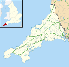
 Doublebois
Doublebois shown within CornwallOS grid reference SX199649 Parish Dobwalls and Trewidland Shire county Cornwall Region South West Country England Sovereign state United Kingdom Post town LISKEARD Postcode district PL14 Dialling code 01579 Police Devon and Cornwall Fire Cornwall Ambulance South Western EU Parliament South West England UK Parliament South East Cornwall List of places: UK • England • Cornwall Doublebois (Cornish: Dewgoes) is a village in south Cornwall, United Kingdom. It is in the civil parish of Dobwalls and Trewidland apprimately three miles (5km) west of Liskeard[1].
Doublebois formerly had a railway station on the Cornish Main Line which closed in the 1960s. Today the main transport link is the adjacent A38 Plymouth to Bodmin trunk road.
- ^ Ordnance Survey: Landranger map sheet 201 Plymouth & Launceston ISBN 9780319231463
External links
 Media related to Doublebois at Wikimedia Commons
Geography of Cornwall Cornwall Portal Unitary authorities Major settlements Bodmin • Bude • Callington • Camborne • Camelford • Falmouth • Fowey • Hayle • Helston • Launceston • Liskeard • Looe • Lostwithiel • Marazion • Newlyn • Newquay • Padstow • Par • Penryn • Penzance • Porthleven • Redruth • Saltash • St Austell • St Blazey • St Columb Major • St Ives • St Just-in-Penwith • St Mawes • Stratton • Torpoint • Truro • Wadebridge
See also: Civil parishes in CornwallRivers Topics History • Status debate • Flag • Culture • Places • People • The Duchy • Diocese • Politics • Hundreds/shires • Places of interest • full list...Categories:- Villages in Cornwall
- Cornwall geography stubs

Wikimedia Foundation. 2010.