- Dobwalls and Trewidland
-
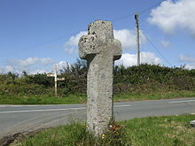 Bosent cross, on the border with St Pinnock civil parish
Dobwalls and Trewidland (Cornish: Fos an Mogh & Trewydhlann) is a civil parish in south-east Cornwall, United Kingdom.
The parish is bounded to the north by St Neot and St Cleer parishes, to the east by Liskeard and Menheniot parishes, to the south by Morval parish, to the west by the East Looe River and the parishes of St Pinnock and St Keyne, and to the south-west by Duloe parish.
The two largest villages in the parish are Dobwalls 50°27′25″N 4°30′54″W / 50.457°N 4.515°WCoordinates: 50°27′25″N 4°30′54″W / 50.457°N 4.515°W and Doublebois 50°27′22″N 4°32′17″W / 50.456°N 4.538°W, both in the north of the parish. There are several smaller villages in the south of the parish including Trewidland and Horningtops, and the hamlet of Boduel to the north.[1]
The ancient village of Dobwalls was originally in Liskeard parish until the separate civil parish of Dobwalls and Trewidland was created. The population of Dobwalls and Trewidland parish in the 2001 census was 1,939.
Rosenun Lane, 1 km north of St Keyne Wishing Well Halt railway station, is a designated Site of Special Scientific Interest noted for its geological interest.[2]
Ward changes
In 2002, the Electoral Commission ordered a re-organisation of wards in Caradon. The former wards were abolished and the district was divided into twenty-two new wards; and the parish of Liskeard was divided into two parish wards, Liskeard North and Liskeard South
The change created 'Dobwalls and District' as a ward electing two councillors and incorporating the parishes of Dobwalls and Trewidland, Morval, St Keyne and St Pinnock.[3]
References
- ^ Ordnance Survey: Landranger map sheet 201 Plymouth & Launceston ISBN 9780319231463
- ^ "Rosenun Lane". Natural England. 27 June 1988. http://www.sssi.naturalengland.org.uk/citation/citation_photo/1001696.pdf. Retrieved 11 November 2011.
- ^ The District of Caradon (Electoral Changes) Order 2002, Statutory Instrument, Crown Copyright, published by HMSO, ISBN 0-11-042876-5
Geography of Cornwall Cornwall Portal Unitary authorities Major settlements Bodmin • Bude • Callington • Camborne • Camelford • Falmouth • Fowey • Hayle • Helston • Launceston • Liskeard • Looe • Lostwithiel • Marazion • Newlyn • Newquay • Padstow • Par • Penryn • Penzance • Porthleven • Redruth • Saltash • St Austell • St Blazey • St Columb Major • St Ives • St Just-in-Penwith • St Mawes • Stratton • Torpoint • Truro • Wadebridge
See also: Civil parishes in CornwallRivers Topics History • Status debate • Flag • Culture • Places • People • The Duchy • Diocese • Politics • Hundreds/shires • Places of interest • full list...Civil parishes of South East Cornwall constituency  Antony • Boconnoc • Botusfleming • Broadoak • Callington • Calstock • Deviock • Dobwalls and Trewidland • Duloe • Landrake with St Erney • Lanreath • Lansallos • Landulph • Lanlivery • Lanteglos • Linkinhorne • Liskeard • Looe • Lostwithiel • Luxulyan • Maker-with-Rame • Menheniot • Millbrook • Morval • Pelynt • Pillaton • Quethiock • Saltash • Sheviock • South Hill • St Cleer • St Dominick • St Germans • St Ive • St John • St Keyne • St Martin-by-Looe • St Mellion • St Neot • St Pinnock • St Veep • St Winnow • Torpoint • Warleggan
Cornwall Portal Categories:- Villages in Cornwall
- Civil parishes in Cornwall
- Cornwall geography stubs

Wikimedia Foundation. 2010.